Flight Information
DEPARTURE 00AA - AERO B RANCH 00C - ANIMAS AIR PARK 00CA - GOLDSTONE /GTS/ 00CL - WILLIAMS AG 00F - BROADUS 00ID - DELTA SHORES 00IG - GOLTL 00S - MC KENZIE BRIDGE STATE 00U - BIG HORN COUNTY 00W - LOWER GRANITE STATE 00WA - HOWELL 00WN - HAWKS RUN 01CL - SWANSBORO COUNTRY 01ID - LAVA HOT SPRINGS 01MT - CRYSTAL LAKES RESORT 01NM - CHAMPION RANCH 01NV - LANTANA RANCH 01U - DUCKWATER 01UT - LA SAL JUNCTION 01WY - KEYHOLE 02CL - CONOVER AIR LODGE 02CO - MC CULLOUGH 02ID - MORGAN RANCH 02MT - STEPPLER FLD 02NV - PAIUTE MEADOWS 02T - WISE RIVER 02UT - LUCIN 02WA - CAWLEYS SOUTH PRAIRIE 02WN - FOWLER FLD 03AZ - THOMPSON INTL AVIATION 03CO - KUGEL-STRONG 03ID - FLYING Y RANCH 03NV - LLAMA RANCH 03OR - POWWATKA RIDGE 03S - SANDY RIVER 03UT - A Z MINERALS CORPORATION 03WA - SPANGLE FLD 03WN - AEROSTONE AIRFIELD 04CA - GRAY BUTTE FLD 04CL - DESERT WINGS SKY RANCH 04ID - LANHAM FLD 04MT - PLUHAR 04NE - MC CONNELL FLD 04NV - KINGSTON RANCH 04OR - COLLINS LANDING STRIP 04UT - NAVAJO MOUNTAIN 04V - SAGUACHE MUNI 04WA - OX MEADOWS 04WN - STILLWATER CREEK 05CL - POPE VALLEY 05CO - RANCHO DE AEREO 05ID - RUNNING CREEK RANCH 05MT - JONES LANDING 05NV - BAKER RANCHES 05OR - 6 RANCH 05S - VERNONIA MUNI 05U - EUREKA 05V - BLANCA 05WN - FLAT CREEK FLD 06CO - JECAN 06ID - LARKIN 06MT - TORGERSON 06NV - SILVER CREEK 06U - JACKPOT/HAYDEN FLD 06WN - WESTERN AIRPARK 07CL - RICHVALE 07CO - COMANCHE CREEK 07ID - SHEPARD STRIP 07MT - GLASGOW INDUSTRIAL 07NV - BORDER LINE FARM 07UT - E NORTHROP GRUMMAN 07V - CUCHARA VALLEY AT LA VETA 07WY - STALLIONS 08CL - KISTLER RANCH 08CO - TERRA FIRMA 08ID - SYMMS 08MT - MATOVICH 08OR - SAXON SYCAN 08U - STEVENS-CROSBY 08WA - P-L RANCH 09AZ - STRONGHOLD 09CL - ALTA SIERRA 09CO - COTTONWOOD FLD 09ID - TAYLOR RANCH LANDING AREA 09K - SARGENT MUNI 09S - SULLIVAN LAKE STATE 09TS - PITCOCK ROSILLOS MOUNTAIN RANCH 0AZ2 - WESTERN SKY AIRPARK 0AZ4 - FLYING BUCKET RANCH 0AZ5 - CASTLE WELL 0CA0 - POM WONDERFUL AIRSTRIP 0CA3 - CRAWFORD 0CA4 - SHEPHERD FARM 0CA5 - HOFFMAN 0CA6 - EMORY RANCH 0CA9 - BLECH RANCH 0CD2 - FOXX VALLEY 0CD5 - PINON CANYON 0CD7 - FOX HOLE 0CL0 - YOSEMITE HIDDEN LAKE RANCH 0CL1 - KREY FLD 0CL3 - JOHN NICHOL'S FLD 0CN1 - FIORINI RANCH 0CN2 - SUTTER BUTTE DUSTERS 0CO1 - DAVE'S 0CO2 - CRESTED BUTTE AIRPARK 0CO5 - LEBEAU RANCH 0CO6 - FLYING M & M RANCH 0CO9 - VAN TREESE 0E0 - MORIARTY MUNI 0E8 - CROWNPOINT 0H1 - TREGO WAKEENEY 0ID - W E RANCH 0ID0 - SOUTH FORK RANCH 0ID1 - ZIGGY'S 0ID2 - FLYING JOSEPH RANCH 0ID3 - COYOTE RUN 0ID4 - BLACK BUTTE RANCH 0ID7 - Z X RANCH 0ID8 - PINNACLE 0ID9 - CORRAL CREEK 0L4 - LIDA JUNCTION 0L7 - JEAN 0L9 - ECHO BAY 0MT1 - WILLIAMS FLD - CLOSED INDEFINITELY 0MT4 - KIMP 0MT5 - COTTONWOOD 0MT6 - HANSON 0MT7 - PINEHURST RANCH 0MT9 - LONE HAWK 0NA9 - BOYD'S TURF 0NE0 - MERRIHEW 0NE1 - RUNNER LANDING AREA 0NM0 - COLUMBUS MUNI 0NM7 - NEGRITO AIRSTRIP 0O2 - BAKER 0O4 - CORNING MUNI 0O9 - WARD FLD 0OR3 - LONG RANCH 0OR5 - EAST OREGON CATTLE COMPANY - CLOSED INDEFINITELY 0OR6 - ROME SERVICE 0OR7 - MARR FLD 0OR8 - SUTTON ON ROGUE 0OR9 - HANEL FLD - CLOSED INDEFINITELY 0P1 - VAN PAK 0Q3 - SONOMA VALLEY 0Q4 - SELMA 0Q5 - SHELTER COVE 0Q9 - SONOMA SKYPARK 0S0 - LIND 0S1 - MEADOW CREEK USFS 0S5 - NEZPERCE MUNI 0S7 - DOROTHY SCOTT INTL 0S9 - JEFFERSON COUNTY INTL 0SD3 - BLEDSOE RANCH 0SD7 - PORCH RANCH 0TS9 - MCCLELLAN CREEK 0U0 - LANDMARK USFS 0U1 - WARM SPRINGS CREEK 0U2 - COPPER BASIN 0U3 - MAHONEY CREEK USFS 0U7 - HOLLOW TOP 0U8 - MAY 0U9 - LEE WILLIAMS MEML 0V7 - KAYENTA 0WA1 - DWIGHT FLD 0WA2 - CURTIS 0WN0 - RUCILLA'S ROOST 0WN1 - SHANGRI-LA 0WN2 - COOPERS LANDING 0WN9 - WINGS FOR CHRIST - CLOSED INDEFINITELY 0WY0 - FREEDOM AIR RANCH 0WY1 - DORSEY CREEK RANCH 10AZ - FARM AG 10CO - MACK MESA 10ID - FLAT TOP AIRSTRIP 10MT - HOOLIE - CLOSED INDEFINITELY 10U - OWYHEE 10WA - FLYING L - CLOSED INDEFINITELY 10WY - WILLOW CREEK RANCH 11AZ - WHETSTONE 11CA - TURNER FLD 11CL - HANSEN 11MT - LAMMERS 11S - SEKIU 11UT - FLYING R 11V - EASTON/VALLEY VIEW/ 11WA - HOMEPORT 11WY - THOMPSON CREEK OILFIELD 12AZ - RANTA STRIP 12CL - NEWTON FLD 12CN - RICHTER AVIATION 12CO - OMEGA 1 12ID - FLYING B RANCH LANDING STRIP 12MT - LINCOLNS FLD 12NE - REISIG BROTHERS 12OR - SKINNER RANCH 12S - MONUMENT MUNI 12WA - FOWLERS NW 40 12WY - BLACK DIAMOND 13CL - MAINE PRAIRIE 13ID - SILVA RANCH - CLOSED INDEFINITELY 13MT - SORENSON 13NE - HOCK 13NM - BEAVERHEAD AIRSTRIP 13OR - AUBREY MOUNTAIN AIRSTRIP 13Q - JEWETT MESA 13W - CAMANO ISLAND AIRFIELD 13WA - ROCKY POND AIRSTRIP 14AZ - RUBY STAR AIRPARK 14ID - PEACEFUL COVE 14MT - SANDY ROCK 14S - WESTPORT 14WA - LZ RANCH 15AZ - QUAIL MESA RANCH - CLOSED INDEFINITELY 15CL - HUNT FARMS 15ID - SCANLON 15MT - SAUBAK 15UT - FIELD OF DREAMS 15WA - SUNSET 16AZ - YAV'PE MA'TA 16CO - DRY PEN 16MT - BANGART FLD 16S - MYRTLE CREEK MUNI 16TA - SEVEN SPRINGS 16W - LITTLE GOOSE LOCK AND DAM 16WA - TIGHTCLIFF 17CL - LAS TRANCAS 17CO - SKYLANE RANCH 17ID - COYOTE RIDGE 17K - BOISE CITY 17MT - ABEL RANCH 17OR - GLIDE AERO 17S - CHEHALEM AIRPARK 17V - HAXTUN MUNI 18AZ - SKY RANCH AT CAREFREE 18CL - BOWLES 18JY - SKAMOKAWA EAST VALLEY 18MT - FISH RANCH 18NV - EMPIRE 18OR - RED'S FLD 18V - PLATTE VALLEY AIRPARK 19AZ - MONTEZUMA 19MT - N BAR RANCH 19NE - HOYT 19OR - NELSON RANCH 19WA - KEY WAY 1AZ0 - MOBILE 1AZ6 - SKYLINE AIR RANCH 1AZ8 - WILLOW SPRINGS RANCH 1C9 - FRAZIER LAKE AIRPARK 1CA6 - ON THE ROCKS 1CD1 - REED INTL 1CD2 - RECK AIRSTRIP 1CD4 - EAGLE SOARING 1CL1 - LITTLE BUTTES ANTIQUE AIRFIELD 1CL2 - ANCIENT VALLEY/PONTIOUS 1CO2 - WILLIAMS RANCH 1CO3 - BELLMORE FARMS 1CO4 - CLIFFORD FLD 1CO5 - MELON FLD 1CO7 - DODSWORTH - CLOSED INDEFINITELY 1CO8 - EVERITT 1DA - BIG BAR USFS 1E2 - TERLINGUA RANCH 1E4 - PALO DURO 1E7 - BUFFALO 1F5 - HOXIE-SHERIDAN COUNTY 1G4 - GRAND CANYON WEST 1ID3 - BEAUX RANCH FLD 1ID4 - RED BARON AIRPARK 1ID7 - FAIRBANKS AIRFIELD 1ID9 - SIMKO FLD 1JY2 - MAHOGANY MTN 1KS8 - BUEHLER 1L1 - LINCOLN COUNTY 1L3 - SEARCHLIGHT 1L4 - KIDWELL 1L7 - ESCALANTE MUNI 1L8 - GENERAL DICK STOUT FLD 1L9 - PAROWAN 1M6 - STEVENS RANCH 1MT0 - NINE QUARTER CIRCLE RANCH 1MT3 - WOOD STRIP 1MT6 - BOBCAT FLD 1MT7 - PRILL FLD 1MT9 - WILCOX 1N1 - SANDIA AIRPARK ESTATES EAST 1NE0 - HIGGINS BROS 1NE2 - WITTHUHN 1NE6 - MILLER AIRSTRIP 1NM0 - ME-OWN 1NV1 - FALLON SOUTHWEST AIRPARK 1O2 - LAMPSON FLD 1O3 - LODI 1O5 - MONTAGUE-YREKA ROHRER FLD 1O6 - DUNSMUIR MUNI-MOTT 1OR0 - SUNNYHILL 1OR3 - SUNSET AIRSTRIP 1OR5 - MAC FLD 1OR7 - SKYHILL 1Q1 - ECKERT FLD 1Q2 - SPAULDING 1Q4 - NEW JERUSALEM 1Q5 - GRAVELLY VALLEY 1QK - GOVE COUNTY 1RL - POINT ROBERTS AIRPARK 1S1 - ECKHART INTL 1S2 - DARRINGTON MUNI 1S3 - TILLITT FLD 1S5 - SUNNYSIDE MUNI 1S6 - PRIEST RIVER MUNI 1S7 - SLATE CREEK 1S8 - ARLINGTON MUNI 1S9 - CHEWELAH MUNI 1SD6 - BOGNER NO II 1TA2 - VIGO PARK 1U0 - BEAR TRAP 1U1 - MOOSE CREEK /USFS/ 1U2 - MUD LAKE/WEST JEFFERSON COUNTY 1U3 - MURPHY 1U4 - NEW MEADOWS 1U6 - OAKLEY MUNI 1U7 - BEAR LAKE COUNTY 1U9 - PINE 1V0 - NAVAJO LAKE 1V2 - GRANT COUNTY 1V6 - FREMONT COUNTY 1V8 - LEACH 1W1 - GROVE FLD 1WA2 - PILOT'S PASTURES 1WA6 - FALL CITY 1WA9 - FRIDAY WEST 1WN0 - SCHMIDT RANCH 1XS7 - HEATH CANYON - CLOSED INDEFINITELY 1Z1 - GRAND CANYON BAR TEN AIRSTRIP 20CL - MYSTERIOUS VALLEY 20ID - HARRINGTON 20MT - PREVOST 20OR - WARNER'S 20U - BEACH 20V - MC ELROY AIRFIELD 20WA - SKYRAIDER SKYRANCH 21AZ - WHITE MOUNTAIN LAKE 21MT - HARRIS RUNWAY 21OG - AMES 21TE - MACGUIRE RANCH 21W - RANGER CREEK 22CL - DOUBLE TREE FARM 22CO - FLYING E 22ID - TREASURE GULCH 22MT - WOUNDED BUCK RANCH 22OG - WITHROTOR 22OR - IRON CROWN 22S - PAISLEY 22UT - LARKSPUR AIRSTRIP 22WA - GOLLEHON 22WY - KISSACK/REYNOLDS 23AZ - MORETON AIRPARK 23CD - AVIATION ACRES 23CN - DOUTHITT STRIP - CLOSED INDEFINITELY 23CO - HIGH MESA 23ID - SOUTHFORK 23JY - JAMISON FLD 23MT - WATERFALL 23S - SEELEY LAKE 24AZ - PLEASANT VALLEY AIRSTRIP 24CL - BOSWELL 24K - KRASSEL USFS 24MT - HAGGERTY 24N - JICARILLA APACHE NATION 24NE - ORR 24S - PINEHURST STATE 25AZ - MYSTERY WELL RANCH 25CA - LOMA MADERA RANCH 25CD - LUX FLD 25CL - VAN DYKE STRIP 25CO - CRYSTAL LAKES 25KS - WYRILL FARMING 25MT - BLATTER 25NE - CORR 25NM - DREAM CATCHER RANCH 25NV - PARKER CARSON 25TS - MILLER AIRFIELD 25U - MEMALOOSE USFS 25WA - HART RANCH 26AZ - FLYING DARE'S RANCH 26CA - BOECKMANN RANCH 26ID - MOOSE LODGE 26MT - HUTCHINSON 26NV - DARROW FLD 26OG - OAKRIDGE RANCH 26U - MC DERMITT STATE 27AZ - EAGLE ROOST AIRPARK 27CA - HOLIDAY RANCH 27CL - SOPWITH FARM 27CO - ROUBIDEAU 27KS - BELLAMY FARM 27MT - RAHN 27ND - OVERLAND-LOHSE FLD 27NE - HENDRICKS FLD 27W - LAKE WENATCHEE STATE 27WA - JC'S 28AZ - SAMPLEY'S 28CA - DOS PALOS 28MT - CAIN RANCH 28OR - PARRETT MOUNTAIN 28U - OWYHEE RESERVOIR STATE 28WA - ROBERT L DELANOY 29AZ - PALOMA RANCH 29CN - MILLER'S MOTHER LODE 29MT - CRAIK 29OR - SUNRISE VALLEY RANCH LODGE 29S - GARDINER 2AZ1 - INDIAN HILLS AIRPARK 2AZ4 - MILLAR 2AZ9 - ETHNOS AIR 2CA2 - CONES FLD 2CA3 - CROSSWINDS 2CA4 - BLACKINTON 2CA8 - B & E RANCH 2CD3 - BIJOU SPRINGS RANCH 2CD4 - WEST DIVIDE 2CD6 - YUKON 2CD9 - KELLOGG AIRSTRIP 2CL1 - BROWNSVILLE 2CL3 - LONGBELL RANCH 2CL9 - MUSTANG 2CN3 - TENAJA VALLEY 2CN4 - WONDERFUL PISTACHIOS & ALMONDS 2CN8 - LAKE ARROWHEAD 2CO1 - CHEROKEE TRAIL RANCH 2CO2 - LAS ARENAS EARTH AND SKY OBSERVATORY 2CO3 - JACKRABBIT STRIP 2CO5 - GUNNISON RIVER FARMS 2E5 - DELL CITY MUNI 2E7 - MC LEAN/GRAY COUNTY 2F1 - SHAMROCK MUNI 2ID2 - LINDA'S ROOST 2ID3 - JOSEPHINE RANCH 2ID5 - SPLAN 2ID6 - LEMONS FLD 2MT0 - BATES AIRSTRIP 2MT1 - RYAN FLD 2MT2 - BRAIDWATER FARM 2MT5 - BRIAR CREEK 2MT8 - SOUTH BOULDER 2MT9 - GOLD CREEK 2NE0 - JOHNSON LAKE 2NE4 - SPRING LAKE 2NE6 - COPPERSMITH 2NE7 - KUMOR 2NM9 - HIGH DESERT RANCH 2NV2 - GIBB RANCH 2O1 - GANSNER FLD 2O3 - ANGWIN-PARRETT FLD 2O6 - CHOWCHILLA 2O7 - INDEPENDENCE 2OG4 - EL RANCHO 2OG5 - MENDENHALL AIRSTRIP 2OR0 - NIELSEN 2OR1 - BIG MUDDY RANCH 2OR3 - DAVIDSON FLD 2OR4 - HEAVENS GATE RANCH 2OR6 - LOCKHART 2Q9 - DYER 2S0 - TWISP MUNI 2S1 - VASHON MUNI 2S2 - BEAVER MARSH 2S4 - WARDEN 2S5 - WATERVILLE 2S6 - SPORTSMAN AIRPARK 2S7 - CHILOQUIN STATE 2S8 - WILBUR 2S9 - WILLAPA HARBOR 2SD0 - PARADISE VALLEY 2TA3 - TRIANGLE RANCH PRIVATE 2TX0 - BLUE SKY AIRFIELD 2U0 - SMITH PRAIRIE 2U4 - ROCKFORD MUNI 2U5 - SHEARER /USFS/ 2U7 - STANLEY 2U8 - THOMAS CREEK 2UT2 - HIGH MEADOW RANCH 2UT3 - FORT RANCH 2UT5 - CHARLEVOIX 2V5 - WRAY MUNI 2V6 - YUMA MUNI 2W1 - DE VERE FLD 2W3 - SWANSON 2WA1 - DIAMOND POINT AIRSTRIP 2WA2 - RED ROCK FLD 2WA3 - STUART ISLAND WEST 2WA6 - RICE RANCH 2WA8 - KRAMER RANCH 2WA9 - TOUCHET VALLEY 2WN9 - HILLCREST 2WY3 - HAAS 2WY8 - BAR FLYING E 30CO - COYOTE CREEK RANCH 30MT - NISTLER HELENA 30OR - BERO FLD 30WA - WELLER CANYON 31AZ - BENSON 31CD - DIAMOND STAR RANCH 31CO - WHOMBLE 31MT - REVERSE 5 BAR M 32CA - STONE AIRSTRIP 32CL - BOB'S FLYING SERVICE INC 32CO - BRAUN 32KS - WILKENS 32OR - PINE HOLLOW 32S - STEVENSVILLE 32TX - ROCKPILE RANCH 32WY - DOUBLE L RANCH 33AZ - YOLO RANCH 33CL - OAK COUNTRY RANCH 33CO - MELBY RANCH AIRSTRIP 33ID - OZZY'S 33NE - ORR RANCH 33OR - CROW-MAG 33S - PRU FLD 33U - DUTCH JOHN 33V - WALDEN-JACKSON COUNTY 33WA - FRANZ RANCH 34CD - ELK PARK RANCH 34CN - BONANZA HILLS 34CO - SIMONS 34ID - FREEMAN CREEK 34NE - EVANS RANCH 35CN - FARNSWORTH RANCH AIRSTRIP 35CO - LONE TREE RANCH 35MT - HAYNES RANCH 35NE - SHELBURNES 35S - WASCO STATE 35WA - FISHER RANCH 36CA - STONE LAND COMPANY 36CO - FAT CHANCE 36MT - 16 RANCH 36OR - JASPER RIDGE AIRSTRIP 36S - HAPPY CAMP 36WA - BOB'S FLD 37AZ - SARITA 37CA - BILLY JOE 37CL - LYALL 37ID - HUNGRY RIDGE RANCH 37OR - VEY SHEEP RANCH 37S - FORT PECK 37V - ARAPAHOE MUNI 37WA - BAUMANN FARM INC 38CL - RIEGO FLIGHT STRIP 38CN - SANBORN 38ID - SKY RANCH NORTH 38S - DEER LODGE-CITY-COUNTY 38U - WAYNE WONDERLAND 38UT - HOYTSVILLE 38WA - BLAKELY ISLAND 39CO - FLYING M RANCH 39P - STROM FLD 39WA - TAILSKID RANCH 3AZ5 - HUALAPAI 3AZ8 - HIGH MESA AIRPARK 3B8 - SHADY ACRES 3CA7 - METZ 3CA9 - CLARK RANCH 3CN7 - ALTA MESA AIRPARK 3CO0 - SKY ISLAND RANCH 3CO1 - CRIDLER FLD 3CO2 - MERTENS 3CO4 - TERCIO RANCH AIRSTRIP 3CO7 - DIETRICHS 3E0 - MIAMI-ROBERTS COUNTY 3ID2 - THE LAST RESORT 3K3 - SYRACUSE-HAMILTON COUNTY MUNI 3K7 - MARK HOARD MEML 3L2 - SKY RANCH 3MT3 - THREE CROSS RANCH 3MT4 - MADDOX RANCH COMPANY 3MT6 - NISTLER 3MT7 - CASCADE FLD 3MT9 - WILLOW 3NE2 - PHILLIPS PRIVATE 3NE3 - WELLS 3O1 - GUSTINE 3O8 - HARRIS RANCH 3OG3 - DILLON FLD 3OR8 - CLINE FALLS AIR PARK 3OR9 - MURPHY RANCH 3Q0 - MINA 3S4 - ILLINOIS VALLEY 3S6 - TOKETEE STATE 3S7 - NEHALEM BAY STATE 3S8 - GRANTS PASS 3S9 - CONDON STATE PAULING FLD 3SD2 - KAUER PRIVATE 3SD3 - BROWN FLD 3T9 - BIG BEND RANCH STATE PARK 3TE4 - HOT SPRINGS 3TE5 - STAMPS FLD 3TE6 - SKELLYTOWN 3TE8 - C FULCHER RANCH 3U0 - MURPHY HOT SPRINGS 3U1 - WARREN /USFS/ 3U2 - JOHNSON CREEK 3U3 - BOWMAN FLD 3U4 - ST LABRE MISSION 3U5 - AUGUSTA 3U7 - BENCHMARK 3U8 - BIG SANDY 3U9 - BOULDER 3V0 - CUSTER STATE PARK 3W5 - MEARS FLD 3W7 - GRAND COULEE DAM 3WA0 - TAYLOR 3WA2 - HANES 3WA3 - ANGEL PARK 3WA4 - WATSON 3XS8 - GIFFIN RANCH 40AZ - BOULAIS RANCH 40G - VALLE 40ID - CAMAS CREEK RANCH 40MT - SILVER CREEK 40U - MANILA 41AZ - FARMS 41CA - SILVER CREEK RANCH 41CO - FLYING DOG RANCH AIRSTRIP 41ID - BLACK'S AIRFIELD 41MT - R & R FLD 41U - MANTI-EPHRAIM 42CN - PEG FLD 42OR - SHOTGUN RANCH AIRSTRIP 42U - MORGAN COUNTY 42V - JONES 42WA - SHEFFELS RANCH 43CN - CORCORAN 43CO - BOEING FLD 43D - ODESSA MUNI 43IG - GRAYLAND INTERGALACTIC 43NV - TOPAZ RANCH 43OR - INSPIRATION 44A - ROLLE AIRFIELD 44AZ - SANDHILL RANCH 44CA - SANTA CRUZ RANCH 44CL - BALSDON 44CO - REDLANDS 44ID - BOULDER CREEK AIRSTRIP 44MT - S&L EDWARDS 44OR - COMPTON 44T - HOSKINS FLD 44U - SALINA-GUNNISON 44WY - UNDERWOOD 45AZ - WILLOW VALLEY 45CL - HELL'ER HIGH WATER 45CN - HERMITAGE 45ID - FOX CREEK 45MT - PESTER 45OG - RUGG RANCHES 45OR - GEDEROS 45S - SILVER LAKE F S STRIP 45WY - AMERICAN FALCONRY 46CN - CRYSTAL 46CO - HUERFANO AG 46NE - JANTZEN 46U - ALPINE 46XS - CANADIAN RIVER RANCH 47CO - MILE HI 47V - CURTIS MUNI 48AZ - RIMROCK 48CO - SHAULL FARM AIRSTRIP 48OR - LOOKINGGLASS 48S - HARLEM 48U - GTR GREEN RIVER INTERGALACTIC SPACEPORT 48WA - WEST VALLEY 48XS - MARAVILLAS GAP RANCH 49B - STURGIS MUNI 49CL - EL PECO RANCH 49CN - RANCHO TEHAMA 49CO - AIR DUSTERS INC 49MT - FIREBUSTER 49OR - LAND'S INN RANCH 49S - BABB - CLOSED INDEFINITELY 49U - SHOSHONI MUNI 49WA - COUGAR MOUNTAIN AIRFIELD 49X - CHEMEHUEVI VALLEY 4AZ2 - BLOCK RANCH 4AZ6 - PARSONS FLD 4AZ9 - LEROY 4CA2 - FUNNY FARM 4CA7 - JOHNSEN 4CL3 - ANTELOPE VALLEY RANCH 4CO0 - GLEN-ASPEN 4CO7 - AMBROSICH FLD 4CO8 - KELGUN 4D9 - ALMA MUNI 4KS8 - BURSCH PRIVATE 4MT1 - KREIKEMEIER 4MT9 - BOULANGER FLD 4NA0 - LINDVIG AIRSTRIP 4NA1 - RING ROCK RANCH 4NA6 - NICKS LANDING 4NE0 - REGIER BROTHERS 4NE1 - MC MILLAN RANCH 4NE8 - MALONE M-BAR RANCH 4NE9 - HOLZFASTER'S 4OR0 - SPRINGBROOK 4OR3 - LAMBERT FLD 4OR4 - SCHROCK 4OR5 - FLY 'N' W 4OR6 - STARGAZER FLD 4OR7 - LUSARDI FLD 4OR8 - WAGONER 4S1 - GOLD BEACH MUNI 4S2 - KEN JERNSTEDT AIRFIELD 4S4 - SKYPORT 4S6 - TIETON STATE 4S7 - MALIN 4S9 - MULINO STATE 4SD4 - DAN'S 4TE4 - TAURUS MESA 4TS7 - ALLISON RANCH 4U6 - CIRCLE TOWN COUNTY 4U7 - WEST FORK LODGE 4U9 - DELL FLIGHT STRIP 4V0 - RANGELY 4V1 - SPANISH PEAKS AIRFIELD 4V6 - HAY SPRINGS MUNI 4W0 - BANDERA STATE 4WA0 - B & G FARMS 4WA1 - BROWN'S CAPE HORN 4WA2 - CRICKET FLD 4WA4 - WINDSOCK 4WA6 - HILLE AIRSTRIP 4WA8 - RIVERSIDE 4WA9 - PORT ORCHARD 50AZ - ROCKY RIDGE 50MT - FLY WM 50OR - GOERING RANCHES / CHOCHETA ESTATES 50S - PARMA 51CA - KELLY - CLOSED INDEFINITELY 51CL - VETTERS SKY RANCH 51WA - EVERGREEN SKY RANCH 51WT - WHITERIK FLD 52AZ - X-1 RANCH UPPER HEADQUARTERS 52CL - ADELANTO 52CO - MOUNTAIN VIEW RANCH 52S - ST IGNATIUS 52U - WEATHERBY USFS 52WA - HONN FARM 52WT - GALT'S GULCH 53CL - LOFTY REDWOODS 53CN - THAYER AVIATION 53U - FERNDALE AIRFIELD 53WA - COLUMBIA AG 54AZ - SOMERTON 54CL - LAKE RIVERSIDE ESTATES 54CN - AKIN 55AZ - POTTERS FLD 55CL - STRAIN RANCH 55H - ATLANTA 55ID - SPEAR VALLEY 55NM - BURRIS RANCH NR 1 55OR - MUDDY CREEK 55S - PACKWOOD 55T - EAGLES AERODROME 55WA - WILKINSON RANCH 56AZ - MAULDIN AIRSTRIP 56CL - MORRIS AG AIR SW 56OG - HORN 56S - SEASIDE MUNI 57AZ - LA CHOLLA AIRPARK 57CL - BORON AIRSTRIP 57CN - VAN VLECK 57MT - FLYING K FLD 57NE - COLE MEML 57NM - MONTE PRIETO RANCH 57S - TROY 57WA - CROWN CREEK RANCH 58AZ - CHAPMAN RANCH AIRSTRIP 58CL - BORREGO AIR RANCH 58MT - GALT RANCH 58OR - UMPQUA 58S - WHITEFISH 58WA - DYE SEED RANCH INC 59AS - BECKER FLD 59AZ - ROBIN 59CN - JAMES BROTHERS 59WA - SORRELL 5AZ3 - PEGASUS AIRPARK 5AZ6 - MOTOWN 5AZ7 - CARRANZA FARM AIRSTRIP 5AZ9 - REGENERATION 5CA4 - LUDLOW 5CA7 - AGRO-WEST 5CA8 - HOWARD /PRIVATE/ 5CL0 - GRUPE RANCH 5CL1 - HART RANCH 5CL3 - MAPES RANCH 5CL7 - GENE WASH RESERVOIR 5CL8 - CREEKSIDE 5CL9 - TABLE MOUNTAIN FLD 5CN4 - VOSBURGH AIRFIELD 5CO0 - WINDY PLAINS 5CO1 - SPRUCE POINT TREE FARM LLC 5CO4 - SPICKARD FARM 5CO6 - LA GARITA CREEK RANCH 5CO8 - PLEASANT VALLEY 5K0 - BRESSLER FLD 5K2 - TRIBUNE MUNI 5KS8 - JACK POORE 5MT5 - UNRAU 5ND0 - STIEHL 5NE3 - DIAMOND BAR JONES 5NE4 - SNYDER RANCH 5NE5 - TREGO 5OR0 - BACKACHERS RANCH 5OR3 - SILETZ 5OR4 - FLYING T RANCH 5OR5 - JUNIPER AIR PARK 5OR8 - HATCH 5OR9 - LONE OAKS RANCH 5S0 - OAKRIDGE STATE 5S1 - GEORGE FELT 5S2 - CRESCENT LAKE STATE 5S4 - TOLEDO STATE 5S5 - LAKE BILLY CHINOOK STATE 5S6 - CAPE BLANCO STATE 5S9 - VALLEY VIEW 5TA4 - REED 5TE1 - RAWLS RANCH 5TE4 - PERKINS-PROTHRO CIMARRON RANCH 5TE5 - IRON MOUNTAIN RANCH 5TE8 - WILLIS N CLARK 5TS7 - J & H 5U0 - DENTON 5U1 - DUTTON 5U5 - FAIRFIELD 5U6 - FAIRVIEW 5U7 - FORT SMITH LANDING STRIP 5U8 - GERALDINE 5V4 - CALHAN 5V5 - SHIPROCK AIRSTRIP 5V8 - KADOKA MUNI 5W1 - WILSON CREEK 5WA0 - SOURDOUGH 5WA1 - DORMAN FLD 5WA2 - BUTLER FLD 5WA5 - RULES ROOST 5WA7 - WILD HAIR 5WA8 - HOGAN'S CORNER 5WA9 - BRUSH PRAIRIE AERODROME 5XS2 - KIMBALL FARM SERVICE INC 60CL - CHP ACADEMY 60OR - WHITAKER 61ID - FLYING W RANCH 61OR - THE CITADEL 61S - COTTAGE GROVE STATE 61WA - BURDEN FLD-(RABBIT RUN) - CLOSED INDEFINITELY 62AZ - JALAPENO RANCH 62CL - FLYING S RANCH 62CO - THE FARM 62NM - SEVEN RIVERS - CLOSED INDEFINITELY 62S - CHRISTMAS VALLEY 63CA - DESERT AIR SKY RANCH 63CL - G3 RANCH 63CN - MEADOWLARK FLD 63CO - HENDRICKS FLD AT WEST CREEK RANCH 63ID - HOSKINS FLD 63MT - BILLINGS FLYING SERVICE 63S - COLVILLE MUNI 63WA - BOYLE R & D 64CL - GOODYEAR BLIMP BASE 64OG - ANTONE RANCH 64OR - PLUM VALLEY 64S - PROSPECT STATE 64V - WALLACE MUNI 65CL - AL DIVINE 65CN - BOTTIMORE RANCH 65CO - WKR 65NM - CURTIS AND CURTIS 65S - BOUNDARY COUNTY 65TX - FLYING EAGLE RANCH 65WA - WISSLER'S 66CA - RANCHO SAN SIMEON 66ID - WIND RIDGE 66NE - CORNELIUS FARM 66S - CAVANAUGH BAY 66V - BLUFF 66WA - TROUT LAKE - CLOSED INDEFINITELY 67CA - CHAPMAN FARMS 67CL - DAVIS 67CO - HIGHLINE FARM AIRSTRIP 67L - MESQUITE 67OG - GEORGE 67OR - MC GEE 67S - PRIEST LAKE USFS 67WA - GREENBLUFF MEADOWS 68AZ - MUSIC MOUNTAIN AIR RANCH 68CA - LAKE CALIFORNIA AIR PARK 68CN - PORTER RANCH 68D - REDS HORSE RANCH USFS 68ID - RAPOPORT RANCH 68NM - FLYING H RANCH 68S - DAVENPORT 68WA - MC MAHON FLD 69CL - MEDLOCK FLD 69MT - FLYING H 69OR - DICK FISHER 69S - AVEY FLD 69V - HUNTINGTON MUNI 6AZ2 - WISKY RANCH/CHEVLON 6AZ5 - ASH CREEK 6AZ8 - FLYING DIAMOND 6CA1 - TRIPLE R RANCH 6CA5 - VALLEY VISTA 6CA6 - EAGLE RIDGE RANCH 6CA8 - DEPUE 6CL8 - HARLEY 6CO0 - DOCTORS MESA 6CO1 - BURNHAM FLD 6CO2 - MESAWOOD 6CO6 - SKYWAGON RANCH 6CO7 - HAPPY BUTT 6ID1 - REGAN RANCH 6K5 - SISTERS EAGLE AIR 6KS2 - STEVENSON PRIVATE 6KS4 - BUSSEN 6NE0 - VAN BOENING 6NE7 - LEE FLD 6NE8 - HOPPY'S 6OG3 - SKY WAGON RANCH LLC 6OR1 - POINTERS 6OR2 - CHENOWETH AIRPARK 6OR4 - TAILWHEEL 6OR6 - WONDER 6OR7 - SCHMIDT 6OR8 - KNOKEY FLD 6S0 - BIG TIMBER 6S1 - BRIDGER MUNI 6S2 - FLORENCE MUNI 6S3 - WOLTERMANN MEML 6S4 - DAVIS 6S6 - POWERS 6S8 - LAUREL MUNI 6S9 - STEHEKIN STATE 6TE7 - MC NEILL RANCH 6TX9 - STOVALL RANCH NR 4 6U5 - HINSDALE 6U6 - HOGELAND 6U7 - HYSHAM 6V0 - EDGEMONT MUNI 6V4 - WALL MUNI 6WA2 - GOWER FLD 6WA3 - GREEN ACRES 6WA4 - OCHOA FLD 6WA5 - WILDING FARM 6WA6 - CARR 70CL - AMARGOSA 70OR - GOODIN CREEK 70S - MEAD FLYING SERVICE 71CL - GUNNERSFIELD RANCH 71OR - CERNY 72CL - IRON MOUNTAIN PUMPING PLANT 72NM - OTERO MILL 72OR - OCHS PRIVATE 72S - ROSALIA MUNI 73AZ - DUNTON RANCH 73CA - BEAR VALLEY 73CL - JULIAN HINDS PUMP PLANT AIRSTRIP 73CO - FLYING D RANCH 73OR - RIBBON RIDGE 73S - WILLARD FLD 73WA - 7 BAYS 73WT - MC GREGOR 74AZ - RANCHO SAN MARCOS 74CA - FLYING GLUEPIE RANCH 74CN - CAMATTA RANCH AIRSTRIP 74CO - WESTBERG-ROSLING FARMS 74OR - STAN JOST 74P - CALVADA MEADOWS 74S - ANACORTES 74V - ROOSEVELT MUNI 74WA - MATTAWA AIR STRIP 75C - OROGRANDE 75DC - OAKESDALE 75WA - PORT ELSNER 76CO - HOY AIRSTRIP 76TE - BIG TANK RANCH 76V - THOMAS MEML 76WA - HEINECK FARM 77CA - DAULTON 77CL - BAKER & HALL 77ID - ASHLEY 77NV - FLYING EAGLE 77S - HOBBY FLD 78OR - CROWLEY RANCH AIRSTRIP 78WA - CENTER ISLAND 79CL - MILHOUS RANCH 79ID - CLEAR CREEK INT 79S - FORT BENTON 79WA - RNR FARMS 79WT - WEST RANCH 7AZ4 - RANCHO RELAXO 7CA1 - ABRAHAM RANCH 7CA2 - PARADISE LAKES 7CL9 - PERRYMAN 7CO0 - PARKLAND 7CO2 - RANGER RANCH 7CO3 - BUFFALO 7CO4 - KOCH FLD 7CO6 - VANTAGE VIEW 7CO8 - WEST PUEBLO 7KS8 - SHAW AERIAL SPRAYING 7NE5 - LIERLEY FARMS 7NE8 - NE HITCHCOCK 7NM1 - MESA VERDE RANCH STRIP 7NV8 - GEYSER RANCH 7OR0 - MINAM LODGE 7OR1 - ARNOLD AIRSTRIP 7OR4 - PINERIDGE RANCH 7OR6 - GREEN ACRES AIR PARK 7OR7 - HOLLIN 7OR8 - INSHALLAH INTL 7OR9 - PARSON LANDING 7S0 - RONAN 7S2 - WINNETT 7S3 - STARK'S TWIN OAKS AIRPARK 7S4 - WISDOM 7S5 - INDEPENDENCE STATE 7S6 - WHITE SULPHUR SPRINGS 7S7 - VALIER 7S8 - ROSS 7S9 - LENHARDT AIRPARK 7TS9 - HEFNER FARMS 7TX8 - FLYING K 7U8 - RICHEY 7V2 - NORTH FORK VALLEY 7V5 - BRUSH MUNI 7V8 - JULESBURG MUNI 7V9 - CITY OF LAS ANIMAS - BENT COUNTY 7W1 - PORT OF ILWACO 7WA0 - BIG ANDY 7WA3 - WESTWIND 7WA4 - HUMBERT 7XS5 - ARRINGTON RANCH 80CA - BACCHI VALLEY INDUSTRIES 80CO - SIMONSON FLD 80ND - TROY FLD 80OR - WILDERNESS 80S - LAVINA 80T - QUINCY MUNI 80V - MEDICINE BOW 80WA - SFS AIRPARK 81CA - SKYDIVE SAN JOAQUIN VALLEY 81CO - MESA 1 81OR - WAGONTIRE 82CL - FORT BRAGG 82NM - SKEEN RANCH 82V - PINE BLUFFS MUNI 82WN - MAGEE CREEK AERODROME 83V - UPTON MUNI 83WA - DARCY'S AIR STRIP - CLOSED INDEFINITELY 84NE - HOOKER COUNTY 84OR - B BAR RANCH 84WA - D AND B AIRPARK 84WY - MOORE RANCH 85OR - ALLEN'S AIRSTRIP 85U - SOLDIER BAR USFS 86CL - ERNST FLD 86CO - LAZY W 86KS - COBERLY 86MT - MOOSE CITY 86WA - KAPOWSIN FLD 87CD - THE FLYING Z 87CO - YOUNG'S STRIP 87OR - MOONDANCE RANCH 88AZ - GRAPEVINE AIRSTRIP 88CO - TRANQUILA 88M - EUREKA 88NV - BLACK ROCK CITY 88OR - TALLMAN 88TA - FIGURE 2 RANCH 89CA - HALTER RANCH 89OR - MUCKY FLAT 89WA - WILLIAMS AIRPATCH 8AN6 - ISAACSON 8AZ5 - LIZZY LIZARD 8CA0 - OSBORNE 8CA8 - WALLOM FLD 8CL1 - LAKE WOHLFORD RESORT 8CL2 - LUCCHETTI RANCH 8CL6 - MOLLER 8CO0 - KENT 8CO2 - WILLIAM LEON SCHAWO 8CO5 - WIDNER 8CO7 - COLORADO ANTIQUE FLD 8CO8 - KOENIG 8CO9 - PINE VIEW 8ID8 - LEWIS AND CLARK AIRSTRIP 8MT4 - ELK MEADOWS RANCH 8NE3 - SMITH FLD 8OA5 - CAMP CROOK MUNI 8OR2 - KINGSTON AIRPARK 8OR3 - RIVERVIEW RANCH 8OR5 - PILOT BUTTE 8OR6 - GRABHORN'S 8OR7 - GATES 8S0 - STARR-BROWNING AIRSTRIP 8S1 - POLSON 8S2 - CASHMERE-DRYDEN 8S3 - SANTIAM JUNCTION STATE 8S4 - ENTERPRISE MUNI 8U0 - RYEGATE 8U1 - SAND SPRINGS STRIP 8U2 - SCHAFER /USFS/ 8U3 - SCOBEY BORDER STATION/EAST POPLAR 8U4 - SPOTTED BEAR /USFS/ 8U6 - TERRY 8U8 - TOWNSEND 8U9 - CANYON FERRY 8V6 - DOVE CREEK 8V7 - SPRINGFIELD MUNI 8W3 - MANSFIELD 8W5 - APEX AIRPARK 8W9 - R & K SKYRANCH 8WA0 - FLYING B 8WA5 - TREE HEART RANCH 8WA6 - CHRISTENSEN FLD 8WA7 - GOSSARD FLD 8WY6 - LAZY T RANCH 90CA - FOWLER'S 90CL - DIAMOND M RANCH 91WA - CHRISTENSEN BROS WAHLUKE STRIP 91WT - RIVERVIEW AIRPARK 92CA - WESTLAKE FARMS 92CL - MORONIS 92CO - LAKE CREEK RANCH 92MT - DBEAR RANCH 92TE - CHANEY SAN FRANCISCO RANCH 93AZ - INDE MOTORSPORTS RANCH 93CO - ANTELOPE AIRPARK 93MT - MASONRY FLD 93TE - MAYHEW RANCH NR 1 94E - WHISKEY CREEK 94OR - UMPQUA RV PARK FLY IN 94WA - WISHKAH RIVER RANCH 95CA - BONEL - CLOSED INDEFINITELY 95CO - MANN RANCH 95E - STALLION AAF 95ID - DEER CREEK 95OR - FLOURNOY VALLEY 95WA - BLACK DIAMOND 96CO - LOGAN 96ID - FLYING H RANCH 96MT - POWERS PROPAIR SERVICE 96NE - RIVERBEND 96OR - CABLE CREEK RANCH 96VE - BEITER 96WA - JIM & JULIE'S 96WY - CEDAR CREEK RANCH 96XA - GNAWS FARM 97CA - ZAMORA 97M - EKALAKA 97MT - CABIN CREEK LANDING 97OG - BYBEE FLD 97OR - HI COUNTRY NO 2 97WA - BASIN CITY AIRFIELD 98MT - ROSEMONT 98OR - DEER CREEK 98TE - HILLTOP 99AZ - EAGLETAIL RANCH 99CL - EL MIRAGE FLD ADELANTO 99CO - ROCK CREEK 99MT - FOX FLD 99OR - LAZY F RANCH 99UT - SUNDOG 99V - CRAWFORD 99WY - XINGU AIRSTRIP 9AZ2 - SAGEBRUSH TRAILS ESTATES 9CA6 - NORTH VALLEY 9CA7 - HARRIS RIVER RANCH 9CL0 - TURLOCK AIRPARK 9CL2 - CHRISTENSEN RANCH 9CL3 - LIKELY 9CL7 - OLD AERODROME 9CL9 - SPEZIA 9CO2 - VAN SLYKE FLD 9CO3 - HUBBARD 9CO5 - SCHERLER PRIVATE AIRSTRIP 9CO6 - D BAR D 9CO7 - DEVOE 9CO8 - BIJOU BOTTOM STRIP 9CO9 - PHYLCON RANCH 9D2 - HARDING COUNTY 9ID0 - JENKINS CREEK RANCH 9ID6 - MALLARD CREEK RANCH 9KS6 - LUNDGREN ANGUS RANCH 9L2 - EDWARDS AF AUX NORTH BASE 9MT0 - PALE MORNING DUN RANCH 9MT9 - PIERCES 9NE1 - EL-CO 9NE3 - DAVIS RANCH 9NE8 - BROSIUS FLD 9NM9 - SPACEPORT AMERICA 9OR0 - LAFFERTY FLD 9OR1 - SHANIKO RANCH 9OR4 - KING'S 9OR8 - WOOLDRIDGE AGSTRIP 9S2 - SCOBEY 9S3 - LAKESIDE MUNI 9S4 - MINERAL COUNTY 9S5 - THREE FORKS 9S7 - WINIFRED 9S9 - LEXINGTON 9U0 - TURNER 9U1 - WILSALL 9U7 - CURRANT RANCH 9V5 - MODISETT 9V6 - MARTIN MUNI 9V7 - EADS MUNI 9WA3 - RIVER BEND 9WA4 - PIPER CANYON 9WA7 - ALBRITTON A05 - DIXIE USFS A09 - EAGLE AIRPARK A20 - SUN VALLEY A24 - CALIFORNIA PINES A26 - ADIN A28 - FORT BIDWELL A30 - SCOTT VALLEY A32 - BUTTE VALLEY A34 - DAYTON VALLEY AIRPARK A39 - AK-CHIN RGNL AN01 - AV RANCH AZ01 - OUTBACK RANCH AIRSTRIP AZ03 - CLIFF DWELLERS AZ04 - SAWTOOTH AZ05 - LAKESIDE AIRPARK AZ06 - DUSTY WINGS FLD AZ09 - BIG CHINO AIRSTRIP AZ13 - SCHU RANCH AZ14 - AMMON AZ17 - CIRCLE H RANCH AZ21 - FOUR PILLARS AZ25 - TRI-ROTOR AG SERVICES AZ26 - EVELYN FLD AZ27 - BIG SPRINGS RANCH AZ28 - THUNDER RIDGE AIRPARK AZ31 - SERENE FLD AZ32 - ROESNER RANCH AZ34 - MASSEY FARM AZ40 - SHEEPY HOLLOW RANCH AZ43 - HIDDEN VALLEY AZ45 - CHINA PEAK OBSERVATORY AZ46 - MORGAN RANCH AIRSTRIP AZ49 - AILERON ORCHARDS AZ50 - TRIANGLE AIRPARK AZ57 - PILOTS REST AZ60 - CURRY RIDGE AZ61 - G M RANCH AZ63 - TWIN HAWKS AIRPARK AZ64 - RIO VISTA HILLS AZ66 - DOUBLE CIRCLE RANCH AZ71 - BIG SANDY AZ72 - NORTHSTAR AZ78 - ARIZONA BAY AZ82 - MOGOLLON AIRPARK AZ85 - TONOPAH AZ88 - ELOY FARMS AIRSTRIP AZ90 - HANGAR HACIENDAS AZ97 - X BAR 1 RANCH (LOWER) B70 - TIBER DAM BB0 - BLACK BUTTE NORTH BW8 - BULLWHACKER C08 - SILVER WEST C24 - MINERAL COUNTY MEML C48 - WILSON BAR USFS C53 - LOWER LOON CREEK C64 - CAYUSE CREEK USFS C72 - CROSS WINDS C80 - NEW COALINGA MUNI C83 - BYRON CA03 - FLYING M CA04 - FLYING N RANCH CA05 - MACHADO DUSTERS CA06 - BATES FLD CA07 - SCHEIDEL RANCH CA09 - ROUND MOUNTAIN RANCH CA11 - BODAD CA13 - REEDLEY COLLEGE CA18 - SUNRISE DUSTERS CA19 - CAMANCHE SKYPARK CA20 - EAGLE'S NEST CA21 - LIMBERLOST RANCH CA22 - LAUPPES STRIP CA32 - SAN JOAQUIN CA34 - ALA DOBLE CA35 - SAN RAFAEL CA38 - TOTEM POLE RANCH CA39 - BELOS CAVALOS CA40 - CENTRAL VALLEY AVIATION INC CA41 - QUINN CA42 - MC CONVILLE AIRSTRIP CA44 - SEQUOIA RANCH CA49 - JONES FARMS CA51 - THE SEA RANCH CA53 - TEWS FLD CA57 - BLAKE SKY PARK CA60 - DEER CREEK RANCH CA62 - MC MILLAN CA66 - MONTEREY BAY ACADEMY CA67 - VALLEY CROP DUSTERS INC CA70 - SUN HILL RANCH CA71 - HORSE SHOE A RANCH - CLOSED INDEFINITELY CA73 - VANDERFORD RANCH COMPANY CA74 - SKYDIVE CALIFORNIA CA76 - FLYING T RANCH CA88 - SAN ARDO FLD CA89 - SKYLARK CA90 - CADIZ AIRSTRIP CA92 - PARADISE SKYPARK CA93 - CROWS LANDING - CLOSED INDEFINITELY CA97 - CHRISTY AIRSTRIP CD01 - LOWE AIRSTRIP CD02 - SKYOTE CD03 - TINNES CD09 - YODER AIRSTRIP CD10 - CHAPMAN FLD CD13 - MORRIS CD14 - J & S CD15 - SCHANTZ AIRSTRIP CD17 - BIJOU BASIN - CLOSED INDEFINITELY CD20 - SPRAGUE CD23 - AERO BEAR FLD CD28 - TALL TIMBER CD32 - CASTLE LAKES CD39 - POND'S FLD CD45 - FLYIN' B RANCH CD48 - CUCHARA RANCH CD69 - MORNING SHADOWS RANCH CD97 - MONTEMADEIRA II CD99 - LUCKY L RANCH CL01 - EAGLE FLD CL04 - SKY WAY ESTATES CL13 - BRIAN RANCH CL23 - JONES/AG-VIATION CL24 - KINDSVATER RANCH CL25 - 7R RANCH CL29 - CAMINO AIRSTRIP CL33 - PAUMA VALLEY AIR PARK CL46 - QUAIL LAKE SKY PARK CL56 - RANCHAERO CL74 - SKYOTEE RANCH CL77 - BONNY DOON CL84 - AHLEM FARMS CN13 - BORGES - CLARKSBURG CN15 - VINEYARD OAKS FARM CN19 - LAS SERPIENTES CN22 - MERCEY HOT SPRINGS CN23 - HARVARD CN29 - J-B CN37 - KELSO VALLEY CN38 - FLYING B RANCH CN42 - DOUBLE CREEK AIRPARK CN44 - FLYING BULL CN63 - EXETER CN64 - DESERT CENTER CN66 - HEARST SAN SIMEON AIRSTRIP CN95 - HERITAGE FLD CN98 - WALTER'S CAMP CN99 - DEL MAR FARMS CO00 - FLAGLER AERIAL SPRAYING INC CO02 - HARRINGTON RANCH CO03 - ASPEN CO06 - WIRTH FLD CO07 - ATHANASIOU VALLEY CO08 - HELLING CO09 - YOUTSEY CO10 - LEMONS PRIVATE STRIP CO11 - GRANITE MOUNTAIN LODGE CO12 - VAN AIRE CO14 - ALAMOSA OUTPOST CO15 - KELLY AIR PARK CO17 - SKY HAVEN CO18 - CHAPARRAL CO19 - TEZAK - CLOSED INDEFINITELY CO20 - FLYING W RANCH CO22 - HILDEBRANDT CO23 - ASHLAWN CO25 - METROGRO FARM CO26 - KUTCHER-LAKEVIEW CO27 - TANNER FLD CO29 - JUNIPER HILLS CO33 - RIA CO38 - COMANCHE AIRFIELD LLC CO39 - FLYING G AIR RANCH CO4 - COLORADO SPRINGS EAST CO41 - CAMPBELLS CO42 - CIRCLE 8 RANCH CO43 - PINYON CO47 - GOLDYS FLD CO48 - CROP AIR CO49 - GREENHORN STRIP CO52 - MARSHDALE CO53 - YANKEE FLD CO54 - G W FLANDERS RANCH STRIP CO55 - CHRISTMAN FLD CO56 - JJS CO58 - WINGS N THINGS AIRPARK & MUSEUM CO59 - HAY FEVER FARM CO60 - HORSESHOE LANDINGS CO61 - GOLDEN FLD (YELLOW HAT) CO65 - GEARY RANCH CO66 - AJC CO67 - BIG VIEW CO70 - BIGFOOT TURF CO73 - AIR-SPRAYERS NR 2 CO76 - EDEN RANCH CO80 - FOWLER CO82 - LAND CO83 - GREEN ACRES CO84 - IDLERS FLD CO89 - BARBER FLD CO90 - USAF ACADEMY BULLSEYE AUX AIRFIELD CO92 - TRINCHERA RANCH AIRSTRIP CO93 - PERRY PARK CO95 - TRUE GRIT SOUTH CO96 - REED HOLLOW RANCH CO97 - COMANCHE SPRINGS RANCH CW0 - COW CREEK D17 - WESTWINDS D47 - COUGAR RANCH D50 - CROSBY MUNI D63 - DINSMORE D69 - ROGERSBURG D83 - BOONVILLE D86 - SEQUOIA FLD E02 - TIMBERON E05 - HATCH MUNI E14 - OHKAY OWINGEH E16 - SAN MARTIN E19 - GRUVER MUNI E24 - WHITERIVER E25 - WICKENBURG MUNI E32 - LINDRITH AIRPARK E34 - SMILEY JOHNSON MUNI/BASS FLD E35 - FABENS E36 - GEORGETOWN E37 - FLYING J RANCH E38 - ALPINE-CASPARIS MUNI E42 - MAJOR SAMUEL B CORNELIUS FLD E45 - PINE MOUNTAIN LAKE E48 - UPTON COUNTY E51 - BAGDAD E52 - OLDHAM COUNTY E55 - OCEAN RIDGE E60 - ELOY MUNI E63 - GILA BEND MUNI E67 - KEARNY E68 - ESTRELLA SAILPORT E77 - SAN MANUEL E78 - SELLS E79 - SIERRA SKY PARK E81 - SUPERIOR MUNI E85 - DENIO JUNCTION E89 - CONCHAS LAKE E91 - CHINLE MUNI E92 - ESTANCIA MUNI E94 - GLENWOOD E95 - BENSON MUNI E98 - MID VALLEY AIRPARK F21 - MEMPHIS MUNI F34 - FIREBAUGH F37 - CARRIZOZO MUNI F62 - HAYFORK F70 - FRENCH VALLEY F72 - FRANKLIN FLD FA99 - FANTASY FLD AIRSTRIP H28 - WHETSTONE H37 - HERLONG H47 - HYAMPOM H70 - STRATFORD FLD H81 - RIVER FALLS I08 - CABIN CREEK USFS I45 - WAPSHILLA I92 - REED RANCH ID00 - HUBLER FLD ID01 - CX RANCH ID04 - CANYON ID05 - HACKNEY AIRPARK ID07 - NICHOLS RANCH ID09 - S BAR RANCH ID10 - WEITZ ID11 - SOUTHFORK RIVER RANCH ID12 - RUSSELL W ANDERSON STRIP ID13 - SKY ISLAND RANCH ID16 - SLUDER AIRSTRIP ID17 - SEVEN DEVILS ID19 - BIRD NR 2 ID21 - SMITH RANCH ID22 - TREEPORT ID23 - ROCK CREEK FARM ID24 - TIMBER BASIN AIRPARK INC ID25 - OLMSTEAD SKY RANCH ID26 - P AND R FLD ID27 - HAWK HAVEN ID28 - MACKAY BAR ID29 - BIG ISLAND ID32 - TUKA ID33 - STOCKING MEADOWS ID35 - HIGH VALLEY ID39 - HELL ROARING RANCH ID40 - SUNRISE SKYPARK ID41 - STIBNITE ID42 - POPLAR POINT ID43 - CARLIN BAY ID44 - HIDDEN LAKES ID45 - SLICKPOO MX PARK ID48 - WESTERN SPUR ID51 - BATTLE RIDGE BUTTE ID52 - 40 ACRE AIRSTRIP ID56 - STAR 'S' RANCH ID57 - RED BIRD ID59 - FLYING A RANCH ID60 - FOUNTAINS ID61 - VALENOV RANCH ID62 - SIMPSON ID63 - RICHARDS ID65 - DRIFTWOOD AIR RANCH ID67 - SANDS ID68 - GREEN ACRES ID70 - FAIRFIELD RANCH ID72 - HUSKEY ID74 - SULPHUR CREEK RANCH ID75 - RIVERLAKE ID76 - ELK RIDGE ID77 - CUDDY MEADOWS ID78 - CX RANCH NR 2 ID79 - SKY RANCH SOUTH ID8 - MARBLE CREEK ID82 - PICABO ID84 - CPTPA HEADQUARTERS ID85 - ELK RIVER ID86 - DEADWOOD DAM AIRSTRIP ID87 - RAINBOW RANCH ID88 - TRACY RANCH ID92 - FOSTER FLD - DZONE SKYDIVING ID94 - WHITE PINE FLATS RANCH LLC ID95 - LOOMIS ID96 - BEAR AIR ID97 - HIBBS K08 - HOLLY K49 - TEXHOMA MUNI - CLOSED INDEFINITELY KAAT - ALTURAS MUNI KABQ - ALBUQUERQUE INTL SUNPORT KACV - CALIFORNIA REDWOOD COAST-HUMBOLDT COUNTY KADT - ATWOOD-RAWLINS COUNTY CITY-COUNTY KAEG - DOUBLE EAGLE II KAEJ - CENTRAL COLORADO RGNL KAFF - USAF ACADEMY AFLD KAFO - AFTON MUNI KAHC - AMEDEE AAF KAIA - ALLIANCE MUNI KAIB - HOPKINS FLD KAJO - CORONA MUNI KAJZ - BLAKE FLD KAKO - COLORADO PLAINS RGNL KALM - ALAMOGORDO-WHITE SANDS RGNL KALS - SAN LUIS VALLEY RGNL/BERGMAN FLD KALW - WALLA WALLA RGNL KAMA - RICK HUSBAND AMARILLO INTL KANK - SALIDA/HARRIETT ALEXANDER FLD KANW - AINSWORTH RGNL KAOC - ARCO-BUTTE COUNTY KAPA - CENTENNIAL KAPC - NAPA COUNTY KAPV - APPLE VALLEY KASE - ASPEN-PITKIN COUNTY/SARDY FLD KAST - ASTORIA RGNL KATS - ARTESIA MUNI KAUN - AUBURN MUNI KAVQ - MARANA RGNL KAVX - CATALINA KAWO - ARLINGTON MUNI KAXX - ANGEL FIRE KAZC - COLORADO CITY MUNI KBAB - BEALE AFB KBAM - BATTLE MOUNTAIN KBBW - BROKEN BOW MUNI/KEITH GLAZE FLD KBCE - BRYCE CANYON KBDG - BLANDING MUNI KBDN - BEND MUNI KBDU - BOULDER MUNI KBFF - WESTERN NEBRASKA RGNL/WILLIAM B HEILIG FLD KBFI - BOEING FLD/KING COUNTY INTL KBFL - MEADOWS FLD KBGD - HUTCHINSON COUNTY KBHK - BAKER MUNI KBIF - BIGGS AAF (FORT BLISS) KBIH - BISHOP KBIL - BILLINGS LOGAN INTL KBJC - ROCKY MOUNTAIN METRO KBKE - BAKER CITY MUNI KBKF - BUCKLEY SPACE FORCE BASE KBLH - BLYTHE KBLI - BELLINGHAM INTL KBLU - BLUE CANYON - NYACK KBMC - BRIGHAM CITY RGNL KBNG - BANNING MUNI KBNO - BURNS MUNI KBOI - BOISE AIR TRML/GOWEN FLD KBOK - BROOKINGS KBPI - MILEY MEML FLD KBRG - BELEN RGNL KBTF - SKYPARK KBTM - BERT MOONEY KBTY - BEATTY KBUB - CRAM FLD KBUR - BOB HOPE KBVS - SKAGIT RGNL KBVU - BOULDER CITY MUNI KBWC - BRAWLEY MUNI KBWW - BOWMAN RGNL KBXK - BUCKEYE MUNI KBYG - JOHNSON COUNTY KBYI - BURLEY MUNI KBYS - BICYCLE LAKE AAF KBZN - BOZEMAN YELLOWSTONE INTL KCAG - CRAIG-MOFFAT KCAO - CLAYTON MUNI AIRPARK KCBK - SHALZ FLD KCCB - CABLE KCCR - BUCHANAN FLD KCDC - CEDAR CITY RGNL KCDR - CHADRON MUNI KCEC - JACK MC NAMARA FLD KCEZ - CORTEZ MUNI KCFO - COLORADO AIR AND SPACE PORT KCFT - GREENLEE COUNTY KCGZ - CASA GRANDE MUNI KCHD - CHANDLER MUNI KCIC - CHICO MUNI KCII - CHOTEAU KCLM - WILLIAM R FAIRCHILD INTL KCLR - CLIFF HATFIELD MEML KCLS - CHEHALIS-CENTRALIA KCMA - CAMARILLO KCMR - H A CLARK MEML FLD KCNM - CAVERN CITY AIR TRML KCNO - CHINO KCNP - BILLY G RAY FLD KCNY - CANYONLANDS RGNL KCOD - YELLOWSTONE RGNL KCOE - COEUR D'ALENE/PAPPY BOYINGTON FLD KCOS - CITY OF COLORADO SPRINGS MUNI KCPM - COMPTON/WOODLEY KCPR - CASPER/NATRONA COUNTY INTL KCPU - CALAVERAS COUNTY-MAURY RASMUSSEN FLD KCRQ - MC CLELLAN-PALOMAR KCSB - CAMBRIDGE MUNI KCTB - CUT BANK INTL KCUT - CUSTER COUNTY KCVH - HOLLISTER MUNI KCVN - CLOVIS RGNL KCVO - CORVALLIS MUNI KCVS - CANNON AFB KCXL - CALEXICO INTL KCXP - CARSON CITY KCYS - CHEYENNE RGNL/JERRY OLSON FLD KCZD - COZAD MUNI KCZK - CASCADE LOCKS STATE KDAG - BARSTOW-DAGGETT KDEN - DENVER INTL KDEW - DEER PARK KDGL - DOUGLAS MUNI KDGW - CONVERSE COUNTY KDHT - DALHART MUNI KDIJ - DRIGGS-REED MEML KDLN - DILLON KDLO - DELANO MUNI KDLS - COLUMBIA GORGE RGNL/THE DALLES MUNI KDMA - DAVIS MONTHAN AFB KDMN - DEMING MUNI KDNA - DONA ANA COUNTY INTL JETPORT KDPG - MICHAEL AAF (DUGWAY PROVING GROUND) KDRO - DURANGO-LA PLATA COUNTY KDTA - DELTA MUNI KDUB - DUBOIS MUNI KDUG - BISBEE DOUGLAS INTL KDUX - MOORE COUNTY KDVO - GNOSS FLD KDVT - PHOENIX DEER VALLEY KDWA - YOLO COUNTY KDWX - DIXON KEAN - PHIFER AIRFIELD KEAT - PANGBORN MEML KECS - MONDELL FLD KEDU - UNIVERSITY KEDW - EDWARDS AFB KEED - NEEDLES KEEO - MEEKER COULTER FLD KEFC - BELLE FOURCHE MUNI KEGE - EAGLE COUNTY RGNL KEIK - ERIE MUNI KEKA - MURRAY FLD KEKO - ELKO RGNL KEKS - ENNIS BIG SKY KELN - BOWERS FLD KELP - EL PASO INTL KELY - ELY/YELLAND FLD KEMM - KEMMERER MUNI KEMT - SAN GABRIEL VALLEY KENV - WENDOVER KEPH - EPHRATA MUNI KESW - EASTON STATE KEUG - MAHLON SWEET FLD KEUL - CALDWELL INDUSTRIAL KEVW - EVANSTON-UINTA COUNTY BURNS FLD KFAT - FRESNO YOSEMITE INTL KFBR - FORT BRIDGER KFCH - FRESNO CHANDLER EXEC KFCS - BUTTS AAF (FORT CARSON) KFFZ - FALCON FLD KFHR - FRIDAY HARBOR KFHU - SIERRA VISTA MUNI-LIBBY AAF KFLG - FLAGSTAFF PULLIAM KFLX - FALLON MUNI KFLY - MEADOW LAKE KFMM - FORT MORGAN MUNI KFMN - FOUR CORNERS RGNL KFNL - NORTHERN COLORADO RGNL KFOM - FILLMORE MUNI KFOT - ROHNERVILLE KFST - FORT STOCKTON-PECOS COUNTY KFSU - FORT SUMNER MUNI KFUL - FULLERTON MUNI KGAB - GABBS KGAX - WILLIAMS AUXILIARY AIRFIELD 6 KGCC - NORTHEAST WYOMING RGNL KGCD - GRANT COUNTY RGNL/OGILVIE FLD KGCN - GRAND CANYON NTL PARK KGDV - DAWSON COMMUNITY KGEG - SPOKANE INTL KGEU - GLENDALE MUNI KGEY - SOUTH BIG HORN COUNTY KGGF - GRANT MUNI KGGW - WOKAL FLD/GLASGOW-VALLEY COUNTY KGIC - IDAHO COUNTY KGJT - GRAND JUNCTION RGNL KGLD - RENNER FLD /GOODLAND MUNI/ KGNB - GRANBY-GRAND COUNTY KGNG - GOODING MUNI KGNT - GRANTS-MILAN MUNI KGOO - NEVADA COUNTY KGPI - GLACIER PARK INTL KGRF - GRAY AAF (JOINT BASE LEWIS-MCCHORD) KGRN - GORDON MUNI KGTE - GOTHENBURG MUNI KGTF - GREAT FALLS INTL KGUC - GUNNISON-CRESTED BUTTE RGNL KGUP - GALLUP MUNI KGUR - CAMP GUERNSEY KGWS - GLENWOOD SPRINGS MUNI KGXF - GILA BEND AF AUX KGXY - GREELEY-WELD COUNTY KGYR - PHOENIX GOODYEAR KHAD - HARFORD FLD KHAF - HALF MOON BAY KHCR - HEBER VALLEY KHDE - BREWSTER FLD KHDN - YAMPA VALLEY KHEQ - HOLYOKE KHES - HEALDSBURG MUNI KHHF - HEMPHILL COUNTY KHHR - JACK NORTHROP FLD/HAWTHORNE MUNI KHIF - HILL AFB KHII - LAKE HAVASU CITY KHIO - PORTLAND-HILLSBORO KHJO - HANFORD MUNI KHLC - HILL CITY MUNI KHLN - HELENA RGNL KHMN - HOLLOMAN AFB KHMT - HEMET-RYAN KHND - HENDERSON EXEC KHQM - BOWERMAN KHRF - RAVALLI COUNTY KHRI - HERMISTON MUNI KHRX - HEREFORD MUNI KHSG - HOT SPRINGS COUNTY KHSR - HOT SPRINGS MUNI KHTH - HAWTHORNE INDUSTRIAL KHVE - HANKSVILLE KHVR - HAVRE CITY-COUNTY KHWD - HAYWARD EXEC KHWQ - WHEATLAND COUNTY AT HARLOWTON KIBM - KIMBALL MUNI/ROBERT E ARRAJ FLD KIDA - IDAHO FALLS RGNL KIEN - PINE RIDGE KIFP - LAUGHLIN/BULLHEAD INTL KIGM - KINGMAN KIML - IMPERIAL MUNI KINS - CREECH AFB KINW - WINSLOW-LINDBERGH RGNL KIPL - IMPERIAL COUNTY KITR - KIT CARSON COUNTY KIWA - PHOENIX-MESA GATEWAY KIYK - INYOKERN KIZA - SANTA YNEZ KJAC - JACKSON HOLE KJAQ - WESTOVER FLD AMADOR COUNTY KJDN - JORDAN KJER - JEROME COUNTY KJSY - JOSEPH STATE KJTC - SPRINGERVILLE MUNI KKIC - MESA DEL REY KKLS - SOUTHWEST WASHINGTON RGNL KKNB - KANAB MUNI KLAA - SOUTHEAST COLORADO RGNL KLAM - LOS ALAMOS KLAR - LARAMIE RGNL KLAS - HARRY REID INTL KLAX - LOS ANGELES INTL KLBF - NORTH PLATTE RGNL/LEE BIRD FLD KLGB - LONG BEACH (DAUGHERTY FLD) KLGD - LA GRANDE/UNION COUNTY KLGF - LAGUNA AAF (YUMA PROVING GROUND) KLGU - LOGAN-CACHE KLHM - LINCOLN RGNL/KARL HARDER FLD KLHX - LA JUNTA MUNI KLIC - LIMON MUNI KLKV - LAKE COUNTY KLLJ - CHALLIS KLLR - LITTLE RIVER KLMO - VANCE BRAND KLMT - CRATER LAKE-KLAMATH RGNL KLND - HUNT FLD KLOL - DERBY FLD KLPC - LOMPOC KLRU - LAS CRUCES INTL KLSB - LORDSBURG MUNI KLSK - LUSK MUNI KLSN - LOS BANOS MUNI KLSV - NELLIS AFB KLTY - LIBERTY COUNTY KLUF - LUKE AFB KLVK - LIVERMORE MUNI KLVM - MISSION FLD KLVS - LAS VEGAS MUNI KLWL - WELLS MUNI/HARRIET FLD KLWS - LEWISTON/NEZ PERCE COUNTY KLWT - LEWISTOWN MUNI KLXN - JIM KELLY FLD KLXV - LAKE COUNTY KMAE - MADERA MUNI KMAN - NAMPA MUNI KMCC - MC CLELLAN AIRFIELD KMCE - MERCED RGNL/MACREADY FLD KMCK - MC COOK BEN NELSON RGNL KMER - CASTLE KMEV - MINDEN-TAHOE KMFR - ROGUE VALLEY INTL - MEDFORD KMHR - SACRAMENTO MATHER KMHV - MOJAVE AIR AND SPACE PORT KMIT - SHAFTER-MINTER FLD KMLD - MALAD CITY KMLF - MILFORD MUNI/BEN AND JUDY BRISCOE FLD KMLS - FRANK WILEY FLD KMMH - MAMMOTH YOSEMITE KMMV - MC MINNVILLE MUNI KMOD - MODESTO CITY-COUNTY-HARRY SHAM FLD KMPI - MARIPOSA-YOSEMITE KMRF - MARFA MUNI KMRY - MONTEREY RGNL KMSO - MISSOULA MONTANA KMTJ - MONTROSE RGNL KMUO - MOUNTAIN HOME AFB KMVI - MONTE VISTA MUNI KMWH - GRANT COUNTY INTL KMYF - MONTGOMERY-GIBBS EXEC KMYL - MC CALL MUNI KMYV - YUBA COUNTY KMZJ - PINAL AIRPARK KNFG - CAMP PENDLETON MCAS (MUNN FLD) KNFL - FALLON NAS (VAN VOORHIS FLD) KNID - CHINA LAKE NAWS (ARMITAGE FLD) KNJK - EL CENTRO NAF (VRACIU FLD) KNKX - MIRAMAR MCAS (JOE FOSS FLD) KNLC - LEMOORE NAS (REEVES FLD) KNOW - PORT ANGELES CGAS KNRA - COUPEVILLE NOLF KNRN - NORTON MUNI KNRS - IMPERIAL BEACH NOLF (REAM FLD) KNSI - SAN NICOLAS ISLAND NOLF KNTD - POINT MUGU NAS (NAVAL BASE VENTURA CO) KNUC - SAN CLEMENTE ISLAND NALF KNUQ - MOFFETT FEDERAL AIRFIELD KNUW - WHIDBEY ISLAND NAS /AULT FLD/ KNXP - TWENTYNINE PALMS SELF KNYL - YUMA MCAS/YUMA INTL KNZY - NORTH ISLAND NAS /HALSEY FLD/ KOAK - METRO OAKLAND INTL KOAR - MARINA MUNI KOEL - OAKLEY MUNI KOGA - SEARLE FLD KOGD - OGDEN-HINCKLEY KOIN - OBERLIN MUNI KOKB - BOB MAXWELL MEML AIRFIELD KOKH - AJ EISENBERG KOKS - GARDEN COUNTY/KING RHILEY FLD KOLF - L M CLAYTON KOLM - OLYMPIA RGNL KOLS - NOGALES INTL KOMK - OMAK KONM - SOCORRO MUNI KONO - ONTARIO MUNI KONP - NEWPORT MUNI KONT - ONTARIO INTL KORS - ORCAS ISLAND KOTH - SOUTHWEST OREGON RGNL KOVE - OROVILLE MUNI KOXR - OXNARD KPAE - SNOHOMISH COUNTY (PAINE FLD) KPAN - PAYSON KPAO - PALO ALTO KPDT - EASTERN OREGON RGNL AT PENDLETON KPDX - PORTLAND INTL KPEQ - PECOS MUNI KPFC - PACIFIC CITY STATE KPGA - PAGE MUNI KPHG - PHILLIPSBURG MUNI KPHP - PHILIP KPHX - PHOENIX SKY HARBOR INTL KPIH - POCATELLO RGNL KPLU - PIERCE COUNTY - THUN FLD KPMD - PALMDALE USAF PLANT 42 KPNA - RALPH WENZ FLD KPOC - BRACKETT FLD KPOY - POWELL MUNI KPPA - PERRY LEFORS FLD KPRB - PASO ROBLES MUNI KPRC - PRESCOTT RGNL - ERNEST A LOVE FLD KPRS - PRESIDIO LELY INTL KPRZ - PORTALES MUNI KPSC - TRI-CITIES KPSO - STEVENS FLD KPSP - PALM SPRINGS INTL KPTV - PORTERVILLE MUNI KPUB - PUEBLO MEML KPUC - CARBON COUNTY RGNL/BUCK DAVIS FLD KPUW - PULLMAN/MOSCOW RGNL KPUW - PULLMAN/MOSCOW RGNL KPVF - PLACERVILLE KPVU - PROVO MUNI KPWD - SHER-WOOD KPWT - BREMERTON NTL KRAL - RIVERSIDE MUNI KRAP - RAPID CITY RGNL KRBE - ROCK COUNTY KRBG - ROSEBURG RGNL KRBL - RED BLUFF MUNI KRCA - ELLSWORTH AFB KRCP - ROOKS COUNTY RGNL KRCV - ASTRONAUT KENT ROMINGER KRDD - REDDING MUNI KRDM - ROBERTS FLD KRED - RED LODGE KREI - REDLANDS MUNI KREO - ROME STATE KRHV - REID-HILLVIEW OF SANTA CLARA COUNTY KRIF - RICHFIELD MUNI KRIL - RIFLE GARFIELD COUNTY KRIR - FLABOB KRIU - RANCHO MURIETA KRIV - MARCH ARB KRIW - CENTRAL WYOMING RGNL KRKS - SOUTHWEST WYOMING RGNL KRLD - RICHLAND KRNM - RAMONA KRNO - RENO/TAHOE INTL KRNT - RENTON MUNI KROW - ROSWELL AIR CENTER KRPX - ROUNDUP KRQE - WINDOW ROCK KRTN - RATON MUNI/CREWS FLD KRTS - RENO/STEAD KRVF - RUBY VALLEY FLD KRWL - RAWLINS MUNI/HARVEY FLD KRXE - REXBURG-MADISON COUNTY KRYN - RYAN FLD KSAA - SHIVELY FLD KSAC - SACRAMENTO EXEC KSAD - SAFFORD RGNL KSAF - SANTA FE MUNI KSAN - SAN DIEGO INTL KSAS - SALTON SEA KSBA - SANTA BARBARA MUNI KSBD - SAN BERNARDINO INTL KSBP - SAN LUIS COUNTY RGNL KSBS - STEAMBOAT SPRINGS/BOB ADAMS FLD KSBX - SHELBY KSCK - STOCKTON METRO KSDL - SCOTTSDALE KSDM - BROWN FLD MUNI KSDY - SIDNEY-RICHLAND RGNL KSEA - SEATTLE-TACOMA INTL KSEE - GILLESPIE FLD KSEZ - SEDONA KSFF - FELTS FLD KSFO - SAN FRANCISCO INTL KSGU - ST GEORGE RGNL KSHN - SANDERSON FLD KSHR - SHERIDAN COUNTY KSIY - SISKIYOU COUNTY KSJC - NORMAN Y MINETA SAN JOSE INTL KSJN - ST JOHNS INDUSTRIAL AIR PARK KSKA - FAIRCHILD AFB KSKX - TAOS RGNL KSLC - SALT LAKE CITY INTL KSLE - MCNARY FLD KSLI - LOS ALAMITOS AAF KSMF - SACRAMENTO INTL KSMN - LEMHI COUNTY KSMO - SANTA MONICA MUNI KSMX - SANTA MARIA PUB/CAPT G ALLAN HANCOCK FLD KSNA - JOHN WAYNE/ORANGE COUNTY KSNS - SALINAS MUNI KSNY - SIDNEY MUNI/LLOYD W CARR FLD KSOW - SHOW LOW RGNL KSPB - SCAPPOOSE KSPF - BLACK HILLS-CLYDE ICE FLD KSPK - SPANISH FORK MUNI/WOODHOUSE FLD KSPZ - SILVER SPRINGS KSQL - SAN CARLOS KSRR - SIERRA BLANCA RGNL KSTK - STERLING MUNI KSTS - CHARLES M SCHULZ - SONOMA COUNTY KSUN - FRIEDMAN MEML KSUO - ROSEBUD SIOUX TRIBAL KSUU - TRAVIS AFB KSVC - GRANT COUNTY KSVE - SUSANVILLE MUNI KSXU - SANTA ROSA ROUTE 66 KSYF - CHEYENNE COUNTY MUNI KSZP - SANTA PAULA KSZT - SANDPOINT KTAD - PERRY STOKES KTCC - TUCUMCARI MUNI KTCM - MCCHORD FLD (JOINT BASE LEWIS-MCCHORD) KTCS - TRUTH OR CONSEQUENCES MUNI KTCY - TRACY MUNI KTDO - ED CARLSON MEML FLD - SOUTH LEWIS COUNTY KTDW - TRADEWIND KTEX - TELLURIDE RGNL KTHM - THOMPSON FALLS KTIF - THOMAS COUNTY KTIW - TACOMA NARROWS KTLR - MEFFORD FLD KTMK - TILLAMOOK KTMT - AUSTIN KTNP - TWENTYNINE PALMS KTNX - TONOPAH TEST RANGE KTOA - ZAMPERINI FLD KTOR - TORRINGTON MUNI KTPH - TONOPAH KTQK - SCOTT CITY MUNI KTRK - TRUCKEE-TAHOE KTRM - JACQUELINE COCHRAN RGNL KTSP - TEHACHAPI MUNI KTTD - PORTLAND-TROUTDALE KTUS - TUCSON INTL KTVL - LAKE TAHOE KTVY - BOLINDER FLD-TOOELE VALLEY KTWF - JOSLIN FLD/MAGIC VALLEY RGNL KTYL - TAYLOR KUAO - AURORA STATE KUDD - BERMUDA DUNES KUIL - QUILLAYUTE KUKI - UKIAH MUNI KVBG - VANDENBERG SPACE FORCE BASE KVCB - NUT TREE KVCV - SOUTHERN CALIFORNIA LOGISTICS KVEL - VERNAL RGNL KVGT - NORTH LAS VEGAS KVHN - CULBERSON COUNTY KVIS - VISALIA MUNI KVNY - VAN NUYS KVTN - MILLER FLD KVUO - PEARSON FLD KWHP - WHITEMAN KWJF - GENERAL WM J FOX AIRFIELD KWLW - WILLOWS-GLENN COUNTY KWMC - WINNEMUCCA MUNI KWRL - WORLAND MUNI KWVI - WATSONVILLE MUNI KWYS - YELLOWSTONE KXNI - ANDREW OTHOLE MEML KXWA - WILLISTON BASIN INTL KYKM - YAKIMA AIR TRML/MCALLISTER FLD L00 - ROSAMOND SKYPARK L04 - HOLTVILLE - CLOSED INDEFINITELY L05 - KERN VALLEY L06 - FURNACE CREEK L08 - BORREGO VALLEY L09 - STOVEPIPE WELLS L17 - TAFT-KERN COUNTY L18 - FALLBROOK COMMUNITY AIRPARK L19 - WASCO-KERN COUNTY L22 - YUCCA VALLEY L23 - PAHUTE MESA AIRSTRIP L25 - PEARCE FERRY L26 - HESPERIA L35 - BIG BEAR CITY L36 - RIO LINDA L37 - GRAND CANYON CAVERNS L41 - MARBLE CANYON L45 - BAKERSFIELD MUNI L51 - HELLER FARM L52 - OCEANO COUNTY L53 - LODI AIRPARK L54 - AGUA CALIENTE SPRINGS L61 - SHOSHONE L62 - ELK HILLS-BUTTONWILLOW L65 - PERRIS VALLEY L70 - AGUA DULCE L71 - CALIFORNIA CITY MUNI L72 - TRONA L73 - POSO-KERN COUNTY L77 - CHIRIACO SUMMIT L78 - JACUMBA L88 - NEW CUYAMA - CLOSED INDEFINITELY L90 - OCOTILLO L92 - ALAMO LANDING FLD L94 - MOUNTAIN VALLEY LC0 - LEFT COULEE M10 - MOUNTAINAIR MUNI M26 - DRUMMOND M42 - RUSSIAN FLAT M45 - ALPINE COUNTY M46 - COLSTRIP M50 - BOARDMAN M75 - MALTA M90 - WILLIAM ROBERT JOHNSTON MUNI M94 - DESERT AIRE RGNL MT01 - OWEN BROS MT02 - HELLINGER MT03 - LAKESIDE MT04 - OLFERT MT05 - LAIRD RANCH MT06 - DUNCAN MT08 - ZORTMAN MT13 - OSTLUNDS MT15 - FORT HARRISON AAF MT18 - TORRES MT19 - HOVERSLAND MT21 - LANDER'S FORK RANCH MT22 - SQUAW ROCK AIRSTRIP MT24 - CLOVER CREST AIRPARK MT29 - SUNDAY CREEK AIRPARK MT3 - KNOX RIDGE MT30 - TRAPPER CREEK STRIP MT32 - CKYE FLD MT33 - BAIR - CLOSED INDEFINITELY MT34 - RUFF MT36 - OTTERTAIL LAKE MT37 - SANDERS MT38 - SWANK MT39 - BLACK CANYON RANCH MT40 - HUSKY RANCH MT41 - JEFCO SKYPARK MT42 - HASSKAMP MT43 - KLIES AIR STRIP MT45 - CASTLEBERRY MT46 - M4 STRIP MT47 - METZEL CREEK - CLOSED INDEFINITELY MT48 - FLYING Y RANCH MT49 - HORNER FLD MT50 - LANNING RANCH MT51 - ZERBE MT52 - NINE MILE MT53 - CARSON FLD MT54 - WEAVER MT57 - LANDING POINTE MT58 - NELSON MT60 - LANGTON AIRSTRIP MT61 - TAYLOR HOMESTEAD MT62 - JEFFERSON RIVER MT65 - SMITHFIELD MT69 - LITTLEBEAR MT71 - EDSALL FLD MT72 - HEDDITCH MT74 - SIKORSKI RANCH MT76 - SMITH FARMS - CLOSED INDEFINITELY MT77 - PETERSON RANCH MT79 - SAND CREEK WILDLIFE STATION MT80 - VINE MT81 - PETTY CREEK MOUNTAIN RANCH MT83 - TEN MILE MT86 - BAR E MT88 - CAMPBELL RANCH MT89 - SANDS MT94 - OUSEL FALLS MT95 - FLATHEAD LAKE SKY RANCH N15 - KINGSTON N17 - VAUGHN MUNI N19 - AZTEC MUNI N24 - QUESTA MUNI NR 2 N29 - MAGDALENA N58 - SAMSARG FLD N59 - ROSASCHI AIR PARK N86 - SPANISH SPRINGS - CLOSED INDEFINITELY NA18 - HOUGHT AIRSTRIP NA22 - VERNON MILLER PVT NA63 - STORSETH AIRSTRIP NA98 - DILSE AIRSTRIP ND26 - GAJEWSKI FLD ND29 - SWENSON ND86 - PETERSON NE08 - LARRABEE FARM NE15 - FRONTIER FLD NE21 - CLYDE AIRFIELD NE25 - ORR FLD NE30 - OLSON FLD NE33 - ARTHUR MUNI NE34 - FEHRINGER AERODROME NE36 - WERNER RANCH AIRFIELD NE45 - KRAUSE NE64 - HERSHEY FLYING SERVICE FLD NE95 - FRENCHMAN NM01 - RANCHO MAGDALENA NM02 - BIPLANE RANCH NM03 - GRANT BESLEY NM05 - CIELO DORADO ESTATES NM08 - SOLO RANCH NM09 - FIRST AERO SQUADRON AIRPARK NM10 - TEQUESQUITE RANCH NM12 - THURMOND NM14 - WEDDING CAKE RANCH NM17 - RAY RANCH NM2 - CUBA LANDING STRIP NM24 - EASTSIDE NM25 - LINCOLN STATION NM26 - LUNA LANDING NM27 - SANOSTEE NM28 - BECKETT FARM NM29 - ROSEBUD NM30 - PORCUPINE RIDGE NM32 - BELL RANCH WAGGONER NM33 - BELL RANCH HEADQUARTERS NM37 - ADOBE RANCH PRIVATE NM38 - DOUBLE V RANCH NM40 - FLYING H NM41 - HAPPY MOUNTAIN NM42 - AERO TECH INC NM47 - 2 X 4 RANCH NM48 - ESENADA NM49 - J & M FARMS NM51 - CHLORIDE NM52 - CAMCO RANCH NM53 - SAN MIGUEL RANCH NM54 - RAINY MESA AIRSTRIP NM55 - WHITEWATER MESA RANCH NM56 - MYSTIC BLUFFS NM64 - GRAY RANCH NM66 - POCO LOCO NM69 - CASAS ADOBES AIRPARK NM70 - RODEO NM73 - AKIN AND AKIN NM78 - HACIENDA SUR LUNA NM80 - QUEMADO NM84 - G BAR F RANCH NM86 - PLAYAS AIR STRIP NM87 - JENKINS NM88 - SKYWAGON FARM NM89 - MANZANO MTN AIR RANCH NM90 - AMIGOS DEL CIELO NM91 - HIGH LONESOME NM92 - TIERRA DE DIOS NM99 - MURROW FLD ON THE DIVIDE NV00 - VALLEY VIEW NV02 - O'TOOLE RANCH NV04 - MARYS RIVER RANCH NV05 - SOLDIER MEADOW NR 2 NV06 - SOLDIER MEADOW NR 1 NV07 - TWO STAR RANCH NV08 - PETAN RANCH NV09 - H BAR H NV12 - I-L RANCH NV14 - JUNIPER NV17 - YOUNGBERG RANCH NV22 - RED ROCK RANCH NV27 - CIRCLE L RANCH NV30 - DIXIE VALLEY NV31 - BARKER CREEK RANCH AIRSTRIP NV33 - FARIAS WHEEL NV35 - HUDSON NV42 - HERITAGE NV50 - GOLDFIELD NV55 - PINENUT NV64 - SWANSON RANCH 3 NV65 - DESERT ROCK NV67 - PILOT CREEK RANCHES NV72 - SWEETWATER (USMC) NV83 - HADLEY NV89 - RED OWL RANCH NV96 - ROLLING THUNDER NV97 - DESERT CREEK NV98 - CAAS NV99 - WILLOW CREEK TRADING POST O02 - NERVINO O05 - ROGERS FLD O08 - COLUSA COUNTY O09 - ROUND VALLEY O15 - TURLOCK MUNI O16 - GARBERVILLE O19 - KNEELAND O20 - KINGDON AIRPARK O21 - HOOPA O22 - COLUMBIA O24 - LEE VINING O26 - LONE PINE/DEATH VALLEY O27 - OAKDALE O28 - ELLS FLD/WILLITS MUNI O32 - REEDLEY MUNI O33 - SAMOA FLD O37 - HAIGH FLD O39 - RAVENDALE O41 - WATTS-WOODLAND O42 - WOODLAKE O43 - YERINGTON MUNI O46 - WEED O52 - SUTTER COUNTY O54 - LONNIE POOL FLD/WEAVERVILLE O55 - SOUTHARD FLD O57 - BRYANT FLD O59 - CEDARVILLE O60 - CLOVERDALE MUNI O61 - CAMERON PARK O62 - B & H USFS O69 - PETALUMA MUNI O79 - SIERRAVILLE DEARWATER O81 - TULELAKE MUNI O85 - BENTON FLD O86 - TRINITY CENTER O88 - RIO VISTA MUNI O89 - FALL RIVER MILLS OG00 - 3 RIVERS RECREATION AREA OG01 - DUNNING VINEYARDS OG02 - RIEBEN OG05 - SUNDANCE MEADOWS OG06 - TABLE ROCK OG07 - COVE SIDE RANCH PORT OG10 - MT HOPE OG13 - FLY BY NIGHT OG14 - SILVIES VALLEY RANCH OG15 - SAGE RANCH OG16 - JIM'S AIRSTRIP OG19 - BOMBAY FARMS OG20 - FAIRWAYS OG21 - DRY CREEK AIRPARK OG23 - POVERTY HOLLOW OG24 - FLYING D RANCH OG25 - FIREFLY RANCH AIRFIELD OG27 - MUDDY CREEK OG28 - THE GREEN TREES RANCH OG29 - MC KINNON AIRPARK OG30 - AEROACRES OG31 - SHADY COVE AIRPARK OG33 - OREGON SKY RANCH OG34 - MEYER RIVERSIDE AIRPARK OG36 - MUNSON OG39 - LONGVIEW RANCH OG40 - NAPIER RANCH OG41 - NACE FAMILY AIRSTRIP OG42 - QUAIL FLD OG44 - MISS KITTYS STRIP OG45 - BALD MOUNTAIN OG48 - GREER OG49 - COCA COLA OG50 - COTTONWOOD CREEK RANCH OG51 - SIX SPRINGS RANCH OG52 - JPM OG53 - WILDHORSE VALLEY OG54 - SHANIKO CATTLE OG63 - GILBERT OL02 - WEST BUTTERCREEK OL05 - SKYDIVE OREGON OR00 - FLYING K RANCH OR02 - RIVER RUN RANCH - CLOSED INDEFINITELY OR03 - REDTAIL RANCH AIRSTRIP OR04 - KENNEL AIRSTRIP OR05 - FLYING M OR06 - SNIDER CREEK OR07 - MIRANDA'S SKYRANCH OR08 - BARTON LAKE RANCH OR09 - WHITEHORSE RANCH OR10 - ROARING SPRINGS RANCH OR11 - JENSENS STRIP OR12 - OXBOW OR13 - WILEY CREEK OR14 - JUNTURA OR16 - BLACK BULL SPRING RANCH OR17 - OXBOW RANCH OR20 - HEMMINGSON OR21 - MILLER AIRSTRIP OR22 - ROPPAIR OR23 - KARPENS OR25 - FLYING E OR26 - FARR - CLOSED INDEFINITELY OR27 - CHADWICK OR28 - HARVEY'S ACRES OR29 - WILD BILLY OR30 - D M STEVENSON RANCH OR31 - SOHLER'S HOLLY HILL OR32 - HOOKS STRIP OR34 - WHIPPET FLD OR35 - FLYING K BAR J RANCH OR38 - WESTERN HELICOPTER SERVICES OR39 - FLYING TOM OR40 - DIETZ AIRPARK OR41 - WORKMAN AIRPARK OR42 - AGAPE FARM OR44 - GRAVE-KING OR45 - WEST POINT OR46 - AJAX OR47 - STRAUCH FLD OR48 - SNYDER RANCH OR50 - LEHMAN FLD OR51 - GILLETTE FLD OR52 - VENELL OR53 - WAPINITIA OR54 - WINN OR57 - WALKER OR59 - TRIVELPIECE OR61 - APPLE VALLEY OR62 - CACHE CREEK USFS OR64 - BEACH RANCH OR65 - EAGLE NEST RANCH OR66 - BEAVER OAKS OR67 - MITCHELL FLD OR70 - PINE VALLEY OR71 - MORGAN'S OR72 - FLY JLA OR73 - CALVERT PEAK - CLOSED INDEFINITELY OR74 - WINKLE BAR OR76 - CIDER RUN OR77 - FAUST FLD OR78 - DANIELS FLD LLC OR79 - FLYING ALPACA OR8 - DUG BAR USFS OR81 - OLINGER AIRPARK OR82 - PAIR-A-DICE OR84 - PEARSON AIRSTRIP OR85 - HIDEAWAY OR86 - GILMOUR AG AIR OR87 - BLUE SKIES FARM OR89 - KINZUA OR9 - LORD FLAT USFS OR90 - LAFAYETTE AIRSTRIP OR92 - K2 OR94 - J & J OR95 - VINEYARD OR96 - BEAGLE SKY RANCH P01 - ERIC MARCUS MUNI P03 - COCHISE COLLEGE P04 - BISBEE MUNI P08 - COOLIDGE MUNI P10 - POLACCA P13 - SAN CARLOS APACHE P14 - HOLBROOK MUNI P19 - STELLAR AIRPARK P20 - AVI SUQUILLA P23 - SELIGMAN P29 - TOMBSTONE MUNI P33 - COCHISE COUNTY P52 - COTTONWOOD PHHF - FRENCH FRIGATE SHOALS PO1 - POPLAR MUNI R03 - ALKALI LAKE STATE R33 - WAKONDA BEACH STATE R49 - FERRY COUNTY RC0 - ROCK CREEK S00 - OPHEIM S01 - CONRAD S03 - ASHLAND MUNI/SUMNER PARKER FLD S04 - CONDON USFS S05 - BANDON STATE S09 - HOT SPRINGS S10 - LAKE CHELAN S12 - ALBANY MUNI S16 - COPALIS STATE S18 - FORKS S20 - GOLDENDALE S21 - SUNRIVER S23 - IONE MUNI S25 - WATFORD CITY MUNI S27 - KALISPELL CITY S30 - LEBANON STATE S31 - LOPEZ ISLAND S33 - MADRAS MUNI S34 - PLAINS S35 - OKANOGAN LEGION S36 - NORMAN GRIER FLD S39 - PRINEVILLE S40 - PROSSER S42 - SPRINGER MUNI S43 - HARVEY FLD S45 - SILETZ BAY STATE S48 - COUNTRY SQUIRE AIRPARK S49 - MILLER MEML AIRPARK S50 - AUBURN MUNI S51 - ANDY MC BETH S52 - METHOW VALLEY STATE S59 - LIBBY S64 - STANFORD/BIGGERSTAFF FLD S66 - HOMEDALE MUNI S68 - OROFINO MUNI S69 - LINCOLN S70 - OTHELLO MUNI S71 - EDGAR G OBIE S72 - ST MARIES MUNI S73 - KAMIAH MUNI S75 - PAYETTE MUNI S77 - MAGEE S78 - EMMETT MUNI S81 - INDIAN CREEK USFS S82 - KOOSKIA MUNI S83 - SHOSHONE COUNTY S84 - COTTONWOOD MUNI S85 - BIG SKY FLD S87 - WEISER MUNI S88 - SKYKOMISH STATE S89 - CRAIGMONT MUNI S90 - ELK CITY S92 - FISH LAKE /USFS/ S93 - CLE ELUM MUNI S94 - PORT OF WHITMAN BUSINESS AIR CENTER S95 - MARTIN FLD S97 - ANDERSON FLD SD24 - EDEN VALLEY SD27 - BLACK HILLS FLYWAY SD33 - SKY RANCH FOR BOYS SD35 - BRUCH AIRFIELD SD66 - COOKS SD68 - FLYING T SD71 - BOGNER FLD SD72 - VIG RANCH AIRFIELD SD76 - TENNANT RANCH SD90 - MITCHELL'S STRIP SD98 - BARBER SN03 - LENORA MUNI T03 - TUBA CITY T16 - RESERVE T42 - RUTH T45 - PANHANDLE-CARSON COUNTY T55 - DIMMITT MUNI T59 - WHEELER MUNI T89 - LAJITAS INTL TA13 - NEBTEX LAND COMPANY TA62 - RANCHO SAN LORENZO TA64 - PERSIMMON GAP RANCH TE04 - SPLIT B RANCH TS15 - CIBOLO CREEK RANCH TX13 - MESA VISTA RANCH U00 - LEADORE U01 - AMERICAN FALLS U02 - MCCARLEY FLD U03 - BUHL MUNI U05 - RIDDICK FLD U06 - COKEVILLE MUNI U07 - BULLFROG BASIN U08 - PERKINS FLD U09 - FORT BELKNAP AGENCY - CLOSED INDEFINITELY U10 - PRESTON U12 - STANFORD FLD U13 - JUNCTION U14 - NEPHI MUNI U30 - TEMPLE BAR U34 - GREEN RIVER MUNI U36 - ABERDEEN MUNI U37 - MIDWAY U41 - DUBOIS MUNI U42 - SOUTH VALLEY RGNL U45 - GRAHAM USFS U46 - BIG SOUTHERN BUTTE U48 - COXS WELL U51 - BANCROFT MUNI U52 - BEAVER MUNI U53 - HENRY'S LAKE U54 - BERNARD USFS U55 - PANGUITCH MUNI U56 - RIGBY U58 - DOWNEY/HYDE MEML/ U60 - BIG CREEK U61 - TWIN BRIDGES U62 - MACKAY U63 - BRUCE MEADOWS U64 - MONTICELLO U65 - CAREY U68 - NORTH BIG HORN COUNTY U69 - DUCHESNE MUNI U70 - CASCADE U72 - UPPER LOON CREEK USFS U74 - CRESCENT VALLEY U76 - MOUNTAIN HOME MUNI U78 - ALLEN H TIGERT U79 - CHAMBERLAIN USFS U81 - COLD MEADOWS USFS U82 - COUNCIL MUNI U84 - DONALD D COSKI MEML U86 - CAMAS COUNTY U87 - SMILEY CREEK U88 - GARDEN VALLEY U89 - GLENNS FERRY MUNI U91 - GRASMERE U92 - ANTELOPE VALLEY U93 - MAGIC RESERVOIR U94 - HAZELTON MUNI U96 - CAL BLACK MEML U97 - HOWE U98 - IDAHO CITY USFS U99 - LAIDLAW CORRALS UT00 - SWAINS CREEK UT01 - MUSSELMAN AIRSTRIP UT03 - HITE UT09 - TAVAPATS RANCH - CLOSED INDEFINITELY UT10 - CEDAR VALLEY UT13 - NUMBER 18 - CLOSED INDEFINITELY UT15 - FLYING CAL UTE RANCHEROS UT17 - PFEILER RANCH UT24 - STRAWBERRY VALLEY ESTATES UT25 - MONUMENT VALLEY UT26 - BRYCE WOODLAND ESTATES LANDING STRIP UT27 - CCR FLD UT28 - SUN VALLEY ESTATES UT29 - HOLYOAK UT30 - DEER SPRINGS RANCH UT41 - GLENMAR RANCH - CLOSED INDEFINITELY UT42 - WESTWATER UT43 - CITABRIAIR UT47 - GRASSY MEADOWS/SKY RANCH LANDOWNERS ASSN UT49 - DESERT AVIATION - CLOSED INDEFINITELY UT53 - SKY RANCH UT54 - CRYSTAL SPRINGS RANCH UT65 - GOSHUTE UT67 - PARADISE AIR PARK - CLOSED INDEFINITELY UT68 - CAVEMAN RANCH UT69 - PELICAN LAKE - CLOSED INDEFINITELY UT74 - FRY CANYON FLD UT75 - MINERAL CANYON STRIP UT79 - 3-I ROCKER RANCH UT80 - HAMILTON FORT RANCH UT82 - BERYL JUNCTION UT83 - THUNDER RIDGE AIRPARK UT9 - WEST DESERT AIRPARK UT90 - CAVOK RANCH UT97 - HAPPY CANYON W01 - TONASKET MUNI W04 - OCEAN SHORES MUNI W09 - LOWER MONUMENTAL STATE W10 - WHIDBEY AIR PARK W12 - LOST RIVER W16 - FIRST AIR FLD W20 - MOSES LAKE MUNI W27 - WOODLAND STATE W28 - SEQUIM VALLEY W43 - HULETT MUNI W52 - GOHEEN W56 - FLY FOR FUN W58 - CEDARS NORTH WA00 - MERCER RANCH WA01 - WIRKKALA WA04 - KYLES WA07 - BARKER WA08 - ZWAINZ FARMS WA10 - PAGE WA12 - ACME FLD WA14 - CONNELL CITY WA15 - COULEE CITY - CLOSED INDEFINITELY WA16 - BANAS FLD WA18 - DECATUR /JONES/ WA21 - SUNSHINE ACRES WA22 - MIRTH WA23 - PINE BLUFF WA24 - PFISTER'S WA25 - GREEN VALLEY AIRFIELD WA26 - HARRAH WA29 - LA CENTER VIEW-AIR WA30 - LACROSSE MUNI WA37 - CHINOOK FARMS WA39 - CROW VALLEY WA42 - STACEY'S WA45 - OLYMPIC FLD WA46 - DAYBREAK WA49 - FLYING R RANCH WA52 - DEER FLAT WA57 - BLUECREEK WA59 - RAKE'S GLEN WA61 - THOMPSON WA62 - PARADISE AIR RANCH WA63 - PLEASANT FARM WA66 - SPRING CREEK RANCH WA67 - GREEN MOUNTAIN WA68 - SKY VALLEY AIRSTRIP WA72 - ZEMA PRIVATE WA73 - SMITH WA74 - QUINCY FLYING SERVICE WA76 - DOGS RUN FREE WA77 - ENUMCLAW WA78 - SKY RIVER RANCH WA79 - WALTER SUTTON'S STRIP WA80 - MC CLELLAN FLD WA81 - EVERGREEN NORTH-SOUTH AIRPARK WA84 - AUBURN ACADEMY WA87 - PARKSIDE AIRPARK WA88 - HORSE FLY WA90 - FLOATHAVEN AIRSTRIP WA93 - ELIZA ISLAND WA95 - SKYQUEEN - CLOSED INDEFINITELY WA96 - LEISURELAND AIRPARK WA97 - BUENA WA99 - FLYING K RANCH - CLOSED INDEFINITELY WH0 - WOODHAWK WN00 - KIMSHAN RANCH WN04 - ELK HEIGHTS WN05 - HARRIS WN07 - DECATUR SHORES WN08 - KENDALL AIRSTRIP WN10 - MOUNT ST HELEN'S AERO RANCH WN13 - VAUGHAN RANCH AIRFIELD WN14 - PETE'S WN15 - BURNETT LANDING WN17 - HOVERHAWK RANCH WN18 - BECKER'S LANDING WN20 - VAN DE PLASCH WN21 - LAWSON AIRPARK WN23 - GRAND VIEW INTL WN26 - SCHOEPFLIN WN29 - BLUE RIBBON WN31 - SLINKARD AIRFIELD WN33 - COLUMBIA AG 2 - CLOSED INDEFINITELY WN35 - MEADOW MIST WN40 - COUPEVILLE AIRPARK - CLOSED INDEFINITELY WN41 - REDFERN AERODROME WN42 - FLYING H RANCH WN45 - TAKE FIVE WN47 - BEAR VALLEY SKYRANCH WN48 - KIMBREL FARM WN49 - BLUE HERON FLD WN51 - BAYVIEW FARMS WN53 - FRONTIER AIRPARK WN54 - ELLERPORT WN55 - RANDLE-KIONA AIRPARK WN59 - NELSONS NITCH WN61 - TAI'S LANDING - CLOSED INDEFINITELY WN64 - J K D FARMS WN65 - MY WN72 - KINCH FARMS WN74 - BURNT RIDGE AIRSTRIP WN76 - BERGSETH FLD WN87 - BRYAN WN88 - MARTIN WN92 - SKY MEADOWS AIRPARK WS87 - PORT FLD WT01 - HILLCREST FARMS WT04 - SILVERBIRD WT21 - RADIAL FLYER WT24 - REED WT37 - LOCKWOOD DRY COULEE WT44 - MICHAIR WT77 - ROCKY BAY WT88 - HILL WY00 - RED REFLET RANCH WY01 - DILTS RANCH WY05 - SKYVIEW AIRPARK WY06 - LUCKINBILL AIRSTRIP WY07 - HARDY RANCH WY09 - SHERWIN FLD NR 1 WY11 - A BAR A RANCH WY12 - OHMAN RANCH WY13 - LITTLE BUFFALO RANCH WY14 - IPY RANCH WY15 - BUNCH GRASS INTERGALACTIC WY16 - ROBBINS WY17 - ELLIS RANCH WY18 - IBERLIN RANCH NR 2 WY19 - FISH CREEK RANCH WY22 - IBERLIN RANCH NR 1 WY23 - IBERLIN STRIP WY25 - SNELL - NORTH LARAMIE RIVER WY27 - WAGONHOUND WY29 - VOWERS RANCH WY30 - KINKY CREEK DIVIDE WY31 - MELODY RANCH WY32 - CIRCLE B WY33 - MOUNTAIN KING RANCH WY34 - BRIDGER CREEK WY36 - BAKERS FLD WY38 - ORCHARD RANCH WY39 - STAR VALLEY RANCH - CLOSED INDEFINITELY WY42 - YU RANCH WY44 - ROBBERS ROOST RANCH WY45 - SLOAN WY46 - RADIO RANCH WY55 - TAYLOR FLD WY59 - TWO BAR RANCH WY60 - HEINER WY61 - ROCK & A HARD PLACE RANCH WY64 - LONE PINE FLYING RANCH WY65 - MADSEN WY66 - CHAMBERLAIN BROTHERS RANCH X43 - SUNRAY X54 - BENGER AIR PARK XA95 - CANDELARIA XA96 - EN GEDI RANCH XS28 - GREEN ACRES AIRFIELD XS39 - EVANS AERODROME XS44 - RANCHO DEL CIELO Z95 - CIBECUE Z99 - METTIE AIRSTRIP DENVER, CO Elevation:
5433
Runways:
17L/35R - 12000x150 - CONC-G
16R/34L - 16000x200 - CONC-G
8/26 - 12000x150 - CONC-G
17R/35L - 12000x150 - CONC-G
16L/34R - 12000x150 - CONC-G
7/25 - 12000x150 - CONC-G
Active PE Departure:
35L - 25 - 8 - 34R
Current PE ATIS:
S
Altimeter:
29.60
Remarks:
MULTIPLE R NAVV ZULU APPROACHES IN USE. V F R DEPARTURES CONTACT CLEARANCE DELIVERY, ADVISE ON COURSE HEADING, ALTITUDE, AND IF FLIGHT FOLLOWING IS REQUESTED.
ATIS:
ARR 125.6 DEP 134.02 ARR 303-342-0819
Clearance Delivery:
118.75
Ground:
127.5 (RWY 07-25, RWY 16L-34R, RWY 16R-34L)
Tower:
DENVER TOWER
DESTINATION id='Destination'00AA - AERO B RANCH 00C - ANIMAS AIR PARK 00CA - GOLDSTONE /GTS/ 00CL - WILLIAMS AG 00F - BROADUS 00ID - DELTA SHORES 00IG - GOLTL 00S - MC KENZIE BRIDGE STATE 00U - BIG HORN COUNTY 00W - LOWER GRANITE STATE 00WA - HOWELL 00WN - HAWKS RUN 01CL - SWANSBORO COUNTRY 01ID - LAVA HOT SPRINGS 01MT - CRYSTAL LAKES RESORT 01NM - CHAMPION RANCH 01NV - LANTANA RANCH 01U - DUCKWATER 01UT - LA SAL JUNCTION 01WY - KEYHOLE 02CL - CONOVER AIR LODGE 02CO - MC CULLOUGH 02ID - MORGAN RANCH 02MT - STEPPLER FLD 02NV - PAIUTE MEADOWS 02T - WISE RIVER 02UT - LUCIN 02WA - CAWLEYS SOUTH PRAIRIE 02WN - FOWLER FLD 03AZ - THOMPSON INTL AVIATION 03CO - KUGEL-STRONG 03ID - FLYING Y RANCH 03NV - LLAMA RANCH 03OR - POWWATKA RIDGE 03S - SANDY RIVER 03UT - A Z MINERALS CORPORATION 03WA - SPANGLE FLD 03WN - AEROSTONE AIRFIELD 04CA - GRAY BUTTE FLD 04CL - DESERT WINGS SKY RANCH 04ID - LANHAM FLD 04MT - PLUHAR 04NE - MC CONNELL FLD 04NV - KINGSTON RANCH 04OR - COLLINS LANDING STRIP 04UT - NAVAJO MOUNTAIN 04V - SAGUACHE MUNI 04WA - OX MEADOWS 04WN - STILLWATER CREEK 05CL - POPE VALLEY 05CO - RANCHO DE AEREO 05ID - RUNNING CREEK RANCH 05MT - JONES LANDING 05NV - BAKER RANCHES 05OR - 6 RANCH 05S - VERNONIA MUNI 05U - EUREKA 05V - BLANCA 05WN - FLAT CREEK FLD 06CO - JECAN 06ID - LARKIN 06MT - TORGERSON 06NV - SILVER CREEK 06U - JACKPOT/HAYDEN FLD 06WN - WESTERN AIRPARK 07CL - RICHVALE 07CO - COMANCHE CREEK 07ID - SHEPARD STRIP 07MT - GLASGOW INDUSTRIAL 07NV - BORDER LINE FARM 07UT - E NORTHROP GRUMMAN 07V - CUCHARA VALLEY AT LA VETA 07WY - STALLIONS 08CL - KISTLER RANCH 08CO - TERRA FIRMA 08ID - SYMMS 08MT - MATOVICH 08OR - SAXON SYCAN 08U - STEVENS-CROSBY 08WA - P-L RANCH 09AZ - STRONGHOLD 09CL - ALTA SIERRA 09CO - COTTONWOOD FLD 09ID - TAYLOR RANCH LANDING AREA 09K - SARGENT MUNI 09S - SULLIVAN LAKE STATE 09TS - PITCOCK ROSILLOS MOUNTAIN RANCH 0AZ2 - WESTERN SKY AIRPARK 0AZ4 - FLYING BUCKET RANCH 0AZ5 - CASTLE WELL 0CA0 - POM WONDERFUL AIRSTRIP 0CA3 - CRAWFORD 0CA4 - SHEPHERD FARM 0CA5 - HOFFMAN 0CA6 - EMORY RANCH 0CA9 - BLECH RANCH 0CD2 - FOXX VALLEY 0CD5 - PINON CANYON 0CD7 - FOX HOLE 0CL0 - YOSEMITE HIDDEN LAKE RANCH 0CL1 - KREY FLD 0CL3 - JOHN NICHOL'S FLD 0CN1 - FIORINI RANCH 0CN2 - SUTTER BUTTE DUSTERS 0CO1 - DAVE'S 0CO2 - CRESTED BUTTE AIRPARK 0CO5 - LEBEAU RANCH 0CO6 - FLYING M & M RANCH 0CO9 - VAN TREESE 0E0 - MORIARTY MUNI 0E8 - CROWNPOINT 0H1 - TREGO WAKEENEY 0ID - W E RANCH 0ID0 - SOUTH FORK RANCH 0ID1 - ZIGGY'S 0ID2 - FLYING JOSEPH RANCH 0ID3 - COYOTE RUN 0ID4 - BLACK BUTTE RANCH 0ID7 - Z X RANCH 0ID8 - PINNACLE 0ID9 - CORRAL CREEK 0L4 - LIDA JUNCTION 0L7 - JEAN 0L9 - ECHO BAY 0MT1 - WILLIAMS FLD - CLOSED INDEFINITELY 0MT4 - KIMP 0MT5 - COTTONWOOD 0MT6 - HANSON 0MT7 - PINEHURST RANCH 0MT9 - LONE HAWK 0NA9 - BOYD'S TURF 0NE0 - MERRIHEW 0NE1 - RUNNER LANDING AREA 0NM0 - COLUMBUS MUNI 0NM7 - NEGRITO AIRSTRIP 0O2 - BAKER 0O4 - CORNING MUNI 0O9 - WARD FLD 0OR3 - LONG RANCH 0OR5 - EAST OREGON CATTLE COMPANY - CLOSED INDEFINITELY 0OR6 - ROME SERVICE 0OR7 - MARR FLD 0OR8 - SUTTON ON ROGUE 0OR9 - HANEL FLD - CLOSED INDEFINITELY 0P1 - VAN PAK 0Q3 - SONOMA VALLEY 0Q4 - SELMA 0Q5 - SHELTER COVE 0Q9 - SONOMA SKYPARK 0S0 - LIND 0S1 - MEADOW CREEK USFS 0S5 - NEZPERCE MUNI 0S7 - DOROTHY SCOTT INTL 0S9 - JEFFERSON COUNTY INTL 0SD3 - BLEDSOE RANCH 0SD7 - PORCH RANCH 0TS9 - MCCLELLAN CREEK 0U0 - LANDMARK USFS 0U1 - WARM SPRINGS CREEK 0U2 - COPPER BASIN 0U3 - MAHONEY CREEK USFS 0U7 - HOLLOW TOP 0U8 - MAY 0U9 - LEE WILLIAMS MEML 0V7 - KAYENTA 0WA1 - DWIGHT FLD 0WA2 - CURTIS 0WN0 - RUCILLA'S ROOST 0WN1 - SHANGRI-LA 0WN2 - COOPERS LANDING 0WN9 - WINGS FOR CHRIST - CLOSED INDEFINITELY 0WY0 - FREEDOM AIR RANCH 0WY1 - DORSEY CREEK RANCH 10AZ - FARM AG 10CO - MACK MESA 10ID - FLAT TOP AIRSTRIP 10MT - HOOLIE - CLOSED INDEFINITELY 10U - OWYHEE 10WA - FLYING L - CLOSED INDEFINITELY 10WY - WILLOW CREEK RANCH 11AZ - WHETSTONE 11CA - TURNER FLD 11CL - HANSEN 11MT - LAMMERS 11S - SEKIU 11UT - FLYING R 11V - EASTON/VALLEY VIEW/ 11WA - HOMEPORT 11WY - THOMPSON CREEK OILFIELD 12AZ - RANTA STRIP 12CL - NEWTON FLD 12CN - RICHTER AVIATION 12CO - OMEGA 1 12ID - FLYING B RANCH LANDING STRIP 12MT - LINCOLNS FLD 12NE - REISIG BROTHERS 12OR - SKINNER RANCH 12S - MONUMENT MUNI 12WA - FOWLERS NW 40 12WY - BLACK DIAMOND 13CL - MAINE PRAIRIE 13ID - SILVA RANCH - CLOSED INDEFINITELY 13MT - SORENSON 13NE - HOCK 13NM - BEAVERHEAD AIRSTRIP 13OR - AUBREY MOUNTAIN AIRSTRIP 13Q - JEWETT MESA 13W - CAMANO ISLAND AIRFIELD 13WA - ROCKY POND AIRSTRIP 14AZ - RUBY STAR AIRPARK 14ID - PEACEFUL COVE 14MT - SANDY ROCK 14S - WESTPORT 14WA - LZ RANCH 15AZ - QUAIL MESA RANCH - CLOSED INDEFINITELY 15CL - HUNT FARMS 15ID - SCANLON 15MT - SAUBAK 15UT - FIELD OF DREAMS 15WA - SUNSET 16AZ - YAV'PE MA'TA 16CO - DRY PEN 16MT - BANGART FLD 16S - MYRTLE CREEK MUNI 16TA - SEVEN SPRINGS 16W - LITTLE GOOSE LOCK AND DAM 16WA - TIGHTCLIFF 17CL - LAS TRANCAS 17CO - SKYLANE RANCH 17ID - COYOTE RIDGE 17K - BOISE CITY 17MT - ABEL RANCH 17OR - GLIDE AERO 17S - CHEHALEM AIRPARK 17V - HAXTUN MUNI 18AZ - SKY RANCH AT CAREFREE 18CL - BOWLES 18JY - SKAMOKAWA EAST VALLEY 18MT - FISH RANCH 18NV - EMPIRE 18OR - RED'S FLD 18V - PLATTE VALLEY AIRPARK 19AZ - MONTEZUMA 19MT - N BAR RANCH 19NE - HOYT 19OR - NELSON RANCH 19WA - KEY WAY 1AZ0 - MOBILE 1AZ6 - SKYLINE AIR RANCH 1AZ8 - WILLOW SPRINGS RANCH 1C9 - FRAZIER LAKE AIRPARK 1CA6 - ON THE ROCKS 1CD1 - REED INTL 1CD2 - RECK AIRSTRIP 1CD4 - EAGLE SOARING 1CL1 - LITTLE BUTTES ANTIQUE AIRFIELD 1CL2 - ANCIENT VALLEY/PONTIOUS 1CO2 - WILLIAMS RANCH 1CO3 - BELLMORE FARMS 1CO4 - CLIFFORD FLD 1CO5 - MELON FLD 1CO7 - DODSWORTH - CLOSED INDEFINITELY 1CO8 - EVERITT 1DA - BIG BAR USFS 1E2 - TERLINGUA RANCH 1E4 - PALO DURO 1E7 - BUFFALO 1F5 - HOXIE-SHERIDAN COUNTY 1G4 - GRAND CANYON WEST 1ID3 - BEAUX RANCH FLD 1ID4 - RED BARON AIRPARK 1ID7 - FAIRBANKS AIRFIELD 1ID9 - SIMKO FLD 1JY2 - MAHOGANY MTN 1KS8 - BUEHLER 1L1 - LINCOLN COUNTY 1L3 - SEARCHLIGHT 1L4 - KIDWELL 1L7 - ESCALANTE MUNI 1L8 - GENERAL DICK STOUT FLD 1L9 - PAROWAN 1M6 - STEVENS RANCH 1MT0 - NINE QUARTER CIRCLE RANCH 1MT3 - WOOD STRIP 1MT6 - BOBCAT FLD 1MT7 - PRILL FLD 1MT9 - WILCOX 1N1 - SANDIA AIRPARK ESTATES EAST 1NE0 - HIGGINS BROS 1NE2 - WITTHUHN 1NE6 - MILLER AIRSTRIP 1NM0 - ME-OWN 1NV1 - FALLON SOUTHWEST AIRPARK 1O2 - LAMPSON FLD 1O3 - LODI 1O5 - MONTAGUE-YREKA ROHRER FLD 1O6 - DUNSMUIR MUNI-MOTT 1OR0 - SUNNYHILL 1OR3 - SUNSET AIRSTRIP 1OR5 - MAC FLD 1OR7 - SKYHILL 1Q1 - ECKERT FLD 1Q2 - SPAULDING 1Q4 - NEW JERUSALEM 1Q5 - GRAVELLY VALLEY 1QK - GOVE COUNTY 1RL - POINT ROBERTS AIRPARK 1S1 - ECKHART INTL 1S2 - DARRINGTON MUNI 1S3 - TILLITT FLD 1S5 - SUNNYSIDE MUNI 1S6 - PRIEST RIVER MUNI 1S7 - SLATE CREEK 1S8 - ARLINGTON MUNI 1S9 - CHEWELAH MUNI 1SD6 - BOGNER NO II 1TA2 - VIGO PARK 1U0 - BEAR TRAP 1U1 - MOOSE CREEK /USFS/ 1U2 - MUD LAKE/WEST JEFFERSON COUNTY 1U3 - MURPHY 1U4 - NEW MEADOWS 1U6 - OAKLEY MUNI 1U7 - BEAR LAKE COUNTY 1U9 - PINE 1V0 - NAVAJO LAKE 1V2 - GRANT COUNTY 1V6 - FREMONT COUNTY 1V8 - LEACH 1W1 - GROVE FLD 1WA2 - PILOT'S PASTURES 1WA6 - FALL CITY 1WA9 - FRIDAY WEST 1WN0 - SCHMIDT RANCH 1XS7 - HEATH CANYON - CLOSED INDEFINITELY 1Z1 - GRAND CANYON BAR TEN AIRSTRIP 20CL - MYSTERIOUS VALLEY 20ID - HARRINGTON 20MT - PREVOST 20OR - WARNER'S 20U - BEACH 20V - MC ELROY AIRFIELD 20WA - SKYRAIDER SKYRANCH 21AZ - WHITE MOUNTAIN LAKE 21MT - HARRIS RUNWAY 21OG - AMES 21TE - MACGUIRE RANCH 21W - RANGER CREEK 22CL - DOUBLE TREE FARM 22CO - FLYING E 22ID - TREASURE GULCH 22MT - WOUNDED BUCK RANCH 22OG - WITHROTOR 22OR - IRON CROWN 22S - PAISLEY 22UT - LARKSPUR AIRSTRIP 22WA - GOLLEHON 22WY - KISSACK/REYNOLDS 23AZ - MORETON AIRPARK 23CD - AVIATION ACRES 23CN - DOUTHITT STRIP - CLOSED INDEFINITELY 23CO - HIGH MESA 23ID - SOUTHFORK 23JY - JAMISON FLD 23MT - WATERFALL 23S - SEELEY LAKE 24AZ - PLEASANT VALLEY AIRSTRIP 24CL - BOSWELL 24K - KRASSEL USFS 24MT - HAGGERTY 24N - JICARILLA APACHE NATION 24NE - ORR 24S - PINEHURST STATE 25AZ - MYSTERY WELL RANCH 25CA - LOMA MADERA RANCH 25CD - LUX FLD 25CL - VAN DYKE STRIP 25CO - CRYSTAL LAKES 25KS - WYRILL FARMING 25MT - BLATTER 25NE - CORR 25NM - DREAM CATCHER RANCH 25NV - PARKER CARSON 25TS - MILLER AIRFIELD 25U - MEMALOOSE USFS 25WA - HART RANCH 26AZ - FLYING DARE'S RANCH 26CA - BOECKMANN RANCH 26ID - MOOSE LODGE 26MT - HUTCHINSON 26NV - DARROW FLD 26OG - OAKRIDGE RANCH 26U - MC DERMITT STATE 27AZ - EAGLE ROOST AIRPARK 27CA - HOLIDAY RANCH 27CL - SOPWITH FARM 27CO - ROUBIDEAU 27KS - BELLAMY FARM 27MT - RAHN 27ND - OVERLAND-LOHSE FLD 27NE - HENDRICKS FLD 27W - LAKE WENATCHEE STATE 27WA - JC'S 28AZ - SAMPLEY'S 28CA - DOS PALOS 28MT - CAIN RANCH 28OR - PARRETT MOUNTAIN 28U - OWYHEE RESERVOIR STATE 28WA - ROBERT L DELANOY 29AZ - PALOMA RANCH 29CN - MILLER'S MOTHER LODE 29MT - CRAIK 29OR - SUNRISE VALLEY RANCH LODGE 29S - GARDINER 2AZ1 - INDIAN HILLS AIRPARK 2AZ4 - MILLAR 2AZ9 - ETHNOS AIR 2CA2 - CONES FLD 2CA3 - CROSSWINDS 2CA4 - BLACKINTON 2CA8 - B & E RANCH 2CD3 - BIJOU SPRINGS RANCH 2CD4 - WEST DIVIDE 2CD6 - YUKON 2CD9 - KELLOGG AIRSTRIP 2CL1 - BROWNSVILLE 2CL3 - LONGBELL RANCH 2CL9 - MUSTANG 2CN3 - TENAJA VALLEY 2CN4 - WONDERFUL PISTACHIOS & ALMONDS 2CN8 - LAKE ARROWHEAD 2CO1 - CHEROKEE TRAIL RANCH 2CO2 - LAS ARENAS EARTH AND SKY OBSERVATORY 2CO3 - JACKRABBIT STRIP 2CO5 - GUNNISON RIVER FARMS 2E5 - DELL CITY MUNI 2E7 - MC LEAN/GRAY COUNTY 2F1 - SHAMROCK MUNI 2ID2 - LINDA'S ROOST 2ID3 - JOSEPHINE RANCH 2ID5 - SPLAN 2ID6 - LEMONS FLD 2MT0 - BATES AIRSTRIP 2MT1 - RYAN FLD 2MT2 - BRAIDWATER FARM 2MT5 - BRIAR CREEK 2MT8 - SOUTH BOULDER 2MT9 - GOLD CREEK 2NE0 - JOHNSON LAKE 2NE4 - SPRING LAKE 2NE6 - COPPERSMITH 2NE7 - KUMOR 2NM9 - HIGH DESERT RANCH 2NV2 - GIBB RANCH 2O1 - GANSNER FLD 2O3 - ANGWIN-PARRETT FLD 2O6 - CHOWCHILLA 2O7 - INDEPENDENCE 2OG4 - EL RANCHO 2OG5 - MENDENHALL AIRSTRIP 2OR0 - NIELSEN 2OR1 - BIG MUDDY RANCH 2OR3 - DAVIDSON FLD 2OR4 - HEAVENS GATE RANCH 2OR6 - LOCKHART 2Q9 - DYER 2S0 - TWISP MUNI 2S1 - VASHON MUNI 2S2 - BEAVER MARSH 2S4 - WARDEN 2S5 - WATERVILLE 2S6 - SPORTSMAN AIRPARK 2S7 - CHILOQUIN STATE 2S8 - WILBUR 2S9 - WILLAPA HARBOR 2SD0 - PARADISE VALLEY 2TA3 - TRIANGLE RANCH PRIVATE 2TX0 - BLUE SKY AIRFIELD 2U0 - SMITH PRAIRIE 2U4 - ROCKFORD MUNI 2U5 - SHEARER /USFS/ 2U7 - STANLEY 2U8 - THOMAS CREEK 2UT2 - HIGH MEADOW RANCH 2UT3 - FORT RANCH 2UT5 - CHARLEVOIX 2V5 - WRAY MUNI 2V6 - YUMA MUNI 2W1 - DE VERE FLD 2W3 - SWANSON 2WA1 - DIAMOND POINT AIRSTRIP 2WA2 - RED ROCK FLD 2WA3 - STUART ISLAND WEST 2WA6 - RICE RANCH 2WA8 - KRAMER RANCH 2WA9 - TOUCHET VALLEY 2WN9 - HILLCREST 2WY3 - HAAS 2WY8 - BAR FLYING E 30CO - COYOTE CREEK RANCH 30MT - NISTLER HELENA 30OR - BERO FLD 30WA - WELLER CANYON 31AZ - BENSON 31CD - DIAMOND STAR RANCH 31CO - WHOMBLE 31MT - REVERSE 5 BAR M 32CA - STONE AIRSTRIP 32CL - BOB'S FLYING SERVICE INC 32CO - BRAUN 32KS - WILKENS 32OR - PINE HOLLOW 32S - STEVENSVILLE 32TX - ROCKPILE RANCH 32WY - DOUBLE L RANCH 33AZ - YOLO RANCH 33CL - OAK COUNTRY RANCH 33CO - MELBY RANCH AIRSTRIP 33ID - OZZY'S 33NE - ORR RANCH 33OR - CROW-MAG 33S - PRU FLD 33U - DUTCH JOHN 33V - WALDEN-JACKSON COUNTY 33WA - FRANZ RANCH 34CD - ELK PARK RANCH 34CN - BONANZA HILLS 34CO - SIMONS 34ID - FREEMAN CREEK 34NE - EVANS RANCH 35CN - FARNSWORTH RANCH AIRSTRIP 35CO - LONE TREE RANCH 35MT - HAYNES RANCH 35NE - SHELBURNES 35S - WASCO STATE 35WA - FISHER RANCH 36CA - STONE LAND COMPANY 36CO - FAT CHANCE 36MT - 16 RANCH 36OR - JASPER RIDGE AIRSTRIP 36S - HAPPY CAMP 36WA - BOB'S FLD 37AZ - SARITA 37CA - BILLY JOE 37CL - LYALL 37ID - HUNGRY RIDGE RANCH 37OR - VEY SHEEP RANCH 37S - FORT PECK 37V - ARAPAHOE MUNI 37WA - BAUMANN FARM INC 38CL - RIEGO FLIGHT STRIP 38CN - SANBORN 38ID - SKY RANCH NORTH 38S - DEER LODGE-CITY-COUNTY 38U - WAYNE WONDERLAND 38UT - HOYTSVILLE 38WA - BLAKELY ISLAND 39CO - FLYING M RANCH 39P - STROM FLD 39WA - TAILSKID RANCH 3AZ5 - HUALAPAI 3AZ8 - HIGH MESA AIRPARK 3B8 - SHADY ACRES 3CA7 - METZ 3CA9 - CLARK RANCH 3CN7 - ALTA MESA AIRPARK 3CO0 - SKY ISLAND RANCH 3CO1 - CRIDLER FLD 3CO2 - MERTENS 3CO4 - TERCIO RANCH AIRSTRIP 3CO7 - DIETRICHS 3E0 - MIAMI-ROBERTS COUNTY 3ID2 - THE LAST RESORT 3K3 - SYRACUSE-HAMILTON COUNTY MUNI 3K7 - MARK HOARD MEML 3L2 - SKY RANCH 3MT3 - THREE CROSS RANCH 3MT4 - MADDOX RANCH COMPANY 3MT6 - NISTLER 3MT7 - CASCADE FLD 3MT9 - WILLOW 3NE2 - PHILLIPS PRIVATE 3NE3 - WELLS 3O1 - GUSTINE 3O8 - HARRIS RANCH 3OG3 - DILLON FLD 3OR8 - CLINE FALLS AIR PARK 3OR9 - MURPHY RANCH 3Q0 - MINA 3S4 - ILLINOIS VALLEY 3S6 - TOKETEE STATE 3S7 - NEHALEM BAY STATE 3S8 - GRANTS PASS 3S9 - CONDON STATE PAULING FLD 3SD2 - KAUER PRIVATE 3SD3 - BROWN FLD 3T9 - BIG BEND RANCH STATE PARK 3TE4 - HOT SPRINGS 3TE5 - STAMPS FLD 3TE6 - SKELLYTOWN 3TE8 - C FULCHER RANCH 3U0 - MURPHY HOT SPRINGS 3U1 - WARREN /USFS/ 3U2 - JOHNSON CREEK 3U3 - BOWMAN FLD 3U4 - ST LABRE MISSION 3U5 - AUGUSTA 3U7 - BENCHMARK 3U8 - BIG SANDY 3U9 - BOULDER 3V0 - CUSTER STATE PARK 3W5 - MEARS FLD 3W7 - GRAND COULEE DAM 3WA0 - TAYLOR 3WA2 - HANES 3WA3 - ANGEL PARK 3WA4 - WATSON 3XS8 - GIFFIN RANCH 40AZ - BOULAIS RANCH 40G - VALLE 40ID - CAMAS CREEK RANCH 40MT - SILVER CREEK 40U - MANILA 41AZ - FARMS 41CA - SILVER CREEK RANCH 41CO - FLYING DOG RANCH AIRSTRIP 41ID - BLACK'S AIRFIELD 41MT - R & R FLD 41U - MANTI-EPHRAIM 42CN - PEG FLD 42OR - SHOTGUN RANCH AIRSTRIP 42U - MORGAN COUNTY 42V - JONES 42WA - SHEFFELS RANCH 43CN - CORCORAN 43CO - BOEING FLD 43D - ODESSA MUNI 43IG - GRAYLAND INTERGALACTIC 43NV - TOPAZ RANCH 43OR - INSPIRATION 44A - ROLLE AIRFIELD 44AZ - SANDHILL RANCH 44CA - SANTA CRUZ RANCH 44CL - BALSDON 44CO - REDLANDS 44ID - BOULDER CREEK AIRSTRIP 44MT - S&L EDWARDS 44OR - COMPTON 44T - HOSKINS FLD 44U - SALINA-GUNNISON 44WY - UNDERWOOD 45AZ - WILLOW VALLEY 45CL - HELL'ER HIGH WATER 45CN - HERMITAGE 45ID - FOX CREEK 45MT - PESTER 45OG - RUGG RANCHES 45OR - GEDEROS 45S - SILVER LAKE F S STRIP 45WY - AMERICAN FALCONRY 46CN - CRYSTAL 46CO - HUERFANO AG 46NE - JANTZEN 46U - ALPINE 46XS - CANADIAN RIVER RANCH 47CO - MILE HI 47V - CURTIS MUNI 48AZ - RIMROCK 48CO - SHAULL FARM AIRSTRIP 48OR - LOOKINGGLASS 48S - HARLEM 48U - GTR GREEN RIVER INTERGALACTIC SPACEPORT 48WA - WEST VALLEY 48XS - MARAVILLAS GAP RANCH 49B - STURGIS MUNI 49CL - EL PECO RANCH 49CN - RANCHO TEHAMA 49CO - AIR DUSTERS INC 49MT - FIREBUSTER 49OR - LAND'S INN RANCH 49S - BABB - CLOSED INDEFINITELY 49U - SHOSHONI MUNI 49WA - COUGAR MOUNTAIN AIRFIELD 49X - CHEMEHUEVI VALLEY 4AZ2 - BLOCK RANCH 4AZ6 - PARSONS FLD 4AZ9 - LEROY 4CA2 - FUNNY FARM 4CA7 - JOHNSEN 4CL3 - ANTELOPE VALLEY RANCH 4CO0 - GLEN-ASPEN 4CO7 - AMBROSICH FLD 4CO8 - KELGUN 4D9 - ALMA MUNI 4KS8 - BURSCH PRIVATE 4MT1 - KREIKEMEIER 4MT9 - BOULANGER FLD 4NA0 - LINDVIG AIRSTRIP 4NA1 - RING ROCK RANCH 4NA6 - NICKS LANDING 4NE0 - REGIER BROTHERS 4NE1 - MC MILLAN RANCH 4NE8 - MALONE M-BAR RANCH 4NE9 - HOLZFASTER'S 4OR0 - SPRINGBROOK 4OR3 - LAMBERT FLD 4OR4 - SCHROCK 4OR5 - FLY 'N' W 4OR6 - STARGAZER FLD 4OR7 - LUSARDI FLD 4OR8 - WAGONER 4S1 - GOLD BEACH MUNI 4S2 - KEN JERNSTEDT AIRFIELD 4S4 - SKYPORT 4S6 - TIETON STATE 4S7 - MALIN 4S9 - MULINO STATE 4SD4 - DAN'S 4TE4 - TAURUS MESA 4TS7 - ALLISON RANCH 4U6 - CIRCLE TOWN COUNTY 4U7 - WEST FORK LODGE 4U9 - DELL FLIGHT STRIP 4V0 - RANGELY 4V1 - SPANISH PEAKS AIRFIELD 4V6 - HAY SPRINGS MUNI 4W0 - BANDERA STATE 4WA0 - B & G FARMS 4WA1 - BROWN'S CAPE HORN 4WA2 - CRICKET FLD 4WA4 - WINDSOCK 4WA6 - HILLE AIRSTRIP 4WA8 - RIVERSIDE 4WA9 - PORT ORCHARD 50AZ - ROCKY RIDGE 50MT - FLY WM 50OR - GOERING RANCHES / CHOCHETA ESTATES 50S - PARMA 51CA - KELLY - CLOSED INDEFINITELY 51CL - VETTERS SKY RANCH 51WA - EVERGREEN SKY RANCH 51WT - WHITERIK FLD 52AZ - X-1 RANCH UPPER HEADQUARTERS 52CL - ADELANTO 52CO - MOUNTAIN VIEW RANCH 52S - ST IGNATIUS 52U - WEATHERBY USFS 52WA - HONN FARM 52WT - GALT'S GULCH 53CL - LOFTY REDWOODS 53CN - THAYER AVIATION 53U - FERNDALE AIRFIELD 53WA - COLUMBIA AG 54AZ - SOMERTON 54CL - LAKE RIVERSIDE ESTATES 54CN - AKIN 55AZ - POTTERS FLD 55CL - STRAIN RANCH 55H - ATLANTA 55ID - SPEAR VALLEY 55NM - BURRIS RANCH NR 1 55OR - MUDDY CREEK 55S - PACKWOOD 55T - EAGLES AERODROME 55WA - WILKINSON RANCH 56AZ - MAULDIN AIRSTRIP 56CL - MORRIS AG AIR SW 56OG - HORN 56S - SEASIDE MUNI 57AZ - LA CHOLLA AIRPARK 57CL - BORON AIRSTRIP 57CN - VAN VLECK 57MT - FLYING K FLD 57NE - COLE MEML 57NM - MONTE PRIETO RANCH 57S - TROY 57WA - CROWN CREEK RANCH 58AZ - CHAPMAN RANCH AIRSTRIP 58CL - BORREGO AIR RANCH 58MT - GALT RANCH 58OR - UMPQUA 58S - WHITEFISH 58WA - DYE SEED RANCH INC 59AS - BECKER FLD 59AZ - ROBIN 59CN - JAMES BROTHERS 59WA - SORRELL 5AZ3 - PEGASUS AIRPARK 5AZ6 - MOTOWN 5AZ7 - CARRANZA FARM AIRSTRIP 5AZ9 - REGENERATION 5CA4 - LUDLOW 5CA7 - AGRO-WEST 5CA8 - HOWARD /PRIVATE/ 5CL0 - GRUPE RANCH 5CL1 - HART RANCH 5CL3 - MAPES RANCH 5CL7 - GENE WASH RESERVOIR 5CL8 - CREEKSIDE 5CL9 - TABLE MOUNTAIN FLD 5CN4 - VOSBURGH AIRFIELD 5CO0 - WINDY PLAINS 5CO1 - SPRUCE POINT TREE FARM LLC 5CO4 - SPICKARD FARM 5CO6 - LA GARITA CREEK RANCH 5CO8 - PLEASANT VALLEY 5K0 - BRESSLER FLD 5K2 - TRIBUNE MUNI 5KS8 - JACK POORE 5MT5 - UNRAU 5ND0 - STIEHL 5NE3 - DIAMOND BAR JONES 5NE4 - SNYDER RANCH 5NE5 - TREGO 5OR0 - BACKACHERS RANCH 5OR3 - SILETZ 5OR4 - FLYING T RANCH 5OR5 - JUNIPER AIR PARK 5OR8 - HATCH 5OR9 - LONE OAKS RANCH 5S0 - OAKRIDGE STATE 5S1 - GEORGE FELT 5S2 - CRESCENT LAKE STATE 5S4 - TOLEDO STATE 5S5 - LAKE BILLY CHINOOK STATE 5S6 - CAPE BLANCO STATE 5S9 - VALLEY VIEW 5TA4 - REED 5TE1 - RAWLS RANCH 5TE4 - PERKINS-PROTHRO CIMARRON RANCH 5TE5 - IRON MOUNTAIN RANCH 5TE8 - WILLIS N CLARK 5TS7 - J & H 5U0 - DENTON 5U1 - DUTTON 5U5 - FAIRFIELD 5U6 - FAIRVIEW 5U7 - FORT SMITH LANDING STRIP 5U8 - GERALDINE 5V4 - CALHAN 5V5 - SHIPROCK AIRSTRIP 5V8 - KADOKA MUNI 5W1 - WILSON CREEK 5WA0 - SOURDOUGH 5WA1 - DORMAN FLD 5WA2 - BUTLER FLD 5WA5 - RULES ROOST 5WA7 - WILD HAIR 5WA8 - HOGAN'S CORNER 5WA9 - BRUSH PRAIRIE AERODROME 5XS2 - KIMBALL FARM SERVICE INC 60CL - CHP ACADEMY 60OR - WHITAKER 61ID - FLYING W RANCH 61OR - THE CITADEL 61S - COTTAGE GROVE STATE 61WA - BURDEN FLD-(RABBIT RUN) - CLOSED INDEFINITELY 62AZ - JALAPENO RANCH 62CL - FLYING S RANCH 62CO - THE FARM 62NM - SEVEN RIVERS - CLOSED INDEFINITELY 62S - CHRISTMAS VALLEY 63CA - DESERT AIR SKY RANCH 63CL - G3 RANCH 63CN - MEADOWLARK FLD 63CO - HENDRICKS FLD AT WEST CREEK RANCH 63ID - HOSKINS FLD 63MT - BILLINGS FLYING SERVICE 63S - COLVILLE MUNI 63WA - BOYLE R & D 64CL - GOODYEAR BLIMP BASE 64OG - ANTONE RANCH 64OR - PLUM VALLEY 64S - PROSPECT STATE 64V - WALLACE MUNI 65CL - AL DIVINE 65CN - BOTTIMORE RANCH 65CO - WKR 65NM - CURTIS AND CURTIS 65S - BOUNDARY COUNTY 65TX - FLYING EAGLE RANCH 65WA - WISSLER'S 66CA - RANCHO SAN SIMEON 66ID - WIND RIDGE 66NE - CORNELIUS FARM 66S - CAVANAUGH BAY 66V - BLUFF 66WA - TROUT LAKE - CLOSED INDEFINITELY 67CA - CHAPMAN FARMS 67CL - DAVIS 67CO - HIGHLINE FARM AIRSTRIP 67L - MESQUITE 67OG - GEORGE 67OR - MC GEE 67S - PRIEST LAKE USFS 67WA - GREENBLUFF MEADOWS 68AZ - MUSIC MOUNTAIN AIR RANCH 68CA - LAKE CALIFORNIA AIR PARK 68CN - PORTER RANCH 68D - REDS HORSE RANCH USFS 68ID - RAPOPORT RANCH 68NM - FLYING H RANCH 68S - DAVENPORT 68WA - MC MAHON FLD 69CL - MEDLOCK FLD 69MT - FLYING H 69OR - DICK FISHER 69S - AVEY FLD 69V - HUNTINGTON MUNI 6AZ2 - WISKY RANCH/CHEVLON 6AZ5 - ASH CREEK 6AZ8 - FLYING DIAMOND 6CA1 - TRIPLE R RANCH 6CA5 - VALLEY VISTA 6CA6 - EAGLE RIDGE RANCH 6CA8 - DEPUE 6CL8 - HARLEY 6CO0 - DOCTORS MESA 6CO1 - BURNHAM FLD 6CO2 - MESAWOOD 6CO6 - SKYWAGON RANCH 6CO7 - HAPPY BUTT 6ID1 - REGAN RANCH 6K5 - SISTERS EAGLE AIR 6KS2 - STEVENSON PRIVATE 6KS4 - BUSSEN 6NE0 - VAN BOENING 6NE7 - LEE FLD 6NE8 - HOPPY'S 6OG3 - SKY WAGON RANCH LLC 6OR1 - POINTERS 6OR2 - CHENOWETH AIRPARK 6OR4 - TAILWHEEL 6OR6 - WONDER 6OR7 - SCHMIDT 6OR8 - KNOKEY FLD 6S0 - BIG TIMBER 6S1 - BRIDGER MUNI 6S2 - FLORENCE MUNI 6S3 - WOLTERMANN MEML 6S4 - DAVIS 6S6 - POWERS 6S8 - LAUREL MUNI 6S9 - STEHEKIN STATE 6TE7 - MC NEILL RANCH 6TX9 - STOVALL RANCH NR 4 6U5 - HINSDALE 6U6 - HOGELAND 6U7 - HYSHAM 6V0 - EDGEMONT MUNI 6V4 - WALL MUNI 6WA2 - GOWER FLD 6WA3 - GREEN ACRES 6WA4 - OCHOA FLD 6WA5 - WILDING FARM 6WA6 - CARR 70CL - AMARGOSA 70OR - GOODIN CREEK 70S - MEAD FLYING SERVICE 71CL - GUNNERSFIELD RANCH 71OR - CERNY 72CL - IRON MOUNTAIN PUMPING PLANT 72NM - OTERO MILL 72OR - OCHS PRIVATE 72S - ROSALIA MUNI 73AZ - DUNTON RANCH 73CA - BEAR VALLEY 73CL - JULIAN HINDS PUMP PLANT AIRSTRIP 73CO - FLYING D RANCH 73OR - RIBBON RIDGE 73S - WILLARD FLD 73WA - 7 BAYS 73WT - MC GREGOR 74AZ - RANCHO SAN MARCOS 74CA - FLYING GLUEPIE RANCH 74CN - CAMATTA RANCH AIRSTRIP 74CO - WESTBERG-ROSLING FARMS 74OR - STAN JOST 74P - CALVADA MEADOWS 74S - ANACORTES 74V - ROOSEVELT MUNI 74WA - MATTAWA AIR STRIP 75C - OROGRANDE 75DC - OAKESDALE 75WA - PORT ELSNER 76CO - HOY AIRSTRIP 76TE - BIG TANK RANCH 76V - THOMAS MEML 76WA - HEINECK FARM 77CA - DAULTON 77CL - BAKER & HALL 77ID - ASHLEY 77NV - FLYING EAGLE 77S - HOBBY FLD 78OR - CROWLEY RANCH AIRSTRIP 78WA - CENTER ISLAND 79CL - MILHOUS RANCH 79ID - CLEAR CREEK INT 79S - FORT BENTON 79WA - RNR FARMS 79WT - WEST RANCH 7AZ4 - RANCHO RELAXO 7CA1 - ABRAHAM RANCH 7CA2 - PARADISE LAKES 7CL9 - PERRYMAN 7CO0 - PARKLAND 7CO2 - RANGER RANCH 7CO3 - BUFFALO 7CO4 - KOCH FLD 7CO6 - VANTAGE VIEW 7CO8 - WEST PUEBLO 7KS8 - SHAW AERIAL SPRAYING 7NE5 - LIERLEY FARMS 7NE8 - NE HITCHCOCK 7NM1 - MESA VERDE RANCH STRIP 7NV8 - GEYSER RANCH 7OR0 - MINAM LODGE 7OR1 - ARNOLD AIRSTRIP 7OR4 - PINERIDGE RANCH 7OR6 - GREEN ACRES AIR PARK 7OR7 - HOLLIN 7OR8 - INSHALLAH INTL 7OR9 - PARSON LANDING 7S0 - RONAN 7S2 - WINNETT 7S3 - STARK'S TWIN OAKS AIRPARK 7S4 - WISDOM 7S5 - INDEPENDENCE STATE 7S6 - WHITE SULPHUR SPRINGS 7S7 - VALIER 7S8 - ROSS 7S9 - LENHARDT AIRPARK 7TS9 - HEFNER FARMS 7TX8 - FLYING K 7U8 - RICHEY 7V2 - NORTH FORK VALLEY 7V5 - BRUSH MUNI 7V8 - JULESBURG MUNI 7V9 - CITY OF LAS ANIMAS - BENT COUNTY 7W1 - PORT OF ILWACO 7WA0 - BIG ANDY 7WA3 - WESTWIND 7WA4 - HUMBERT 7XS5 - ARRINGTON RANCH 80CA - BACCHI VALLEY INDUSTRIES 80CO - SIMONSON FLD 80ND - TROY FLD 80OR - WILDERNESS 80S - LAVINA 80T - QUINCY MUNI 80V - MEDICINE BOW 80WA - SFS AIRPARK 81CA - SKYDIVE SAN JOAQUIN VALLEY 81CO - MESA 1 81OR - WAGONTIRE 82CL - FORT BRAGG 82NM - SKEEN RANCH 82V - PINE BLUFFS MUNI 82WN - MAGEE CREEK AERODROME 83V - UPTON MUNI 83WA - DARCY'S AIR STRIP - CLOSED INDEFINITELY 84NE - HOOKER COUNTY 84OR - B BAR RANCH 84WA - D AND B AIRPARK 84WY - MOORE RANCH 85OR - ALLEN'S AIRSTRIP 85U - SOLDIER BAR USFS 86CL - ERNST FLD 86CO - LAZY W 86KS - COBERLY 86MT - MOOSE CITY 86WA - KAPOWSIN FLD 87CD - THE FLYING Z 87CO - YOUNG'S STRIP 87OR - MOONDANCE RANCH 88AZ - GRAPEVINE AIRSTRIP 88CO - TRANQUILA 88M - EUREKA 88NV - BLACK ROCK CITY 88OR - TALLMAN 88TA - FIGURE 2 RANCH 89CA - HALTER RANCH 89OR - MUCKY FLAT 89WA - WILLIAMS AIRPATCH 8AN6 - ISAACSON 8AZ5 - LIZZY LIZARD 8CA0 - OSBORNE 8CA8 - WALLOM FLD 8CL1 - LAKE WOHLFORD RESORT 8CL2 - LUCCHETTI RANCH 8CL6 - MOLLER 8CO0 - KENT 8CO2 - WILLIAM LEON SCHAWO 8CO5 - WIDNER 8CO7 - COLORADO ANTIQUE FLD 8CO8 - KOENIG 8CO9 - PINE VIEW 8ID8 - LEWIS AND CLARK AIRSTRIP 8MT4 - ELK MEADOWS RANCH 8NE3 - SMITH FLD 8OA5 - CAMP CROOK MUNI 8OR2 - KINGSTON AIRPARK 8OR3 - RIVERVIEW RANCH 8OR5 - PILOT BUTTE 8OR6 - GRABHORN'S 8OR7 - GATES 8S0 - STARR-BROWNING AIRSTRIP 8S1 - POLSON 8S2 - CASHMERE-DRYDEN 8S3 - SANTIAM JUNCTION STATE 8S4 - ENTERPRISE MUNI 8U0 - RYEGATE 8U1 - SAND SPRINGS STRIP 8U2 - SCHAFER /USFS/ 8U3 - SCOBEY BORDER STATION/EAST POPLAR 8U4 - SPOTTED BEAR /USFS/ 8U6 - TERRY 8U8 - TOWNSEND 8U9 - CANYON FERRY 8V6 - DOVE CREEK 8V7 - SPRINGFIELD MUNI 8W3 - MANSFIELD 8W5 - APEX AIRPARK 8W9 - R & K SKYRANCH 8WA0 - FLYING B 8WA5 - TREE HEART RANCH 8WA6 - CHRISTENSEN FLD 8WA7 - GOSSARD FLD 8WY6 - LAZY T RANCH 90CA - FOWLER'S 90CL - DIAMOND M RANCH 91WA - CHRISTENSEN BROS WAHLUKE STRIP 91WT - RIVERVIEW AIRPARK 92CA - WESTLAKE FARMS 92CL - MORONIS 92CO - LAKE CREEK RANCH 92MT - DBEAR RANCH 92TE - CHANEY SAN FRANCISCO RANCH 93AZ - INDE MOTORSPORTS RANCH 93CO - ANTELOPE AIRPARK 93MT - MASONRY FLD 93TE - MAYHEW RANCH NR 1 94E - WHISKEY CREEK 94OR - UMPQUA RV PARK FLY IN 94WA - WISHKAH RIVER RANCH 95CA - BONEL - CLOSED INDEFINITELY 95CO - MANN RANCH 95E - STALLION AAF 95ID - DEER CREEK 95OR - FLOURNOY VALLEY 95WA - BLACK DIAMOND 96CO - LOGAN 96ID - FLYING H RANCH 96MT - POWERS PROPAIR SERVICE 96NE - RIVERBEND 96OR - CABLE CREEK RANCH 96VE - BEITER 96WA - JIM & JULIE'S 96WY - CEDAR CREEK RANCH 96XA - GNAWS FARM 97CA - ZAMORA 97M - EKALAKA 97MT - CABIN CREEK LANDING 97OG - BYBEE FLD 97OR - HI COUNTRY NO 2 97WA - BASIN CITY AIRFIELD 98MT - ROSEMONT 98OR - DEER CREEK 98TE - HILLTOP 99AZ - EAGLETAIL RANCH 99CL - EL MIRAGE FLD ADELANTO 99CO - ROCK CREEK 99MT - FOX FLD 99OR - LAZY F RANCH 99UT - SUNDOG 99V - CRAWFORD 99WY - XINGU AIRSTRIP 9AZ2 - SAGEBRUSH TRAILS ESTATES 9CA6 - NORTH VALLEY 9CA7 - HARRIS RIVER RANCH 9CL0 - TURLOCK AIRPARK 9CL2 - CHRISTENSEN RANCH 9CL3 - LIKELY 9CL7 - OLD AERODROME 9CL9 - SPEZIA 9CO2 - VAN SLYKE FLD 9CO3 - HUBBARD 9CO5 - SCHERLER PRIVATE AIRSTRIP 9CO6 - D BAR D 9CO7 - DEVOE 9CO8 - BIJOU BOTTOM STRIP 9CO9 - PHYLCON RANCH 9D2 - HARDING COUNTY 9ID0 - JENKINS CREEK RANCH 9ID6 - MALLARD CREEK RANCH 9KS6 - LUNDGREN ANGUS RANCH 9L2 - EDWARDS AF AUX NORTH BASE 9MT0 - PALE MORNING DUN RANCH 9MT9 - PIERCES 9NE1 - EL-CO 9NE3 - DAVIS RANCH 9NE8 - BROSIUS FLD 9NM9 - SPACEPORT AMERICA 9OR0 - LAFFERTY FLD 9OR1 - SHANIKO RANCH 9OR4 - KING'S 9OR8 - WOOLDRIDGE AGSTRIP 9S2 - SCOBEY 9S3 - LAKESIDE MUNI 9S4 - MINERAL COUNTY 9S5 - THREE FORKS 9S7 - WINIFRED 9S9 - LEXINGTON 9U0 - TURNER 9U1 - WILSALL 9U7 - CURRANT RANCH 9V5 - MODISETT 9V6 - MARTIN MUNI 9V7 - EADS MUNI 9WA3 - RIVER BEND 9WA4 - PIPER CANYON 9WA7 - ALBRITTON A05 - DIXIE USFS A09 - EAGLE AIRPARK A20 - SUN VALLEY A24 - CALIFORNIA PINES A26 - ADIN A28 - FORT BIDWELL A30 - SCOTT VALLEY A32 - BUTTE VALLEY A34 - DAYTON VALLEY AIRPARK A39 - AK-CHIN RGNL AN01 - AV RANCH AZ01 - OUTBACK RANCH AIRSTRIP AZ03 - CLIFF DWELLERS AZ04 - SAWTOOTH AZ05 - LAKESIDE AIRPARK AZ06 - DUSTY WINGS FLD AZ09 - BIG CHINO AIRSTRIP AZ13 - SCHU RANCH AZ14 - AMMON AZ17 - CIRCLE H RANCH AZ21 - FOUR PILLARS AZ25 - TRI-ROTOR AG SERVICES AZ26 - EVELYN FLD AZ27 - BIG SPRINGS RANCH AZ28 - THUNDER RIDGE AIRPARK AZ31 - SERENE FLD AZ32 - ROESNER RANCH AZ34 - MASSEY FARM AZ40 - SHEEPY HOLLOW RANCH AZ43 - HIDDEN VALLEY AZ45 - CHINA PEAK OBSERVATORY AZ46 - MORGAN RANCH AIRSTRIP AZ49 - AILERON ORCHARDS AZ50 - TRIANGLE AIRPARK AZ57 - PILOTS REST AZ60 - CURRY RIDGE AZ61 - G M RANCH AZ63 - TWIN HAWKS AIRPARK AZ64 - RIO VISTA HILLS AZ66 - DOUBLE CIRCLE RANCH AZ71 - BIG SANDY AZ72 - NORTHSTAR AZ78 - ARIZONA BAY AZ82 - MOGOLLON AIRPARK AZ85 - TONOPAH AZ88 - ELOY FARMS AIRSTRIP AZ90 - HANGAR HACIENDAS AZ97 - X BAR 1 RANCH (LOWER) B70 - TIBER DAM BB0 - BLACK BUTTE NORTH BW8 - BULLWHACKER C08 - SILVER WEST C24 - MINERAL COUNTY MEML C48 - WILSON BAR USFS C53 - LOWER LOON CREEK C64 - CAYUSE CREEK USFS C72 - CROSS WINDS C80 - NEW COALINGA MUNI C83 - BYRON CA03 - FLYING M CA04 - FLYING N RANCH CA05 - MACHADO DUSTERS CA06 - BATES FLD CA07 - SCHEIDEL RANCH CA09 - ROUND MOUNTAIN RANCH CA11 - BODAD CA13 - REEDLEY COLLEGE CA18 - SUNRISE DUSTERS CA19 - CAMANCHE SKYPARK CA20 - EAGLE'S NEST CA21 - LIMBERLOST RANCH CA22 - LAUPPES STRIP CA32 - SAN JOAQUIN CA34 - ALA DOBLE CA35 - SAN RAFAEL CA38 - TOTEM POLE RANCH CA39 - BELOS CAVALOS CA40 - CENTRAL VALLEY AVIATION INC CA41 - QUINN CA42 - MC CONVILLE AIRSTRIP CA44 - SEQUOIA RANCH CA49 - JONES FARMS CA51 - THE SEA RANCH CA53 - TEWS FLD CA57 - BLAKE SKY PARK CA60 - DEER CREEK RANCH CA62 - MC MILLAN CA66 - MONTEREY BAY ACADEMY CA67 - VALLEY CROP DUSTERS INC CA70 - SUN HILL RANCH CA71 - HORSE SHOE A RANCH - CLOSED INDEFINITELY CA73 - VANDERFORD RANCH COMPANY CA74 - SKYDIVE CALIFORNIA CA76 - FLYING T RANCH CA88 - SAN ARDO FLD CA89 - SKYLARK CA90 - CADIZ AIRSTRIP CA92 - PARADISE SKYPARK CA93 - CROWS LANDING - CLOSED INDEFINITELY CA97 - CHRISTY AIRSTRIP CD01 - LOWE AIRSTRIP CD02 - SKYOTE CD03 - TINNES CD09 - YODER AIRSTRIP CD10 - CHAPMAN FLD CD13 - MORRIS CD14 - J & S CD15 - SCHANTZ AIRSTRIP CD17 - BIJOU BASIN - CLOSED INDEFINITELY CD20 - SPRAGUE CD23 - AERO BEAR FLD CD28 - TALL TIMBER CD32 - CASTLE LAKES CD39 - POND'S FLD CD45 - FLYIN' B RANCH CD48 - CUCHARA RANCH CD69 - MORNING SHADOWS RANCH CD97 - MONTEMADEIRA II CD99 - LUCKY L RANCH CL01 - EAGLE FLD CL04 - SKY WAY ESTATES CL13 - BRIAN RANCH CL23 - JONES/AG-VIATION CL24 - KINDSVATER RANCH CL25 - 7R RANCH CL29 - CAMINO AIRSTRIP CL33 - PAUMA VALLEY AIR PARK CL46 - QUAIL LAKE SKY PARK CL56 - RANCHAERO CL74 - SKYOTEE RANCH CL77 - BONNY DOON CL84 - AHLEM FARMS CN13 - BORGES - CLARKSBURG CN15 - VINEYARD OAKS FARM CN19 - LAS SERPIENTES CN22 - MERCEY HOT SPRINGS CN23 - HARVARD CN29 - J-B CN37 - KELSO VALLEY CN38 - FLYING B RANCH CN42 - DOUBLE CREEK AIRPARK CN44 - FLYING BULL CN63 - EXETER CN64 - DESERT CENTER CN66 - HEARST SAN SIMEON AIRSTRIP CN95 - HERITAGE FLD CN98 - WALTER'S CAMP CN99 - DEL MAR FARMS CO00 - FLAGLER AERIAL SPRAYING INC CO02 - HARRINGTON RANCH CO03 - ASPEN CO06 - WIRTH FLD CO07 - ATHANASIOU VALLEY CO08 - HELLING CO09 - YOUTSEY CO10 - LEMONS PRIVATE STRIP CO11 - GRANITE MOUNTAIN LODGE CO12 - VAN AIRE CO14 - ALAMOSA OUTPOST CO15 - KELLY AIR PARK CO17 - SKY HAVEN CO18 - CHAPARRAL CO19 - TEZAK - CLOSED INDEFINITELY CO20 - FLYING W RANCH CO22 - HILDEBRANDT CO23 - ASHLAWN CO25 - METROGRO FARM CO26 - KUTCHER-LAKEVIEW CO27 - TANNER FLD CO29 - JUNIPER HILLS CO33 - RIA CO38 - COMANCHE AIRFIELD LLC CO39 - FLYING G AIR RANCH CO4 - COLORADO SPRINGS EAST CO41 - CAMPBELLS CO42 - CIRCLE 8 RANCH CO43 - PINYON CO47 - GOLDYS FLD CO48 - CROP AIR CO49 - GREENHORN STRIP CO52 - MARSHDALE CO53 - YANKEE FLD CO54 - G W FLANDERS RANCH STRIP CO55 - CHRISTMAN FLD CO56 - JJS CO58 - WINGS N THINGS AIRPARK & MUSEUM CO59 - HAY FEVER FARM CO60 - HORSESHOE LANDINGS CO61 - GOLDEN FLD (YELLOW HAT) CO65 - GEARY RANCH CO66 - AJC CO67 - BIG VIEW CO70 - BIGFOOT TURF CO73 - AIR-SPRAYERS NR 2 CO76 - EDEN RANCH CO80 - FOWLER CO82 - LAND CO83 - GREEN ACRES CO84 - IDLERS FLD CO89 - BARBER FLD CO90 - USAF ACADEMY BULLSEYE AUX AIRFIELD CO92 - TRINCHERA RANCH AIRSTRIP CO93 - PERRY PARK CO95 - TRUE GRIT SOUTH CO96 - REED HOLLOW RANCH CO97 - COMANCHE SPRINGS RANCH CW0 - COW CREEK D17 - WESTWINDS D47 - COUGAR RANCH D50 - CROSBY MUNI D63 - DINSMORE D69 - ROGERSBURG D83 - BOONVILLE D86 - SEQUOIA FLD E02 - TIMBERON E05 - HATCH MUNI E14 - OHKAY OWINGEH E16 - SAN MARTIN E19 - GRUVER MUNI E24 - WHITERIVER E25 - WICKENBURG MUNI E32 - LINDRITH AIRPARK E34 - SMILEY JOHNSON MUNI/BASS FLD E35 - FABENS E36 - GEORGETOWN E37 - FLYING J RANCH E38 - ALPINE-CASPARIS MUNI E42 - MAJOR SAMUEL B CORNELIUS FLD E45 - PINE MOUNTAIN LAKE E48 - UPTON COUNTY E51 - BAGDAD E52 - OLDHAM COUNTY E55 - OCEAN RIDGE E60 - ELOY MUNI E63 - GILA BEND MUNI E67 - KEARNY E68 - ESTRELLA SAILPORT E77 - SAN MANUEL E78 - SELLS E79 - SIERRA SKY PARK E81 - SUPERIOR MUNI E85 - DENIO JUNCTION E89 - CONCHAS LAKE E91 - CHINLE MUNI E92 - ESTANCIA MUNI E94 - GLENWOOD E95 - BENSON MUNI E98 - MID VALLEY AIRPARK F21 - MEMPHIS MUNI F34 - FIREBAUGH F37 - CARRIZOZO MUNI F62 - HAYFORK F70 - FRENCH VALLEY F72 - FRANKLIN FLD FA99 - FANTASY FLD AIRSTRIP H28 - WHETSTONE H37 - HERLONG H47 - HYAMPOM H70 - STRATFORD FLD H81 - RIVER FALLS I08 - CABIN CREEK USFS I45 - WAPSHILLA I92 - REED RANCH ID00 - HUBLER FLD ID01 - CX RANCH ID04 - CANYON ID05 - HACKNEY AIRPARK ID07 - NICHOLS RANCH ID09 - S BAR RANCH ID10 - WEITZ ID11 - SOUTHFORK RIVER RANCH ID12 - RUSSELL W ANDERSON STRIP ID13 - SKY ISLAND RANCH ID16 - SLUDER AIRSTRIP ID17 - SEVEN DEVILS ID19 - BIRD NR 2 ID21 - SMITH RANCH ID22 - TREEPORT ID23 - ROCK CREEK FARM ID24 - TIMBER BASIN AIRPARK INC ID25 - OLMSTEAD SKY RANCH ID26 - P AND R FLD ID27 - HAWK HAVEN ID28 - MACKAY BAR ID29 - BIG ISLAND ID32 - TUKA ID33 - STOCKING MEADOWS ID35 - HIGH VALLEY ID39 - HELL ROARING RANCH ID40 - SUNRISE SKYPARK ID41 - STIBNITE ID42 - POPLAR POINT ID43 - CARLIN BAY ID44 - HIDDEN LAKES ID45 - SLICKPOO MX PARK ID48 - WESTERN SPUR ID51 - BATTLE RIDGE BUTTE ID52 - 40 ACRE AIRSTRIP ID56 - STAR 'S' RANCH ID57 - RED BIRD ID59 - FLYING A RANCH ID60 - FOUNTAINS ID61 - VALENOV RANCH ID62 - SIMPSON ID63 - RICHARDS ID65 - DRIFTWOOD AIR RANCH ID67 - SANDS ID68 - GREEN ACRES ID70 - FAIRFIELD RANCH ID72 - HUSKEY ID74 - SULPHUR CREEK RANCH ID75 - RIVERLAKE ID76 - ELK RIDGE ID77 - CUDDY MEADOWS ID78 - CX RANCH NR 2 ID79 - SKY RANCH SOUTH ID8 - MARBLE CREEK ID82 - PICABO ID84 - CPTPA HEADQUARTERS ID85 - ELK RIVER ID86 - DEADWOOD DAM AIRSTRIP ID87 - RAINBOW RANCH ID88 - TRACY RANCH ID92 - FOSTER FLD - DZONE SKYDIVING ID94 - WHITE PINE FLATS RANCH LLC ID95 - LOOMIS ID96 - BEAR AIR ID97 - HIBBS K08 - HOLLY K49 - TEXHOMA MUNI - CLOSED INDEFINITELY KAAT - ALTURAS MUNI KABQ - ALBUQUERQUE INTL SUNPORT KACV - CALIFORNIA REDWOOD COAST-HUMBOLDT COUNTY KADT - ATWOOD-RAWLINS COUNTY CITY-COUNTY KAEG - DOUBLE EAGLE II KAEJ - CENTRAL COLORADO RGNL KAFF - USAF ACADEMY AFLD KAFO - AFTON MUNI KAHC - AMEDEE AAF KAIA - ALLIANCE MUNI KAIB - HOPKINS FLD KAJO - CORONA MUNI KAJZ - BLAKE FLD KAKO - COLORADO PLAINS RGNL KALM - ALAMOGORDO-WHITE SANDS RGNL KALS - SAN LUIS VALLEY RGNL/BERGMAN FLD KALW - WALLA WALLA RGNL KAMA - RICK HUSBAND AMARILLO INTL KANK - SALIDA/HARRIETT ALEXANDER FLD KANW - AINSWORTH RGNL KAOC - ARCO-BUTTE COUNTY KAPA - CENTENNIAL KAPC - NAPA COUNTY KAPV - APPLE VALLEY KASE - ASPEN-PITKIN COUNTY/SARDY FLD KAST - ASTORIA RGNL KATS - ARTESIA MUNI KAUN - AUBURN MUNI KAVQ - MARANA RGNL KAVX - CATALINA KAWO - ARLINGTON MUNI KAXX - ANGEL FIRE KAZC - COLORADO CITY MUNI KBAB - BEALE AFB KBAM - BATTLE MOUNTAIN KBBW - BROKEN BOW MUNI/KEITH GLAZE FLD KBCE - BRYCE CANYON KBDG - BLANDING MUNI KBDN - BEND MUNI KBDU - BOULDER MUNI KBFF - WESTERN NEBRASKA RGNL/WILLIAM B HEILIG FLD KBFI - BOEING FLD/KING COUNTY INTL KBFL - MEADOWS FLD KBGD - HUTCHINSON COUNTY KBHK - BAKER MUNI KBIF - BIGGS AAF (FORT BLISS) KBIH - BISHOP KBIL - BILLINGS LOGAN INTL KBJC - ROCKY MOUNTAIN METRO KBKE - BAKER CITY MUNI KBKF - BUCKLEY SPACE FORCE BASE KBLH - BLYTHE KBLI - BELLINGHAM INTL KBLU - BLUE CANYON - NYACK KBMC - BRIGHAM CITY RGNL KBNG - BANNING MUNI KBNO - BURNS MUNI KBOI - BOISE AIR TRML/GOWEN FLD KBOK - BROOKINGS KBPI - MILEY MEML FLD KBRG - BELEN RGNL KBTF - SKYPARK KBTM - BERT MOONEY KBTY - BEATTY KBUB - CRAM FLD KBUR - BOB HOPE KBVS - SKAGIT RGNL KBVU - BOULDER CITY MUNI KBWC - BRAWLEY MUNI KBWW - BOWMAN RGNL KBXK - BUCKEYE MUNI KBYG - JOHNSON COUNTY KBYI - BURLEY MUNI KBYS - BICYCLE LAKE AAF KBZN - BOZEMAN YELLOWSTONE INTL KCAG - CRAIG-MOFFAT KCAO - CLAYTON MUNI AIRPARK KCBK - SHALZ FLD KCCB - CABLE KCCR - BUCHANAN FLD KCDC - CEDAR CITY RGNL KCDR - CHADRON MUNI KCEC - JACK MC NAMARA FLD KCEZ - CORTEZ MUNI KCFO - COLORADO AIR AND SPACE PORT KCFT - GREENLEE COUNTY KCGZ - CASA GRANDE MUNI KCHD - CHANDLER MUNI KCIC - CHICO MUNI KCII - CHOTEAU KCLM - WILLIAM R FAIRCHILD INTL KCLR - CLIFF HATFIELD MEML KCLS - CHEHALIS-CENTRALIA KCMA - CAMARILLO KCMR - H A CLARK MEML FLD KCNM - CAVERN CITY AIR TRML KCNO - CHINO KCNP - BILLY G RAY FLD KCNY - CANYONLANDS RGNL KCOD - YELLOWSTONE RGNL KCOE - COEUR D'ALENE/PAPPY BOYINGTON FLD KCOS - CITY OF COLORADO SPRINGS MUNI KCPM - COMPTON/WOODLEY KCPR - CASPER/NATRONA COUNTY INTL KCPU - CALAVERAS COUNTY-MAURY RASMUSSEN FLD KCRQ - MC CLELLAN-PALOMAR KCSB - CAMBRIDGE MUNI KCTB - CUT BANK INTL KCUT - CUSTER COUNTY KCVH - HOLLISTER MUNI KCVN - CLOVIS RGNL KCVO - CORVALLIS MUNI KCVS - CANNON AFB KCXL - CALEXICO INTL KCXP - CARSON CITY KCYS - CHEYENNE RGNL/JERRY OLSON FLD KCZD - COZAD MUNI KCZK - CASCADE LOCKS STATE KDAG - BARSTOW-DAGGETT KDEN - DENVER INTL KDEW - DEER PARK KDGL - DOUGLAS MUNI KDGW - CONVERSE COUNTY KDHT - DALHART MUNI KDIJ - DRIGGS-REED MEML KDLN - DILLON KDLO - DELANO MUNI KDLS - COLUMBIA GORGE RGNL/THE DALLES MUNI KDMA - DAVIS MONTHAN AFB KDMN - DEMING MUNI KDNA - DONA ANA COUNTY INTL JETPORT KDPG - MICHAEL AAF (DUGWAY PROVING GROUND) KDRO - DURANGO-LA PLATA COUNTY KDTA - DELTA MUNI KDUB - DUBOIS MUNI KDUG - BISBEE DOUGLAS INTL KDUX - MOORE COUNTY KDVO - GNOSS FLD KDVT - PHOENIX DEER VALLEY KDWA - YOLO COUNTY KDWX - DIXON KEAN - PHIFER AIRFIELD KEAT - PANGBORN MEML KECS - MONDELL FLD KEDU - UNIVERSITY KEDW - EDWARDS AFB KEED - NEEDLES KEEO - MEEKER COULTER FLD KEFC - BELLE FOURCHE MUNI KEGE - EAGLE COUNTY RGNL KEIK - ERIE MUNI KEKA - MURRAY FLD KEKO - ELKO RGNL KEKS - ENNIS BIG SKY KELN - BOWERS FLD KELP - EL PASO INTL KELY - ELY/YELLAND FLD KEMM - KEMMERER MUNI KEMT - SAN GABRIEL VALLEY KENV - WENDOVER KEPH - EPHRATA MUNI KESW - EASTON STATE KEUG - MAHLON SWEET FLD KEUL - CALDWELL INDUSTRIAL KEVW - EVANSTON-UINTA COUNTY BURNS FLD KFAT - FRESNO YOSEMITE INTL KFBR - FORT BRIDGER KFCH - FRESNO CHANDLER EXEC KFCS - BUTTS AAF (FORT CARSON) KFFZ - FALCON FLD KFHR - FRIDAY HARBOR KFHU - SIERRA VISTA MUNI-LIBBY AAF KFLG - FLAGSTAFF PULLIAM KFLX - FALLON MUNI KFLY - MEADOW LAKE KFMM - FORT MORGAN MUNI KFMN - FOUR CORNERS RGNL KFNL - NORTHERN COLORADO RGNL KFOM - FILLMORE MUNI KFOT - ROHNERVILLE KFST - FORT STOCKTON-PECOS COUNTY KFSU - FORT SUMNER MUNI KFUL - FULLERTON MUNI KGAB - GABBS KGAX - WILLIAMS AUXILIARY AIRFIELD 6 KGCC - NORTHEAST WYOMING RGNL KGCD - GRANT COUNTY RGNL/OGILVIE FLD KGCN - GRAND CANYON NTL PARK KGDV - DAWSON COMMUNITY KGEG - SPOKANE INTL KGEU - GLENDALE MUNI KGEY - SOUTH BIG HORN COUNTY KGGF - GRANT MUNI KGGW - WOKAL FLD/GLASGOW-VALLEY COUNTY KGIC - IDAHO COUNTY KGJT - GRAND JUNCTION RGNL KGLD - RENNER FLD /GOODLAND MUNI/ KGNB - GRANBY-GRAND COUNTY KGNG - GOODING MUNI KGNT - GRANTS-MILAN MUNI KGOO - NEVADA COUNTY KGPI - GLACIER PARK INTL KGRF - GRAY AAF (JOINT BASE LEWIS-MCCHORD) KGRN - GORDON MUNI KGTE - GOTHENBURG MUNI KGTF - GREAT FALLS INTL KGUC - GUNNISON-CRESTED BUTTE RGNL KGUP - GALLUP MUNI KGUR - CAMP GUERNSEY KGWS - GLENWOOD SPRINGS MUNI KGXF - GILA BEND AF AUX KGXY - GREELEY-WELD COUNTY KGYR - PHOENIX GOODYEAR KHAD - HARFORD FLD KHAF - HALF MOON BAY KHCR - HEBER VALLEY KHDE - BREWSTER FLD KHDN - YAMPA VALLEY KHEQ - HOLYOKE KHES - HEALDSBURG MUNI KHHF - HEMPHILL COUNTY KHHR - JACK NORTHROP FLD/HAWTHORNE MUNI KHIF - HILL AFB KHII - LAKE HAVASU CITY KHIO - PORTLAND-HILLSBORO KHJO - HANFORD MUNI KHLC - HILL CITY MUNI KHLN - HELENA RGNL KHMN - HOLLOMAN AFB KHMT - HEMET-RYAN KHND - HENDERSON EXEC KHQM - BOWERMAN KHRF - RAVALLI COUNTY KHRI - HERMISTON MUNI KHRX - HEREFORD MUNI KHSG - HOT SPRINGS COUNTY KHSR - HOT SPRINGS MUNI KHTH - HAWTHORNE INDUSTRIAL KHVE - HANKSVILLE KHVR - HAVRE CITY-COUNTY KHWD - HAYWARD EXEC KHWQ - WHEATLAND COUNTY AT HARLOWTON KIBM - KIMBALL MUNI/ROBERT E ARRAJ FLD KIDA - IDAHO FALLS RGNL KIEN - PINE RIDGE KIFP - LAUGHLIN/BULLHEAD INTL KIGM - KINGMAN KIML - IMPERIAL MUNI KINS - CREECH AFB KINW - WINSLOW-LINDBERGH RGNL KIPL - IMPERIAL COUNTY KITR - KIT CARSON COUNTY KIWA - PHOENIX-MESA GATEWAY KIYK - INYOKERN KIZA - SANTA YNEZ KJAC - JACKSON HOLE KJAQ - WESTOVER FLD AMADOR COUNTY KJDN - JORDAN KJER - JEROME COUNTY KJSY - JOSEPH STATE KJTC - SPRINGERVILLE MUNI KKIC - MESA DEL REY KKLS - SOUTHWEST WASHINGTON RGNL KKNB - KANAB MUNI KLAA - SOUTHEAST COLORADO RGNL KLAM - LOS ALAMOS KLAR - LARAMIE RGNL KLAS - HARRY REID INTL KLAX - LOS ANGELES INTL KLBF - NORTH PLATTE RGNL/LEE BIRD FLD KLGB - LONG BEACH (DAUGHERTY FLD) KLGD - LA GRANDE/UNION COUNTY KLGF - LAGUNA AAF (YUMA PROVING GROUND) KLGU - LOGAN-CACHE KLHM - LINCOLN RGNL/KARL HARDER FLD KLHX - LA JUNTA MUNI KLIC - LIMON MUNI KLKV - LAKE COUNTY KLLJ - CHALLIS KLLR - LITTLE RIVER KLMO - VANCE BRAND KLMT - CRATER LAKE-KLAMATH RGNL KLND - HUNT FLD KLOL - DERBY FLD KLPC - LOMPOC KLRU - LAS CRUCES INTL KLSB - LORDSBURG MUNI KLSK - LUSK MUNI KLSN - LOS BANOS MUNI KLSV - NELLIS AFB KLTY - LIBERTY COUNTY KLUF - LUKE AFB KLVK - LIVERMORE MUNI KLVM - MISSION FLD KLVS - LAS VEGAS MUNI KLWL - WELLS MUNI/HARRIET FLD KLWS - LEWISTON/NEZ PERCE COUNTY KLWT - LEWISTOWN MUNI KLXN - JIM KELLY FLD KLXV - LAKE COUNTY KMAE - MADERA MUNI KMAN - NAMPA MUNI KMCC - MC CLELLAN AIRFIELD KMCE - MERCED RGNL/MACREADY FLD KMCK - MC COOK BEN NELSON RGNL KMER - CASTLE KMEV - MINDEN-TAHOE KMFR - ROGUE VALLEY INTL - MEDFORD KMHR - SACRAMENTO MATHER KMHV - MOJAVE AIR AND SPACE PORT KMIT - SHAFTER-MINTER FLD KMLD - MALAD CITY KMLF - MILFORD MUNI/BEN AND JUDY BRISCOE FLD KMLS - FRANK WILEY FLD KMMH - MAMMOTH YOSEMITE KMMV - MC MINNVILLE MUNI KMOD - MODESTO CITY-COUNTY-HARRY SHAM FLD KMPI - MARIPOSA-YOSEMITE KMRF - MARFA MUNI KMRY - MONTEREY RGNL KMSO - MISSOULA MONTANA KMTJ - MONTROSE RGNL KMUO - MOUNTAIN HOME AFB KMVI - MONTE VISTA MUNI KMWH - GRANT COUNTY INTL KMYF - MONTGOMERY-GIBBS EXEC KMYL - MC CALL MUNI KMYV - YUBA COUNTY KMZJ - PINAL AIRPARK KNFG - CAMP PENDLETON MCAS (MUNN FLD) KNFL - FALLON NAS (VAN VOORHIS FLD) KNID - CHINA LAKE NAWS (ARMITAGE FLD) KNJK - EL CENTRO NAF (VRACIU FLD) KNKX - MIRAMAR MCAS (JOE FOSS FLD) KNLC - LEMOORE NAS (REEVES FLD) KNOW - PORT ANGELES CGAS KNRA - COUPEVILLE NOLF KNRN - NORTON MUNI KNRS - IMPERIAL BEACH NOLF (REAM FLD) KNSI - SAN NICOLAS ISLAND NOLF KNTD - POINT MUGU NAS (NAVAL BASE VENTURA CO) KNUC - SAN CLEMENTE ISLAND NALF KNUQ - MOFFETT FEDERAL AIRFIELD KNUW - WHIDBEY ISLAND NAS /AULT FLD/ KNXP - TWENTYNINE PALMS SELF KNYL - YUMA MCAS/YUMA INTL KNZY - NORTH ISLAND NAS /HALSEY FLD/ KOAK - METRO OAKLAND INTL KOAR - MARINA MUNI KOEL - OAKLEY MUNI KOGA - SEARLE FLD KOGD - OGDEN-HINCKLEY KOIN - OBERLIN MUNI KOKB - BOB MAXWELL MEML AIRFIELD KOKH - AJ EISENBERG KOKS - GARDEN COUNTY/KING RHILEY FLD KOLF - L M CLAYTON KOLM - OLYMPIA RGNL KOLS - NOGALES INTL KOMK - OMAK KONM - SOCORRO MUNI KONO - ONTARIO MUNI KONP - NEWPORT MUNI KONT - ONTARIO INTL KORS - ORCAS ISLAND KOTH - SOUTHWEST OREGON RGNL KOVE - OROVILLE MUNI KOXR - OXNARD KPAE - SNOHOMISH COUNTY (PAINE FLD) KPAN - PAYSON KPAO - PALO ALTO KPDT - EASTERN OREGON RGNL AT PENDLETON KPDX - PORTLAND INTL KPEQ - PECOS MUNI KPFC - PACIFIC CITY STATE KPGA - PAGE MUNI KPHG - PHILLIPSBURG MUNI KPHP - PHILIP KPHX - PHOENIX SKY HARBOR INTL KPIH - POCATELLO RGNL KPLU - PIERCE COUNTY - THUN FLD KPMD - PALMDALE USAF PLANT 42 KPNA - RALPH WENZ FLD KPOC - BRACKETT FLD KPOY - POWELL MUNI KPPA - PERRY LEFORS FLD KPRB - PASO ROBLES MUNI KPRC - PRESCOTT RGNL - ERNEST A LOVE FLD KPRS - PRESIDIO LELY INTL KPRZ - PORTALES MUNI KPSC - TRI-CITIES KPSO - STEVENS FLD KPSP - PALM SPRINGS INTL KPTV - PORTERVILLE MUNI KPUB - PUEBLO MEML KPUC - CARBON COUNTY RGNL/BUCK DAVIS FLD KPUW - PULLMAN/MOSCOW RGNL KPUW - PULLMAN/MOSCOW RGNL KPVF - PLACERVILLE KPVU - PROVO MUNI KPWD - SHER-WOOD KPWT - BREMERTON NTL KRAL - RIVERSIDE MUNI KRAP - RAPID CITY RGNL KRBE - ROCK COUNTY KRBG - ROSEBURG RGNL KRBL - RED BLUFF MUNI KRCA - ELLSWORTH AFB KRCP - ROOKS COUNTY RGNL KRCV - ASTRONAUT KENT ROMINGER KRDD - REDDING MUNI KRDM - ROBERTS FLD KRED - RED LODGE KREI - REDLANDS MUNI KREO - ROME STATE KRHV - REID-HILLVIEW OF SANTA CLARA COUNTY KRIF - RICHFIELD MUNI KRIL - RIFLE GARFIELD COUNTY KRIR - FLABOB KRIU - RANCHO MURIETA KRIV - MARCH ARB KRIW - CENTRAL WYOMING RGNL KRKS - SOUTHWEST WYOMING RGNL KRLD - RICHLAND KRNM - RAMONA KRNO - RENO/TAHOE INTL KRNT - RENTON MUNI KROW - ROSWELL AIR CENTER KRPX - ROUNDUP KRQE - WINDOW ROCK KRTN - RATON MUNI/CREWS FLD KRTS - RENO/STEAD KRVF - RUBY VALLEY FLD KRWL - RAWLINS MUNI/HARVEY FLD KRXE - REXBURG-MADISON COUNTY KRYN - RYAN FLD KSAA - SHIVELY FLD KSAC - SACRAMENTO EXEC KSAD - SAFFORD RGNL KSAF - SANTA FE MUNI KSAN - SAN DIEGO INTL KSAS - SALTON SEA KSBA - SANTA BARBARA MUNI KSBD - SAN BERNARDINO INTL KSBP - SAN LUIS COUNTY RGNL KSBS - STEAMBOAT SPRINGS/BOB ADAMS FLD KSBX - SHELBY KSCK - STOCKTON METRO KSDL - SCOTTSDALE KSDM - BROWN FLD MUNI KSDY - SIDNEY-RICHLAND RGNL KSEA - SEATTLE-TACOMA INTL KSEE - GILLESPIE FLD KSEZ - SEDONA KSFF - FELTS FLD KSFO - SAN FRANCISCO INTL KSGU - ST GEORGE RGNL KSHN - SANDERSON FLD KSHR - SHERIDAN COUNTY KSIY - SISKIYOU COUNTY KSJC - NORMAN Y MINETA SAN JOSE INTL KSJN - ST JOHNS INDUSTRIAL AIR PARK KSKA - FAIRCHILD AFB KSKX - TAOS RGNL KSLC - SALT LAKE CITY INTL KSLE - MCNARY FLD KSLI - LOS ALAMITOS AAF KSMF - SACRAMENTO INTL KSMN - LEMHI COUNTY KSMO - SANTA MONICA MUNI KSMX - SANTA MARIA PUB/CAPT G ALLAN HANCOCK FLD KSNA - JOHN WAYNE/ORANGE COUNTY KSNS - SALINAS MUNI KSNY - SIDNEY MUNI/LLOYD W CARR FLD KSOW - SHOW LOW RGNL KSPB - SCAPPOOSE KSPF - BLACK HILLS-CLYDE ICE FLD KSPK - SPANISH FORK MUNI/WOODHOUSE FLD KSPZ - SILVER SPRINGS KSQL - SAN CARLOS KSRR - SIERRA BLANCA RGNL KSTK - STERLING MUNI KSTS - CHARLES M SCHULZ - SONOMA COUNTY KSUN - FRIEDMAN MEML KSUO - ROSEBUD SIOUX TRIBAL KSUU - TRAVIS AFB KSVC - GRANT COUNTY KSVE - SUSANVILLE MUNI KSXU - SANTA ROSA ROUTE 66 KSYF - CHEYENNE COUNTY MUNI KSZP - SANTA PAULA KSZT - SANDPOINT KTAD - PERRY STOKES KTCC - TUCUMCARI MUNI KTCM - MCCHORD FLD (JOINT BASE LEWIS-MCCHORD) KTCS - TRUTH OR CONSEQUENCES MUNI KTCY - TRACY MUNI KTDO - ED CARLSON MEML FLD - SOUTH LEWIS COUNTY KTDW - TRADEWIND KTEX - TELLURIDE RGNL KTHM - THOMPSON FALLS KTIF - THOMAS COUNTY KTIW - TACOMA NARROWS KTLR - MEFFORD FLD KTMK - TILLAMOOK KTMT - AUSTIN KTNP - TWENTYNINE PALMS KTNX - TONOPAH TEST RANGE KTOA - ZAMPERINI FLD KTOR - TORRINGTON MUNI KTPH - TONOPAH KTQK - SCOTT CITY MUNI KTRK - TRUCKEE-TAHOE KTRM - JACQUELINE COCHRAN RGNL KTSP - TEHACHAPI MUNI KTTD - PORTLAND-TROUTDALE KTUS - TUCSON INTL KTVL - LAKE TAHOE KTVY - BOLINDER FLD-TOOELE VALLEY KTWF - JOSLIN FLD/MAGIC VALLEY RGNL KTYL - TAYLOR KUAO - AURORA STATE KUDD - BERMUDA DUNES KUIL - QUILLAYUTE KUKI - UKIAH MUNI KVBG - VANDENBERG SPACE FORCE BASE KVCB - NUT TREE KVCV - SOUTHERN CALIFORNIA LOGISTICS KVEL - VERNAL RGNL KVGT - NORTH LAS VEGAS KVHN - CULBERSON COUNTY KVIS - VISALIA MUNI KVNY - VAN NUYS KVTN - MILLER FLD KVUO - PEARSON FLD KWHP - WHITEMAN KWJF - GENERAL WM J FOX AIRFIELD KWLW - WILLOWS-GLENN COUNTY KWMC - WINNEMUCCA MUNI KWRL - WORLAND MUNI KWVI - WATSONVILLE MUNI KWYS - YELLOWSTONE KXNI - ANDREW OTHOLE MEML KXWA - WILLISTON BASIN INTL KYKM - YAKIMA AIR TRML/MCALLISTER FLD L00 - ROSAMOND SKYPARK L04 - HOLTVILLE - CLOSED INDEFINITELY L05 - KERN VALLEY L06 - FURNACE CREEK L08 - BORREGO VALLEY L09 - STOVEPIPE WELLS L17 - TAFT-KERN COUNTY L18 - FALLBROOK COMMUNITY AIRPARK L19 - WASCO-KERN COUNTY L22 - YUCCA VALLEY L23 - PAHUTE MESA AIRSTRIP L25 - PEARCE FERRY L26 - HESPERIA L35 - BIG BEAR CITY L36 - RIO LINDA L37 - GRAND CANYON CAVERNS L41 - MARBLE CANYON L45 - BAKERSFIELD MUNI L51 - HELLER FARM L52 - OCEANO COUNTY L53 - LODI AIRPARK L54 - AGUA CALIENTE SPRINGS L61 - SHOSHONE L62 - ELK HILLS-BUTTONWILLOW L65 - PERRIS VALLEY L70 - AGUA DULCE L71 - CALIFORNIA CITY MUNI L72 - TRONA L73 - POSO-KERN COUNTY L77 - CHIRIACO SUMMIT L78 - JACUMBA L88 - NEW CUYAMA - CLOSED INDEFINITELY L90 - OCOTILLO L92 - ALAMO LANDING FLD L94 - MOUNTAIN VALLEY LC0 - LEFT COULEE M10 - MOUNTAINAIR MUNI M26 - DRUMMOND M42 - RUSSIAN FLAT M45 - ALPINE COUNTY M46 - COLSTRIP M50 - BOARDMAN M75 - MALTA M90 - WILLIAM ROBERT JOHNSTON MUNI M94 - DESERT AIRE RGNL MT01 - OWEN BROS MT02 - HELLINGER MT03 - LAKESIDE MT04 - OLFERT MT05 - LAIRD RANCH MT06 - DUNCAN MT08 - ZORTMAN MT13 - OSTLUNDS MT15 - FORT HARRISON AAF MT18 - TORRES MT19 - HOVERSLAND MT21 - LANDER'S FORK RANCH MT22 - SQUAW ROCK AIRSTRIP MT24 - CLOVER CREST AIRPARK MT29 - SUNDAY CREEK AIRPARK MT3 - KNOX RIDGE MT30 - TRAPPER CREEK STRIP MT32 - CKYE FLD MT33 - BAIR - CLOSED INDEFINITELY MT34 - RUFF MT36 - OTTERTAIL LAKE MT37 - SANDERS MT38 - SWANK MT39 - BLACK CANYON RANCH MT40 - HUSKY RANCH MT41 - JEFCO SKYPARK MT42 - HASSKAMP MT43 - KLIES AIR STRIP MT45 - CASTLEBERRY MT46 - M4 STRIP MT47 - METZEL CREEK - CLOSED INDEFINITELY MT48 - FLYING Y RANCH MT49 - HORNER FLD MT50 - LANNING RANCH MT51 - ZERBE MT52 - NINE MILE MT53 - CARSON FLD MT54 - WEAVER MT57 - LANDING POINTE MT58 - NELSON MT60 - LANGTON AIRSTRIP MT61 - TAYLOR HOMESTEAD MT62 - JEFFERSON RIVER MT65 - SMITHFIELD MT69 - LITTLEBEAR MT71 - EDSALL FLD MT72 - HEDDITCH MT74 - SIKORSKI RANCH MT76 - SMITH FARMS - CLOSED INDEFINITELY MT77 - PETERSON RANCH MT79 - SAND CREEK WILDLIFE STATION MT80 - VINE MT81 - PETTY CREEK MOUNTAIN RANCH MT83 - TEN MILE MT86 - BAR E MT88 - CAMPBELL RANCH MT89 - SANDS MT94 - OUSEL FALLS MT95 - FLATHEAD LAKE SKY RANCH N15 - KINGSTON N17 - VAUGHN MUNI N19 - AZTEC MUNI N24 - QUESTA MUNI NR 2 N29 - MAGDALENA N58 - SAMSARG FLD N59 - ROSASCHI AIR PARK N86 - SPANISH SPRINGS - CLOSED INDEFINITELY NA18 - HOUGHT AIRSTRIP NA22 - VERNON MILLER PVT NA63 - STORSETH AIRSTRIP NA98 - DILSE AIRSTRIP ND26 - GAJEWSKI FLD ND29 - SWENSON ND86 - PETERSON NE08 - LARRABEE FARM NE15 - FRONTIER FLD NE21 - CLYDE AIRFIELD NE25 - ORR FLD NE30 - OLSON FLD NE33 - ARTHUR MUNI NE34 - FEHRINGER AERODROME NE36 - WERNER RANCH AIRFIELD NE45 - KRAUSE NE64 - HERSHEY FLYING SERVICE FLD NE95 - FRENCHMAN NM01 - RANCHO MAGDALENA NM02 - BIPLANE RANCH NM03 - GRANT BESLEY NM05 - CIELO DORADO ESTATES NM08 - SOLO RANCH NM09 - FIRST AERO SQUADRON AIRPARK NM10 - TEQUESQUITE RANCH NM12 - THURMOND NM14 - WEDDING CAKE RANCH NM17 - RAY RANCH NM2 - CUBA LANDING STRIP NM24 - EASTSIDE NM25 - LINCOLN STATION NM26 - LUNA LANDING NM27 - SANOSTEE NM28 - BECKETT FARM NM29 - ROSEBUD NM30 - PORCUPINE RIDGE NM32 - BELL RANCH WAGGONER NM33 - BELL RANCH HEADQUARTERS NM37 - ADOBE RANCH PRIVATE NM38 - DOUBLE V RANCH NM40 - FLYING H NM41 - HAPPY MOUNTAIN NM42 - AERO TECH INC NM47 - 2 X 4 RANCH NM48 - ESENADA NM49 - J & M FARMS NM51 - CHLORIDE NM52 - CAMCO RANCH NM53 - SAN MIGUEL RANCH NM54 - RAINY MESA AIRSTRIP NM55 - WHITEWATER MESA RANCH NM56 - MYSTIC BLUFFS NM64 - GRAY RANCH NM66 - POCO LOCO NM69 - CASAS ADOBES AIRPARK NM70 - RODEO NM73 - AKIN AND AKIN NM78 - HACIENDA SUR LUNA NM80 - QUEMADO NM84 - G BAR F RANCH NM86 - PLAYAS AIR STRIP NM87 - JENKINS NM88 - SKYWAGON FARM NM89 - MANZANO MTN AIR RANCH NM90 - AMIGOS DEL CIELO NM91 - HIGH LONESOME NM92 - TIERRA DE DIOS NM99 - MURROW FLD ON THE DIVIDE NV00 - VALLEY VIEW NV02 - O'TOOLE RANCH NV04 - MARYS RIVER RANCH NV05 - SOLDIER MEADOW NR 2 NV06 - SOLDIER MEADOW NR 1 NV07 - TWO STAR RANCH NV08 - PETAN RANCH NV09 - H BAR H NV12 - I-L RANCH NV14 - JUNIPER NV17 - YOUNGBERG RANCH NV22 - RED ROCK RANCH NV27 - CIRCLE L RANCH NV30 - DIXIE VALLEY NV31 - BARKER CREEK RANCH AIRSTRIP NV33 - FARIAS WHEEL NV35 - HUDSON NV42 - HERITAGE NV50 - GOLDFIELD NV55 - PINENUT NV64 - SWANSON RANCH 3 NV65 - DESERT ROCK NV67 - PILOT CREEK RANCHES NV72 - SWEETWATER (USMC) NV83 - HADLEY NV89 - RED OWL RANCH NV96 - ROLLING THUNDER NV97 - DESERT CREEK NV98 - CAAS NV99 - WILLOW CREEK TRADING POST O02 - NERVINO O05 - ROGERS FLD O08 - COLUSA COUNTY O09 - ROUND VALLEY O15 - TURLOCK MUNI O16 - GARBERVILLE O19 - KNEELAND O20 - KINGDON AIRPARK O21 - HOOPA O22 - COLUMBIA O24 - LEE VINING O26 - LONE PINE/DEATH VALLEY O27 - OAKDALE O28 - ELLS FLD/WILLITS MUNI O32 - REEDLEY MUNI O33 - SAMOA FLD O37 - HAIGH FLD O39 - RAVENDALE O41 - WATTS-WOODLAND O42 - WOODLAKE O43 - YERINGTON MUNI O46 - WEED O52 - SUTTER COUNTY O54 - LONNIE POOL FLD/WEAVERVILLE O55 - SOUTHARD FLD O57 - BRYANT FLD O59 - CEDARVILLE O60 - CLOVERDALE MUNI O61 - CAMERON PARK O62 - B & H USFS O69 - PETALUMA MUNI O79 - SIERRAVILLE DEARWATER O81 - TULELAKE MUNI O85 - BENTON FLD O86 - TRINITY CENTER O88 - RIO VISTA MUNI O89 - FALL RIVER MILLS OG00 - 3 RIVERS RECREATION AREA OG01 - DUNNING VINEYARDS OG02 - RIEBEN OG05 - SUNDANCE MEADOWS OG06 - TABLE ROCK OG07 - COVE SIDE RANCH PORT OG10 - MT HOPE OG13 - FLY BY NIGHT OG14 - SILVIES VALLEY RANCH OG15 - SAGE RANCH OG16 - JIM'S AIRSTRIP OG19 - BOMBAY FARMS OG20 - FAIRWAYS OG21 - DRY CREEK AIRPARK OG23 - POVERTY HOLLOW OG24 - FLYING D RANCH OG25 - FIREFLY RANCH AIRFIELD OG27 - MUDDY CREEK OG28 - THE GREEN TREES RANCH OG29 - MC KINNON AIRPARK OG30 - AEROACRES OG31 - SHADY COVE AIRPARK OG33 - OREGON SKY RANCH OG34 - MEYER RIVERSIDE AIRPARK OG36 - MUNSON OG39 - LONGVIEW RANCH OG40 - NAPIER RANCH OG41 - NACE FAMILY AIRSTRIP OG42 - QUAIL FLD OG44 - MISS KITTYS STRIP OG45 - BALD MOUNTAIN OG48 - GREER OG49 - COCA COLA OG50 - COTTONWOOD CREEK RANCH OG51 - SIX SPRINGS RANCH OG52 - JPM OG53 - WILDHORSE VALLEY OG54 - SHANIKO CATTLE OG63 - GILBERT OL02 - WEST BUTTERCREEK OL05 - SKYDIVE OREGON OR00 - FLYING K RANCH OR02 - RIVER RUN RANCH - CLOSED INDEFINITELY OR03 - REDTAIL RANCH AIRSTRIP OR04 - KENNEL AIRSTRIP OR05 - FLYING M OR06 - SNIDER CREEK OR07 - MIRANDA'S SKYRANCH OR08 - BARTON LAKE RANCH OR09 - WHITEHORSE RANCH OR10 - ROARING SPRINGS RANCH OR11 - JENSENS STRIP OR12 - OXBOW OR13 - WILEY CREEK OR14 - JUNTURA OR16 - BLACK BULL SPRING RANCH OR17 - OXBOW RANCH OR20 - HEMMINGSON OR21 - MILLER AIRSTRIP OR22 - ROPPAIR OR23 - KARPENS OR25 - FLYING E OR26 - FARR - CLOSED INDEFINITELY OR27 - CHADWICK OR28 - HARVEY'S ACRES OR29 - WILD BILLY OR30 - D M STEVENSON RANCH OR31 - SOHLER'S HOLLY HILL OR32 - HOOKS STRIP OR34 - WHIPPET FLD OR35 - FLYING K BAR J RANCH OR38 - WESTERN HELICOPTER SERVICES OR39 - FLYING TOM OR40 - DIETZ AIRPARK OR41 - WORKMAN AIRPARK OR42 - AGAPE FARM OR44 - GRAVE-KING OR45 - WEST POINT OR46 - AJAX OR47 - STRAUCH FLD OR48 - SNYDER RANCH OR50 - LEHMAN FLD OR51 - GILLETTE FLD OR52 - VENELL OR53 - WAPINITIA OR54 - WINN OR57 - WALKER OR59 - TRIVELPIECE OR61 - APPLE VALLEY OR62 - CACHE CREEK USFS OR64 - BEACH RANCH OR65 - EAGLE NEST RANCH OR66 - BEAVER OAKS OR67 - MITCHELL FLD OR70 - PINE VALLEY OR71 - MORGAN'S OR72 - FLY JLA OR73 - CALVERT PEAK - CLOSED INDEFINITELY OR74 - WINKLE BAR OR76 - CIDER RUN OR77 - FAUST FLD OR78 - DANIELS FLD LLC OR79 - FLYING ALPACA OR8 - DUG BAR USFS OR81 - OLINGER AIRPARK OR82 - PAIR-A-DICE OR84 - PEARSON AIRSTRIP OR85 - HIDEAWAY OR86 - GILMOUR AG AIR OR87 - BLUE SKIES FARM OR89 - KINZUA OR9 - LORD FLAT USFS OR90 - LAFAYETTE AIRSTRIP OR92 - K2 OR94 - J & J OR95 - VINEYARD OR96 - BEAGLE SKY RANCH P01 - ERIC MARCUS MUNI P03 - COCHISE COLLEGE P04 - BISBEE MUNI P08 - COOLIDGE MUNI P10 - POLACCA P13 - SAN CARLOS APACHE P14 - HOLBROOK MUNI P19 - STELLAR AIRPARK P20 - AVI SUQUILLA P23 - SELIGMAN P29 - TOMBSTONE MUNI P33 - COCHISE COUNTY P52 - COTTONWOOD PHHF - FRENCH FRIGATE SHOALS PO1 - POPLAR MUNI R03 - ALKALI LAKE STATE R33 - WAKONDA BEACH STATE R49 - FERRY COUNTY RC0 - ROCK CREEK S00 - OPHEIM S01 - CONRAD S03 - ASHLAND MUNI/SUMNER PARKER FLD S04 - CONDON USFS S05 - BANDON STATE S09 - HOT SPRINGS S10 - LAKE CHELAN S12 - ALBANY MUNI S16 - COPALIS STATE S18 - FORKS S20 - GOLDENDALE S21 - SUNRIVER S23 - IONE MUNI S25 - WATFORD CITY MUNI S27 - KALISPELL CITY S30 - LEBANON STATE S31 - LOPEZ ISLAND S33 - MADRAS MUNI S34 - PLAINS S35 - OKANOGAN LEGION S36 - NORMAN GRIER FLD S39 - PRINEVILLE S40 - PROSSER S42 - SPRINGER MUNI S43 - HARVEY FLD S45 - SILETZ BAY STATE S48 - COUNTRY SQUIRE AIRPARK S49 - MILLER MEML AIRPARK S50 - AUBURN MUNI S51 - ANDY MC BETH S52 - METHOW VALLEY STATE S59 - LIBBY S64 - STANFORD/BIGGERSTAFF FLD S66 - HOMEDALE MUNI S68 - OROFINO MUNI S69 - LINCOLN S70 - OTHELLO MUNI S71 - EDGAR G OBIE S72 - ST MARIES MUNI S73 - KAMIAH MUNI S75 - PAYETTE MUNI S77 - MAGEE S78 - EMMETT MUNI S81 - INDIAN CREEK USFS S82 - KOOSKIA MUNI S83 - SHOSHONE COUNTY S84 - COTTONWOOD MUNI S85 - BIG SKY FLD S87 - WEISER MUNI S88 - SKYKOMISH STATE S89 - CRAIGMONT MUNI S90 - ELK CITY S92 - FISH LAKE /USFS/ S93 - CLE ELUM MUNI S94 - PORT OF WHITMAN BUSINESS AIR CENTER S95 - MARTIN FLD S97 - ANDERSON FLD SD24 - EDEN VALLEY SD27 - BLACK HILLS FLYWAY SD33 - SKY RANCH FOR BOYS SD35 - BRUCH AIRFIELD SD66 - COOKS SD68 - FLYING T SD71 - BOGNER FLD SD72 - VIG RANCH AIRFIELD SD76 - TENNANT RANCH SD90 - MITCHELL'S STRIP SD98 - BARBER SN03 - LENORA MUNI T03 - TUBA CITY T16 - RESERVE T42 - RUTH T45 - PANHANDLE-CARSON COUNTY T55 - DIMMITT MUNI T59 - WHEELER MUNI T89 - LAJITAS INTL TA13 - NEBTEX LAND COMPANY TA62 - RANCHO SAN LORENZO TA64 - PERSIMMON GAP RANCH TE04 - SPLIT B RANCH TS15 - CIBOLO CREEK RANCH TX13 - MESA VISTA RANCH U00 - LEADORE U01 - AMERICAN FALLS U02 - MCCARLEY FLD U03 - BUHL MUNI U05 - RIDDICK FLD U06 - COKEVILLE MUNI U07 - BULLFROG BASIN U08 - PERKINS FLD U09 - FORT BELKNAP AGENCY - CLOSED INDEFINITELY U10 - PRESTON U12 - STANFORD FLD U13 - JUNCTION U14 - NEPHI MUNI U30 - TEMPLE BAR U34 - GREEN RIVER MUNI U36 - ABERDEEN MUNI U37 - MIDWAY U41 - DUBOIS MUNI U42 - SOUTH VALLEY RGNL U45 - GRAHAM USFS U46 - BIG SOUTHERN BUTTE U48 - COXS WELL U51 - BANCROFT MUNI U52 - BEAVER MUNI U53 - HENRY'S LAKE U54 - BERNARD USFS U55 - PANGUITCH MUNI U56 - RIGBY U58 - DOWNEY/HYDE MEML/ U60 - BIG CREEK U61 - TWIN BRIDGES U62 - MACKAY U63 - BRUCE MEADOWS U64 - MONTICELLO U65 - CAREY U68 - NORTH BIG HORN COUNTY U69 - DUCHESNE MUNI U70 - CASCADE U72 - UPPER LOON CREEK USFS U74 - CRESCENT VALLEY U76 - MOUNTAIN HOME MUNI U78 - ALLEN H TIGERT U79 - CHAMBERLAIN USFS U81 - COLD MEADOWS USFS U82 - COUNCIL MUNI U84 - DONALD D COSKI MEML U86 - CAMAS COUNTY U87 - SMILEY CREEK U88 - GARDEN VALLEY U89 - GLENNS FERRY MUNI U91 - GRASMERE U92 - ANTELOPE VALLEY U93 - MAGIC RESERVOIR U94 - HAZELTON MUNI U96 - CAL BLACK MEML U97 - HOWE U98 - IDAHO CITY USFS U99 - LAIDLAW CORRALS UT00 - SWAINS CREEK UT01 - MUSSELMAN AIRSTRIP UT03 - HITE UT09 - TAVAPATS RANCH - CLOSED INDEFINITELY UT10 - CEDAR VALLEY UT13 - NUMBER 18 - CLOSED INDEFINITELY UT15 - FLYING CAL UTE RANCHEROS UT17 - PFEILER RANCH UT24 - STRAWBERRY VALLEY ESTATES UT25 - MONUMENT VALLEY UT26 - BRYCE WOODLAND ESTATES LANDING STRIP UT27 - CCR FLD UT28 - SUN VALLEY ESTATES UT29 - HOLYOAK UT30 - DEER SPRINGS RANCH UT41 - GLENMAR RANCH - CLOSED INDEFINITELY UT42 - WESTWATER UT43 - CITABRIAIR UT47 - GRASSY MEADOWS/SKY RANCH LANDOWNERS ASSN UT49 - DESERT AVIATION - CLOSED INDEFINITELY UT53 - SKY RANCH UT54 - CRYSTAL SPRINGS RANCH UT65 - GOSHUTE UT67 - PARADISE AIR PARK - CLOSED INDEFINITELY UT68 - CAVEMAN RANCH UT69 - PELICAN LAKE - CLOSED INDEFINITELY UT74 - FRY CANYON FLD UT75 - MINERAL CANYON STRIP UT79 - 3-I ROCKER RANCH UT80 - HAMILTON FORT RANCH UT82 - BERYL JUNCTION UT83 - THUNDER RIDGE AIRPARK UT9 - WEST DESERT AIRPARK UT90 - CAVOK RANCH UT97 - HAPPY CANYON W01 - TONASKET MUNI W04 - OCEAN SHORES MUNI W09 - LOWER MONUMENTAL STATE W10 - WHIDBEY AIR PARK W12 - LOST RIVER W16 - FIRST AIR FLD W20 - MOSES LAKE MUNI W27 - WOODLAND STATE W28 - SEQUIM VALLEY W43 - HULETT MUNI W52 - GOHEEN W56 - FLY FOR FUN W58 - CEDARS NORTH WA00 - MERCER RANCH WA01 - WIRKKALA WA04 - KYLES WA07 - BARKER WA08 - ZWAINZ FARMS WA10 - PAGE WA12 - ACME FLD WA14 - CONNELL CITY WA15 - COULEE CITY - CLOSED INDEFINITELY WA16 - BANAS FLD WA18 - DECATUR /JONES/ WA21 - SUNSHINE ACRES WA22 - MIRTH WA23 - PINE BLUFF WA24 - PFISTER'S WA25 - GREEN VALLEY AIRFIELD WA26 - HARRAH WA29 - LA CENTER VIEW-AIR WA30 - LACROSSE MUNI WA37 - CHINOOK FARMS WA39 - CROW VALLEY WA42 - STACEY'S WA45 - OLYMPIC FLD WA46 - DAYBREAK WA49 - FLYING R RANCH WA52 - DEER FLAT WA57 - BLUECREEK WA59 - RAKE'S GLEN WA61 - THOMPSON WA62 - PARADISE AIR RANCH WA63 - PLEASANT FARM WA66 - SPRING CREEK RANCH WA67 - GREEN MOUNTAIN WA68 - SKY VALLEY AIRSTRIP WA72 - ZEMA PRIVATE WA73 - SMITH WA74 - QUINCY FLYING SERVICE WA76 - DOGS RUN FREE WA77 - ENUMCLAW WA78 - SKY RIVER RANCH WA79 - WALTER SUTTON'S STRIP WA80 - MC CLELLAN FLD WA81 - EVERGREEN NORTH-SOUTH AIRPARK WA84 - AUBURN ACADEMY WA87 - PARKSIDE AIRPARK WA88 - HORSE FLY WA90 - FLOATHAVEN AIRSTRIP WA93 - ELIZA ISLAND WA95 - SKYQUEEN - CLOSED INDEFINITELY WA96 - LEISURELAND AIRPARK WA97 - BUENA WA99 - FLYING K RANCH - CLOSED INDEFINITELY WH0 - WOODHAWK WN00 - KIMSHAN RANCH WN04 - ELK HEIGHTS WN05 - HARRIS WN07 - DECATUR SHORES WN08 - KENDALL AIRSTRIP WN10 - MOUNT ST HELEN'S AERO RANCH WN13 - VAUGHAN RANCH AIRFIELD WN14 - PETE'S WN15 - BURNETT LANDING WN17 - HOVERHAWK RANCH WN18 - BECKER'S LANDING WN20 - VAN DE PLASCH WN21 - LAWSON AIRPARK WN23 - GRAND VIEW INTL WN26 - SCHOEPFLIN WN29 - BLUE RIBBON WN31 - SLINKARD AIRFIELD WN33 - COLUMBIA AG 2 - CLOSED INDEFINITELY WN35 - MEADOW MIST WN40 - COUPEVILLE AIRPARK - CLOSED INDEFINITELY WN41 - REDFERN AERODROME WN42 - FLYING H RANCH WN45 - TAKE FIVE WN47 - BEAR VALLEY SKYRANCH WN48 - KIMBREL FARM WN49 - BLUE HERON FLD WN51 - BAYVIEW FARMS WN53 - FRONTIER AIRPARK WN54 - ELLERPORT WN55 - RANDLE-KIONA AIRPARK WN59 - NELSONS NITCH WN61 - TAI'S LANDING - CLOSED INDEFINITELY WN64 - J K D FARMS WN65 - MY WN72 - KINCH FARMS WN74 - BURNT RIDGE AIRSTRIP WN76 - BERGSETH FLD WN87 - BRYAN WN88 - MARTIN WN92 - SKY MEADOWS AIRPARK WS87 - PORT FLD WT01 - HILLCREST FARMS WT04 - SILVERBIRD WT21 - RADIAL FLYER WT24 - REED WT37 - LOCKWOOD DRY COULEE WT44 - MICHAIR WT77 - ROCKY BAY WT88 - HILL WY00 - RED REFLET RANCH WY01 - DILTS RANCH WY05 - SKYVIEW AIRPARK WY06 - LUCKINBILL AIRSTRIP WY07 - HARDY RANCH WY09 - SHERWIN FLD NR 1 WY11 - A BAR A RANCH WY12 - OHMAN RANCH WY13 - LITTLE BUFFALO RANCH WY14 - IPY RANCH WY15 - BUNCH GRASS INTERGALACTIC WY16 - ROBBINS WY17 - ELLIS RANCH WY18 - IBERLIN RANCH NR 2 WY19 - FISH CREEK RANCH WY22 - IBERLIN RANCH NR 1 WY23 - IBERLIN STRIP WY25 - SNELL - NORTH LARAMIE RIVER WY27 - WAGONHOUND WY29 - VOWERS RANCH WY30 - KINKY CREEK DIVIDE WY31 - MELODY RANCH WY32 - CIRCLE B WY33 - MOUNTAIN KING RANCH WY34 - BRIDGER CREEK WY36 - BAKERS FLD WY38 - ORCHARD RANCH WY39 - STAR VALLEY RANCH - CLOSED INDEFINITELY WY42 - YU RANCH WY44 - ROBBERS ROOST RANCH WY45 - SLOAN WY46 - RADIO RANCH WY55 - TAYLOR FLD WY59 - TWO BAR RANCH WY60 - HEINER WY61 - ROCK & A HARD PLACE RANCH WY64 - LONE PINE FLYING RANCH WY65 - MADSEN WY66 - CHAMBERLAIN BROTHERS RANCH X43 - SUNRAY X54 - BENGER AIR PARK XA95 - CANDELARIA XA96 - EN GEDI RANCH XS28 - GREEN ACRES AIRFIELD XS39 - EVANS AERODROME XS44 - RANCHO DEL CIELO Z95 - CIBECUE Z99 - METTIE AIRSTRIP , Elevation:
TPA:
1000 (est.)
-- Departure Procedure -- BAYLR SIX (RNAV) BAYLR SIX (RNAV), CONT.1 CHUWY ONE (RNAV) CHUWY ONE (RNAV), CONT.1 CONNR SEVEN (RNAV) CONNR SEVEN (RNAV), CONT.1 COORZ SIX (RNAV) COORZ SIX (RNAV), CONT.1 DDRTH ONE (RNAV) DDRTH ONE (RNAV), CONT.1 DENVER TWO DENVER TWO, CONT.1 EEONS EIGHT (RNAV) EEONS EIGHT (RNAV), CONT.1 EMMYS EIGHT (RNAV) EMMYS EIGHT (RNAV), CONT.1 EPKEE SEVEN (RNAV) EPKEE SEVEN (RNAV), CONT.1 EXTAN SEVEN (RNAV) EXTAN SEVEN (RNAV), CONT.1 HHOTH TWO (RNAV) HHOTH TWO (RNAV), CONT.1 PIKES TWO PIKES TWO, CONT.1 PLAINS ONE PLAINS ONE, CONT.1 ROCKIES FIVE ROCKIES FIVE, CONT.1 SABTH TWO (RNAV) SABTH TWO (RNAV), CONT.1 SLEEK TWO (RNAV) SLEEK TWO (RNAV), CONT.1 SMMUR TWO (RNAV) SMMUR TWO (RNAV), CONT.1 SUDDZ ONE (RNAV) SUDDZ ONE (RNAV), CONT.1 XXWNG ONE (RNAV) XXWNG ONE (RNAV), CONT.1 YELLOWSTONE FOUR YELLOWSTONE FOUR, CONT.1 ZIMMR THREE (RNAV) ZIMMR THREE (RNAV), CONT.1 HOT SPOT DIVERSE VECTOR AREA TAKEOFF MINIMUMS -- Arrival Procedure -- -- Approach Procedure --
6072.5 NM 80° True -11° Var 69° HDG
A/FD Airport Diagram A/FD Airport Diagram
Time Off
Landed
reset
Departure ATIS:
A -ALFA
B -BRAVO
C -CHARLIE
D -DELTA
E -ECHO
F -FOXTROT
G -GOLF
H -HOTEL
I -INDIA
J -JULIETT
K -KILO
L -LIMA
M -MIKE
N -NOVEMBER
O -OSCAR
P -PAPA
Q -QUEBEC
R -ROMEO
S -SIERRA
T -TANGO
U -UNIFORM
V -VICTOR
W -WHISKEY
X -XRAY
Y -YANKEE
Z -ZULU
Destination ATIS:
A -ALFA
B -BRAVO
C -CHARLIE
D -DELTA
E -ECHO
F -FOXTROT
G -GOLF
H -HOTEL
I -INDIA
J -JULIETT
K -KILO
L -LIMA
M -MIKE
N -NOVEMBER
O -OSCAR
P -PAPA
Q -QUEBEC
R -ROMEO
S -SIERRA
T -TANGO
U -UNIFORM
V -VICTOR
W -WHISKEY
X -XRAY
Y -YANKEE
Z -ZULU
Hide Weather >
WX not avaialble
Data extracted from FAA Digital Chart Supplement. Effective: 0901Z Thursday, 27 JAN 2022 to 0900z Thursday, 24 MAR 2022PilotEdge.

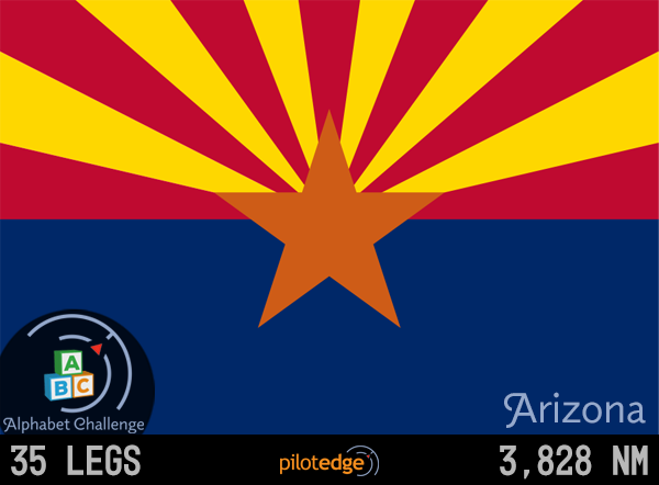 Arizona Edition
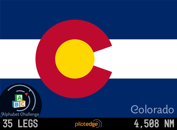 Colorado Edition
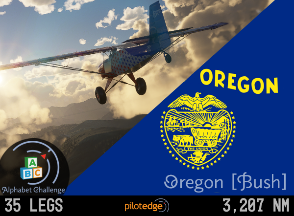 Oregon Bush Edition
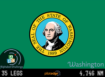 Washington Edition
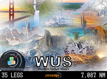 WUS Edition
 ZLA Edition